Since '02 xBhp is different things to different people. From a close knit national community of bikers to India's only motorcycling lifestyle magazine and a place to make like-minded biker friends. Join us

Castrol Power 1

Squeeze that brake, don’t grat a handful.

Our Partner

Announcement

Collapse
No announcement yet.

Maps for traveling through India

Collapse
X
 
  • Filter
  • Time
  • Show
Clear All
new posts

  • Maps for traveling through India

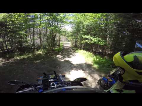
    Does anyone know where proper maps of India can be obtained? I don't mean the generally-vague maps that more or less show the major highways and most of the larger local roads, but actual maps that show every road, even the small unpaved ones, as well as topographic features and other landmarks so proper navigation is possible. Such maps are readily available here in the US at any sporting goods store, as well as every other developed country except apparently India. I have searched online, and while there are some few regions of India available, the maps of those areas are witheringly expensive and usually are done in useless scales like 1:250,000.

    There are programs out there that make it possible to import Google Maps data and transform it so that it can be printed in standard map sheet formats at scales useful for travel/exploring (1:24,000 1:25,000 and 1:50,000), but the process is labor-intensive, time-consuming, tedious, and requires a large-format printer to actually generate the physical map at the end of the process. Plus, the programs that do this aren't generally free, so there's an upfront expense before you can even get started. That's nice for one-off needs, but doing that for the fifteen or twenty map squares needed to take a trip up into the Ghats or across a scenic portion of Southern India is a major undertaking.

    There has to be a better way.
    ATGATT: All The Gear, All The Time!

    Current bike: Yamaha XT1200Z Super Tenere

    Put the phone away, put your helmet on, and ride!

    Scooters are like fat girls: fun to ride, but embarrassing if your friends see you with one.

  • #2
    Re: Maps for traveling through India

    GBD Approved

    There are no accurate paper maps available. At least none that i know about. The only thing would be military maps, but that won't be available for obvious reasons.

    Everyone and their grandmothers these days use Google Maps or Map my India. Both available digitally. I have personally found GMaps to be pretty darn accurate.

    Just curious, why do you want paper maps?
    Biking is not about what you have between your legs, its all about how well you use it!!!!!!!

    Give your details here if you want to help your fellow xBhpian stranded in your city

    Touring Blog: Cycling in Mongolia!

    Comment


    • #3
      Re: Maps for traveling through India

      Originally posted by The Monk View Post
      GBD Approved

      ...
      Just curious, why do you want paper maps?
      Because cellular data coverage gets spotty out in western Odisha, and electronic devices can fail. Paper maps never run out of battery. Plus, Google Maps is ok for getting you from one point to another, but it generally routes you across main roads. Great example: I looked up a route from Bhubaneswar to the Tikarpada Crocodile Sanctuary. The route it gave me takes me up through Cuttack and across on Hwy 55. But there's a much shorter route that even uses a road that goes right through the middle of the Tikarpada Wildlife Sanctuary. Google Maps didn't even offer that as an alternate. Why would I want to spend my time droning along a heavily-traveled highway, when I could be riding through the countryside?

      On top of that, with a proper map, I can be riding through an area and see an interesting road, and I can see immediately where it goes and what it links to. If I use Google Maps, I have to exit the route I'm driving, and spend a lot of time scrolling to figure out where that road goes. Google maps also doesn't include much detail. It might show a road, but not the kind of terrain it passes through, nor the type of road.

      I know not every rider likes the kind of riding I do. I don't ride a sportbike. I ride an adventure bike. It's *intended* for back-road exploring. Here's a short video of the kinds of roads my bike is intended for (NB this road is very close to where I live, and I fully intend to ride it as soon as the weather gets warmer here; also note that the road in this video is considered a public road, but is not maintained. It is not an offroad trail):


      ----consecutive posts auto-merged-----

      And just so there's no misunderstanding, here's a picture of the bike I ride:

      Click image for larger version

Name:	nv542663_0.jpg
Views:	1
Size:	58.5 KB
ID:	1958075

      I'll be mounting knobby tires as soon as the OEMs wear out, and I have already added a heavy skidplate and crash bars.
      Last edited by The Mountain; 04-04-2018, 07:04 PM.
      ATGATT: All The Gear, All The Time!

      Current bike: Yamaha XT1200Z Super Tenere

      Put the phone away, put your helmet on, and ride!

      Scooters are like fat girls: fun to ride, but embarrassing if your friends see you with one.

      Comment


      • #4
        Re: Maps for traveling through India

        I'm still digging into this. The MoD apparently recently released new guidelines for maps: http://www.surveyofindia.gov.in/files/policy_1.pdf . Any maps (that aren't Defense Series Maps) of Mainland areas not within some 80km of the coastline, of any scale and format, are to be declassified and published for the public. Areas around the LOC and Kashmir and all that are still restricted as well, as are the higher-resolution maps of Andaman/Nicobar.

        So the coast of India is still apparently a State Secret, a policy apparently left over from the Raj (when the British East India Company was more worried about other Imperial powers somehow invading India and subverting it), but the interior is supposedly now available. I also found a very nice essay/open letter from S. V. Srikantia, a prominent geologist from India, calling for abandoning the now badly-outdated restrictions on maps in India, in light of all the new technologies that make such restrictions pointless: https://www.geospatialworld.net/arti...maps-in-india/ . Very apropos, going back to my point about the coasts being "restricted", since you can look at e.g. the naval base at Vishakapatnam on Google Earth and see the submarines tied up at the wharfs but you can't get a paper map of the same area. I'll be passing that particular tidbit about the base on Google Earth on to a contact in MoD, since that sort of thing shouldn't be possible even if the photos are out of date; the US obscures actual military installations, no reason India can't do the same.

        Here's hoping that this policy of openness will continue until anyone can go to a local hiking/camping shop and purchase adequately-comprehensive topographical maps of any area, just as they can in Europe or the US. Being able to go on back-country rides to find old hidden temples or archaeological sites, or explore rural India, would be a lot more fun than a truck-infested highway ride around some urban area.
        Last edited by The Mountain; 04-05-2018, 12:10 AM.
        ATGATT: All The Gear, All The Time!

        Current bike: Yamaha XT1200Z Super Tenere

        Put the phone away, put your helmet on, and ride!

        Scooters are like fat girls: fun to ride, but embarrassing if your friends see you with one.

        Comment


        • #5
          Re: Maps for traveling through India

          Originally posted by The Mountain View Post
          Because cellular data coverage gets spotty out in western Odisha, and electronic devices can fail. Paper maps never run out of battery. Plus, Google Maps is ok for getting you from one point to another, but it generally routes you across main roads. Great example: I looked up a route from Bhubaneswar to the Tikarpada Crocodile Sanctuary. The route it gave me takes me up through Cuttack and across on Hwy 55. But there's a much shorter route that even uses a road that goes right through the middle of the Tikarpada Wildlife Sanctuary. Google Maps didn't even offer that as an alternate. Why would I want to spend my time droning along a heavily-traveled highway, when I could be riding through the countryside?

          On top of that, with a proper map, I can be riding through an area and see an interesting road, and I can see immediately where it goes and what it links to. If I use Google Maps, I have to exit the route I'm driving, and spend a lot of time scrolling to figure out where that road goes. Google maps also doesn't include much detail. It might show a road, but not the kind of terrain it passes through, nor the type of road.

          I know not every rider likes the kind of riding I do. I don't ride a sportbike. I ride an adventure bike. It's *intended* for back-road exploring. Here's a short video of the kinds of roads my bike is intended for (NB this road is very close to where I live, and I fully intend to ride it as soon as the weather gets warmer here; also note that the road in this video is considered a public road, but is not maintained. It is not an offroad trail):


          ----consecutive posts auto-merged-----

          And just so there's no misunderstanding, here's a picture of the bike I ride:


          I'll be mounting knobby tires as soon as the OEMs wear out, and I have already added a heavy skidplate and crash bars.
          You imported a S10 to india?

          Comment


          • #6
            Re: Maps for traveling through India

            Originally posted by HyperRetard View Post
            You imported a S10 to india?

            Not yet. Probably later this year. The S10 was actually available in India at one point. I know I saw it on the Yamaha India site. It may have been only for one year. The video is from New Hampshire, where I am currently.
            ATGATT: All The Gear, All The Time!

            Current bike: Yamaha XT1200Z Super Tenere

            Put the phone away, put your helmet on, and ride!

            Scooters are like fat girls: fun to ride, but embarrassing if your friends see you with one.

            Comment


            • #7
              Re: Maps for traveling through India

              Thanks for the information and the links.

              But it brings us back to the same point. Accurate paper maps are not available.

              You can download Google offline maps for the area you plan to visit. You would then not need cellular network. Or get a dedicated GPS device with Map My India.

              Also, don't use Google Maps to navigate, as you correctly state, it will show you the quickest route through the major highways. Use it to find the narrow back roads, which are more often than not marked. You can then plot the route at home. Download the GPX file and upload it onto any device.

              But India is densely populated and there is hardly any place which doesn't have human presence.

              Your best bet to explore new places, around where you are going to be present, is find some local biker lads who do the same, tag along for a few rides and then go on exploring the back roads. I know people in Rajasthan (around Jaipur and Ajmer) who have ridden practically every back road in their backyard! Not too sure about Orissa. Though you could possibly check with the xBhp BBSR gang and maybe get some leads from them.

              Electronic devices can fail, but they usually don't. It's rare now to get stuck somewhere because of a gadget failure.

              With a bit of planning in advance, you can find some interesting roads to ride on, away from the maddening crowd. Unfortunately, I cannot help you with Orissa. Being based out of Delhi, I could have helped you out with routes in Himachal Pradesh and Uttarakhand. In fact, since you are returning to India with your bike, then it would be a good idea to ride some sections of the Himalayas.
              Biking is not about what you have between your legs, its all about how well you use it!!!!!!!

              Give your details here if you want to help your fellow xBhpian stranded in your city

              Touring Blog: Cycling in Mongolia!

              Comment


              • #8
                Re: Maps for traveling through India

                Originally posted by The Monk View Post
                Thanks for the information and the links.

                But it brings us back to the same point. Accurate paper maps are not available.

                You can download Google offline maps for the area you plan to visit. You would then not need cellular network. Or get a dedicated GPS device with Map My India.

                Also, don't use Google Maps to navigate, as you correctly state, it will show you the quickest route through the major highways. Use it to find the narrow back roads, which are more often than not marked. You can then plot the route at home. Download the GPX file and upload it onto any device.

                But India is densely populated and there is hardly any place which doesn't have human presence.

                Your best bet to explore new places, around where you are going to be present, is find some local biker lads who do the same, tag along for a few rides and then go on exploring the back roads. I know people in Rajasthan (around Jaipur and Ajmer) who have ridden practically every back road in their backyard! Not too sure about Orissa. Though you could possibly check with the xBhp BBSR gang and maybe get some leads from them.

                Electronic devices can fail, but they usually don't. It's rare now to get stuck somewhere because of a gadget failure.

                With a bit of planning in advance, you can find some interesting roads to ride on, away from the maddening crowd. Unfortunately, I cannot help you with Orissa. Being based out of Delhi, I could have helped you out with routes in Himachal Pradesh and Uttarakhand. In fact, since you are returning to India with your bike, then it would be a good idea to ride some sections of the Himalayas.

                Thanks for the offer. I do hope to get some mountain riding in when I'm there. I plan to do the Leh/Ladakh thing as well.

                I also plan to hook up with the Bhubaneswar clubs. From the videos I've seen, there's a guy with an Africa Twin, so I'll have at least one person to do some backcountry riding with.
                ATGATT: All The Gear, All The Time!

                Current bike: Yamaha XT1200Z Super Tenere

                Put the phone away, put your helmet on, and ride!

                Scooters are like fat girls: fun to ride, but embarrassing if your friends see you with one.

                Comment


                • #9
                  Re: Maps for traveling through India

                  You can also try "maps.me " i guess you've heard of it. It is quite accurate and it's completely free and offline. I've used it for some short rides, it's good.

                  Comment

                  Working...
                  X