


 Tweet
Tweet
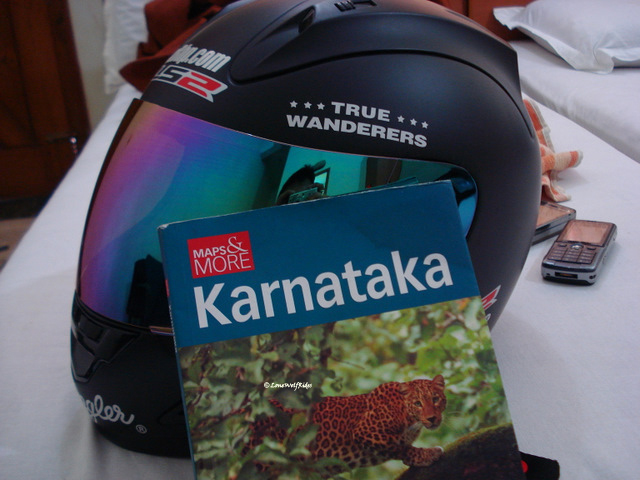
NOTE: If you like what you read and see, please follow this link --> Search for the True Wanderers - Preview Winner to vote for my Wrangler True Wanderers Travelogue. Click on the stars on the top of the page to cast your vote 
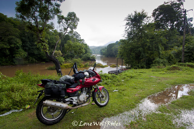
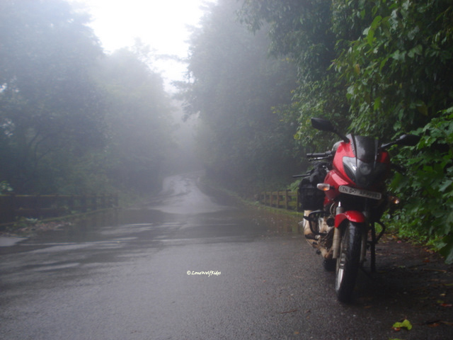
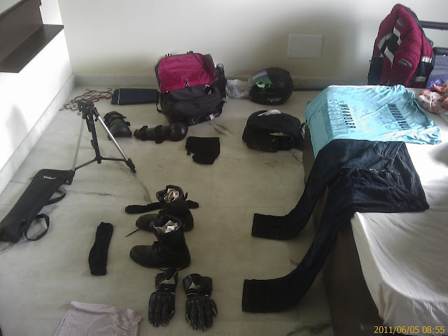
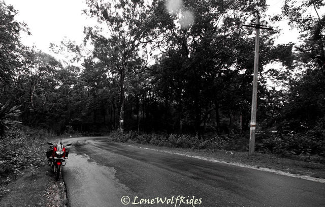
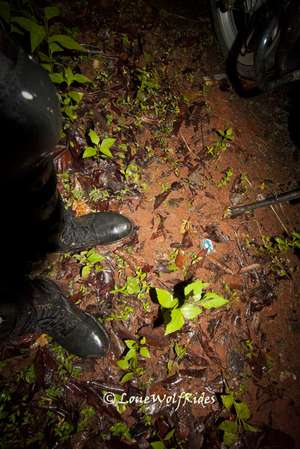
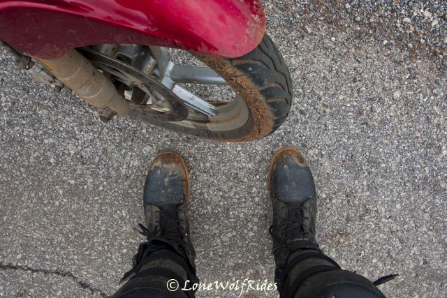
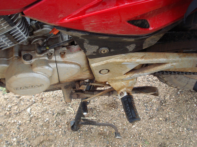
Blink!! Blink!! as I opened my eyes I see can hear a whirring at its fastest speed and I am tucked under two heavy blankets. What the hell is wrong with me, I think to myself. As my drowsy stupor fades, I see a mess strewn across the room and all of yesterday's ride trailing the 'Banana Express' comes back to mind. All what I was wearing was dripping wet when I walked in yesterday, and after getting out of bed when I check the stuff, realized that most of the stuff had "mostly" dried barring the True Wanderer jeans and my riding jacket, they were still a little wet even now after being under a fan for over 12 hours!
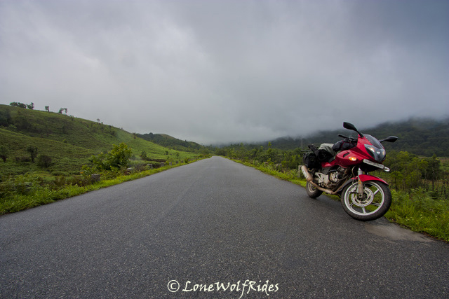
I spent the next few hours trying to catch up blogging about the previous day's ride, a very time consuming exercise. Which meant, even today I start almost as late as the previous day. The hotel where I put up did not have any restaurant of any sort, so a cup of coffee was the best they could offer. I asked them if there was any where along the route I was planning, they replied in affirmative. So I just packed up and left, on the way I did not spot a single place to eat so I thought to myself, that I'd eat once I've completed the short haul trip that I had lined up for now. As I headed out of Chikmagalur, a board read 'You are entering an oxygen rich zone, please do no pollute', if only such boards had any effect on the people of my country.
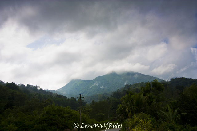
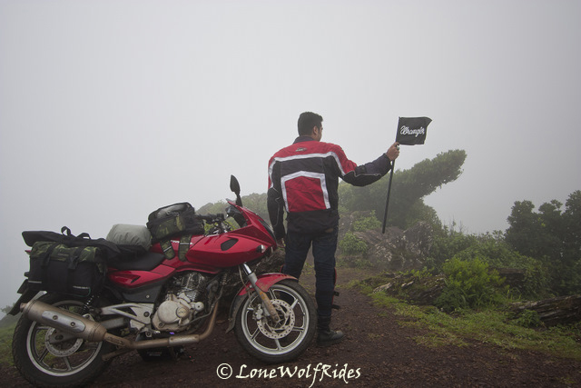
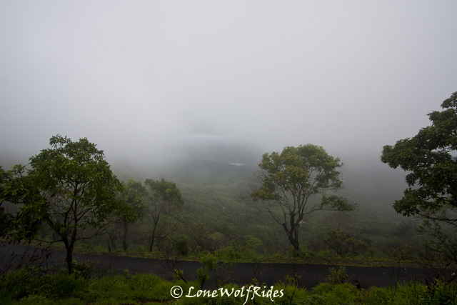
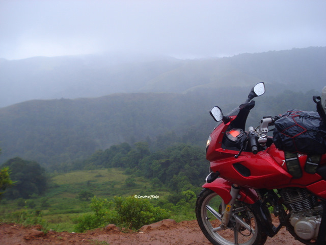
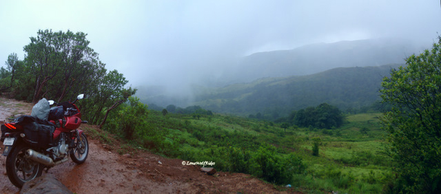
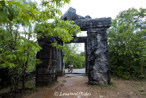
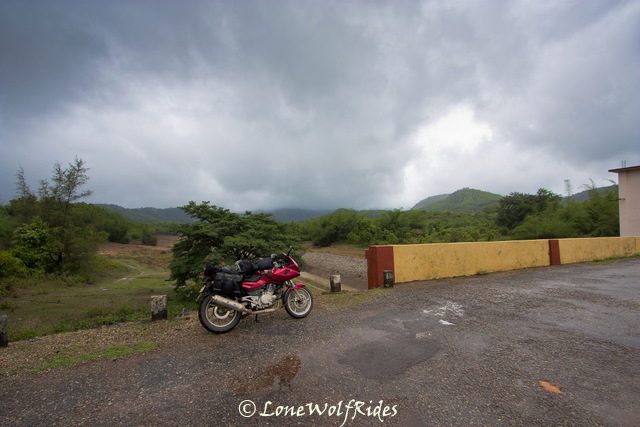
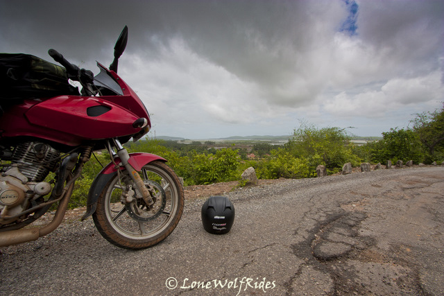
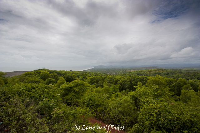
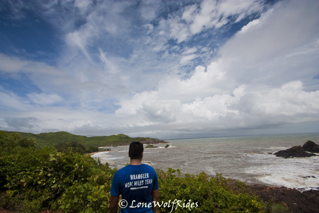
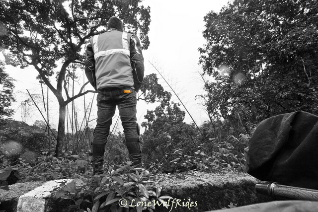
The plan for now was to head to the Baba Budangiri hills which form an impressive backdrop for Chikmagalur town. There are two peaks in this mountain range, Mullyangiri and Baba Budangiri, it is said that both these mountains form the shape of a crescent moon. I could not see any of this much talked about crescent stuff as the entire top of the hill was covered in clouds. I reached a forest check post where the police person was asking me if I was carring any alcohol, I replied that I don't even have water forget alcohol. He let out a small smile and let me pass through. Once past the gate I could see huge estates on both sides of the road, and what a smooth piece of tarmac that I let my right hand a little slack and let it roll up the throttle to decent speeds. Within a few kilometers the turn off for Mulliyangiri and Kemmangundi approaches, I took the one to Mulliyangiri as I had other plans for today and Kemmangundi owing to the distance would screws the said plans. The twisty roads now were a proper 'ghat' type of twisty road and Boy! it was fun. I did not click any pictures whilst climbing up as I thought I'd get more pictures on the way down. The road gets narrower and narrower and the beautiful landscape opening up in front of me just got better and better, my friend Veda had insisted that I visit this place since I had come all the way to Chikmagalur and with the scenery unfolding in front of me I had nothing but praises for insistence. Beyond a certain distance you quite literally IN the clouds, the sight of which made me chuckle once again as I said a mental thank you to him. By now I was quite literally in the clouds and visibility was down to couple of feet ahead of me. As I reached the top I could see a huge rush of people running amok, I took my bike off the road and onto some rocks perched a little higher than the road.
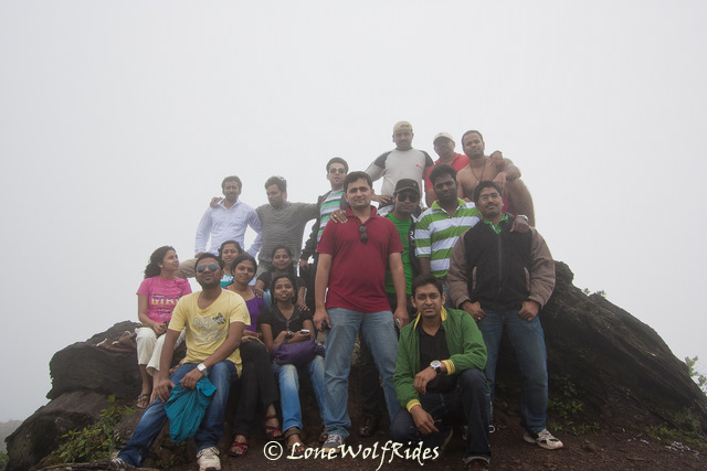
I got off my bike and as I took out the camera to start clicking pictures a few people were giving me odd stares wondering what I upto in this crazy outfit. A group of about 5-6 people were walking down the path where I'd taken up my bike and were a little curious, so one of them came asking me what lens was I using on my camera and the general series of questions such as 'where/why/what'. I explained to them the concept of Wrangler True Wanderers and how I was on a exciting 7 day ride wearing only one pair of jeans. They seemed more interested in the 'wearing one pair of jeans for 7 days' part more than anything else. So after we had spoken I got them to click a few pics of me. They wished me luck and were off. After clicking a picture or two another group of about 15 people landed up there who again gave me the 'who is this alien?' look. They all gathered around some rocks to get a group pic, and one of them walked up to me to ask if I could take a picture of them. He had a cell phone camera in hand, so I offered to take pictures from my SLR instead, with the promise that I'd mail them the picture that very night. After I clicked their picture, they all surrounded me and asked me the same who/what/where questions and after giving them all the story about True Wanderers they promised to get me the whole of Wipro's votes
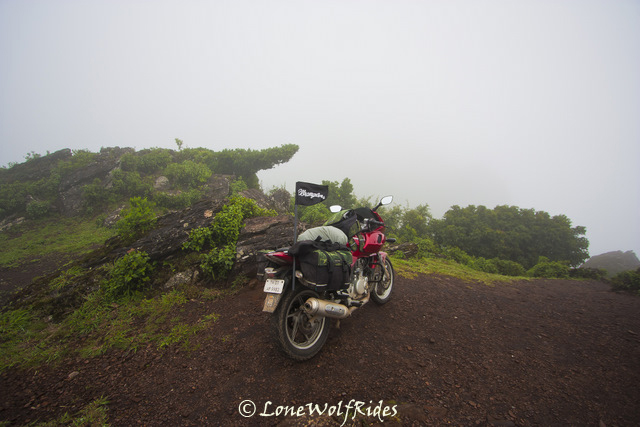
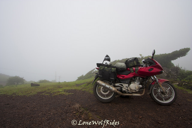
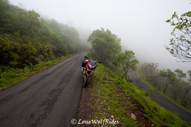
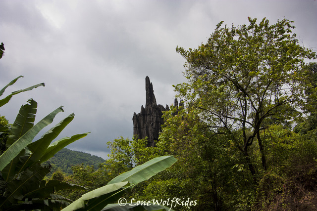
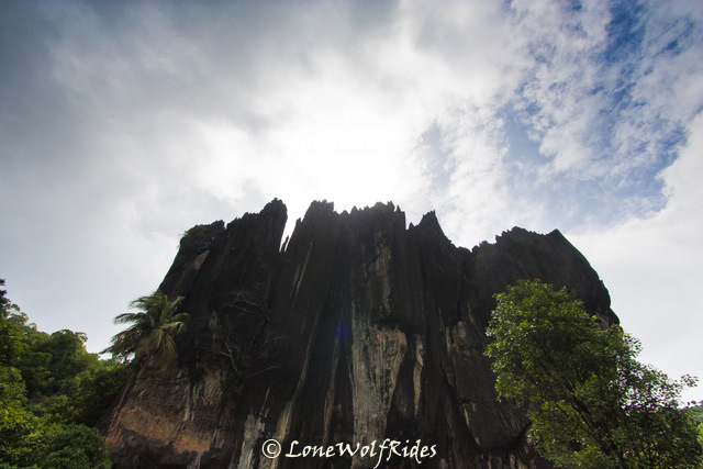
Mulliyangiri is the highest peak in Karnataka at about 1930 meters above sea level. I had not gone more than a few meters beyond the parking lot and I was definitely not at the very topmost part as that would involved me leaving behind all my luggage and walking up some distance. My GPS read out 1850 meters at the point I was standing on and it was good enough for me as this was the highest any motorized two wheels could go in the state of Karnataka. The wind was starting to pick up and it was strong enough to almost blow away my Wrangler flag, so I packed up and started descending down the twisty and extremely narrow route. I took a couple of pictures on my way down as the clouds played hide and seek with me, at times on some faces of the mountain I would extremely dense clouds and sometimes on the other sides I would have completely clear skies. So far it had not rained much either, so I was getting drier by the minute. A slight drizzle would set in at times, but nothing more than that.
With the phase 1 of running the bike complete I was able to push the bike's performance envelope a little bit more and have much needed fun on the twisties on my way down. I tried my best to recollect some of the names of the homestay's on the way so I could come back a later time to explore this area in greater details but no such thing happened, forgot all the names I saw and absorbed so much in a day that it was almost impossible to recollect the finer details. I made my way quickly across Chikmagalur town to the other side as I wanted to do some deep diving into lush green forests. I filled fuel on the outskirts of town, by now the sky's were overcast in an ominous shade of grey. Not that I have any issues with riding rain, I love it. On day one I was saying 'Lil Johnny wants some rain to play' so I guess this was my wishes getting answered.
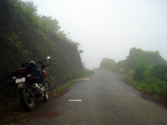
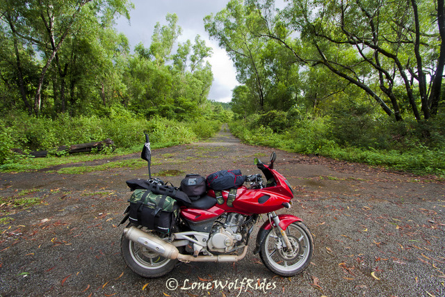
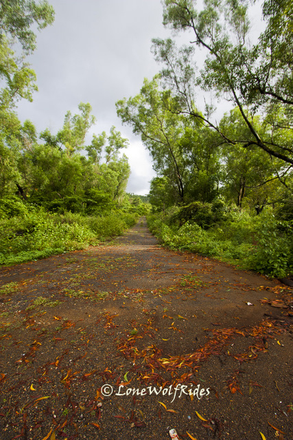
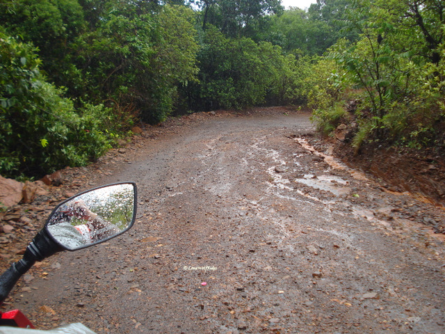
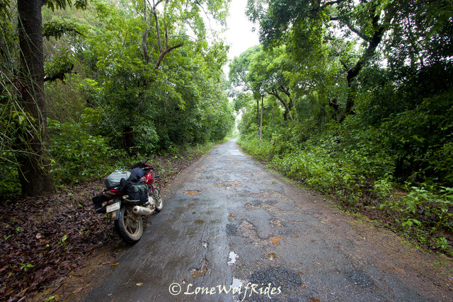
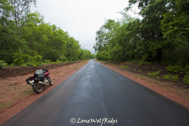
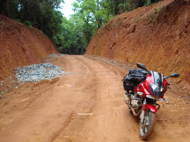
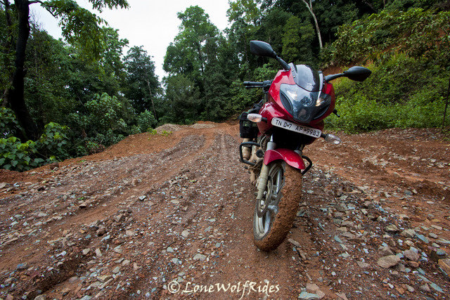
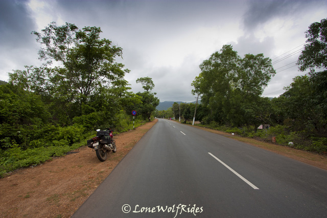
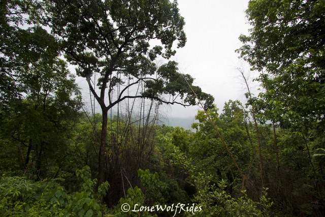
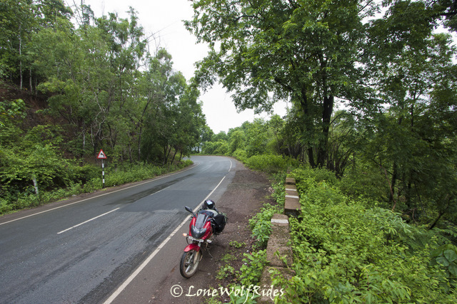
After tanking up and tackling a minor traffic jam, yes you read that right a jam even in a small town as this. I had been down this road about two years back and I wanted to experience something like that, but this time it was going to all alone not like last time when I had 3 other bikers accompanying me. The forests officially start a considerate distance away from Chikmagalur, but even at the outskirts the green cover is almost forest like. The road surface was no longer as smooth as I had seen earlier this morning during the ascent to Mulliyangiri, but this kind of road was right up my alley, it involved being alert and avoiding any oddball pothole that the roads suddenly throws up at you, all whilst you are going a sufficiently high speeds. As I progressed ahead the forest cover got denser and lot more wilder. The estates on the outskirts of Chikmagalur had long gone and now it was just pure wilderness all around me. I had initially thought about heading up all the way up north through the Bhadra Wildlife Sanctuary which apparently has tigers and leopards as well. About 3 years back I had been on a safari into the 'Tiger' reserve part of Bhadra, and all I saw was deer and a few monkeys. So I was pretty sure I wouldn't be spotting any wild fauna, flora yes but definitely not fauna. The rains by now had become a soap opera, they would come and go at their own free will put a little drama into things and be gone before you know it. But this is after all the Malnad region and even the rains for a short period are enough to make you completely wet. I took a solitary break in the Bhadra reserve to catch a little breather as I had been riding nonstop for long time.
The intensity of the beauty of this region cannot be captured in words that I write, neither can I capture it behind a lens, it is something that one needs to experience it for themselves. As I got deeper and deeper into the forest the number of vehicles on the road thinned down and beyond a certain point even the villages stopped appearing, all together indicating that arrival of forest. And it was just around this time that the skies open the flood gates to let the water come down on an already wet planet earth. The rains, the beautiful lush green forest and spectacularly curvy roads had made me forget everything and I just had the time of my life riding without a stop, I missed a lot of great photography opportunities, but the pure joy of riding in this very setting just kept me going and going. As I reached a small town called Balehonnur somewhere in the middle of Bhadra on reaching this town there were two roads, one which went up north to where I intended to head to, another headed south but to a 'fun' place called Kalasa. More on Kalasa later, now I remember seeing the map to find and very small road on the map connecting these place and it seemed more like a village back road on the map. What the heck? I don't have anything loose
As I took a left on this route the first impression was pretty bad as it was immediately visible that the road is pretty bad and I did not want to go through such a sorry state of road for another 35 odd kilometers. But I persisted with my 'no wrong turns' funda and ambled down this road. Within a few hundred meters the road improved, and this would actually be an understatement. I was way better than the Aldur-Balehonnur stretch that I was doing, only difference being that the road was very narrow. The route started with the Bhadra river flowing right next to it and so far things were looking up. The setting was perfect for another round of crazy non-stop riding, this continued all the way till I reached the middle of this route to a village called Magundi. It had been a long time and I took a break at a small tea stall for a much needed chai break.
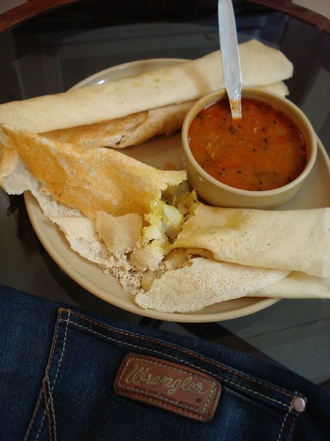
All he had was parle-G biscuits, I realized now that in my enjoyment of riding I had completely forgotten about breakfast and lunch so far, and this cup of tea and biscuits was the first thing I was eating after my morning coffee. Call me crazy, call me stupid or call me passionate, but once the riding rhythm is set food and drink become immaterial and the ride takes precedence over everything. Whilst I was having my cuppa, a curious auto driver siting a little distance away decides that curiosity does not kill the cat and he started mumbling something in Kannada, to my surprise when I told him that I dint understand what he said, he replied back in hindi. He was interested to know about my riding gear and why did travel so far. After a brief concentration with this auto guy I packed up and headed to leave. By now the rains had started to pick up intensity and slowly but steadily the non-stop mode was about to get triggered I stopped here as the sounds of the forest seemed to even overcome the drone of my bike's engine. I killed the engine just to hear the sounds of the forest here, but somehow the sound died out with my engine's sound. As I started my bike the rains came with a fresh vigor and hit so hard that I actually thought I was going to get washed away.
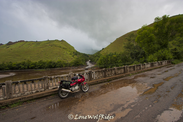
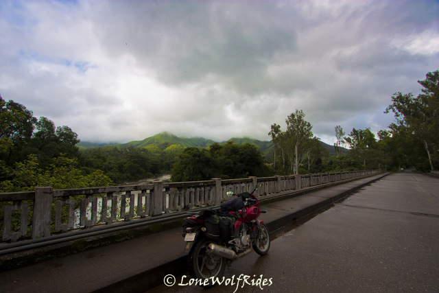
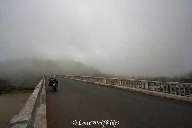
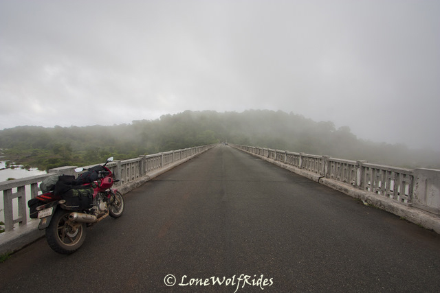
At the start of this stretch of road from Balehonnur, the Bhadra river had made its first appearance, but the it had vanished away. Now it was slowly making its presence felt as I could see it little bit of it as I rode on. Finally after some amount of riding an opening appeared showing as of the river as possible. Finally I came up a bridge that went over the river Bhadra just before touching Kalasa.
The western ghats all along this region maintains its standard of green 'foresty' type of environs, but the characteristics of this lush green cover change with as I progressed from Chikmagalur to Balehonnur and then had another change as I changed track and dived south into what I thought was a lesser used track via Magundi, and now as I approached Kalasa the kind of green further changed a little bit in character. The forest roads wherein the trees covered almost the whole part of the road, sometimes even forming a canopy of sorts had now given way to smaller trees that covered only a part of the view of the sky.
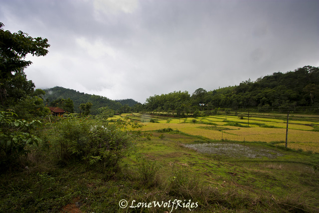
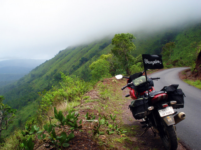
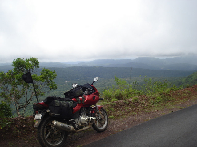
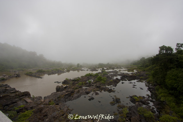
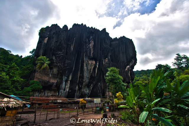
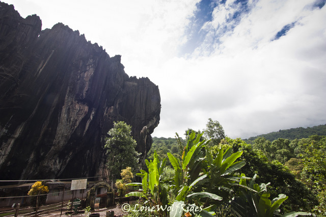
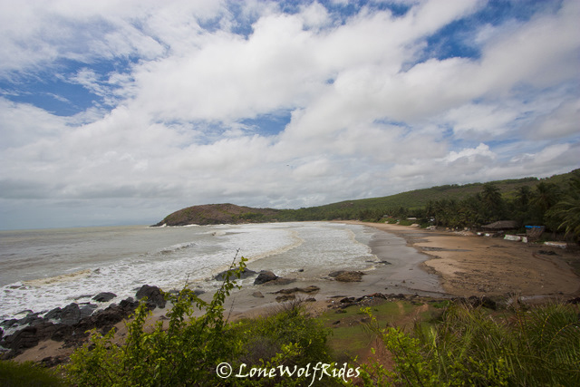
Kalasa, is a small temple town surrounded by the Bhadra river on three sides and a hill in the backdrop. I had passed through this town some time in early 2009, during one of my previous 'LoneWolfRides'. This town leads to one of Karnataka's most beautiful stretches of road right through the Kudremukh national reserve which is one of the few biodiversity hotspots in this region. Surrounded by controversy amidst this beautiful stretch is the Kudremukh Iron ore company which faced the ire of many environmentalists in relation of their plant being a threat to the flora and fauna of this region, which finally lead to shutting down of their mining activities in the region. The road running right through the heart of this national reserve is one of the most amazing pieces of tarmac I had seen, with super smooth roads and mind blowing scenery on both sides of the road there is not much more a bike could really ask for. I stopped for a couple of pictures just before the Kudremukh national park started.
Lush fields before Kudremukh
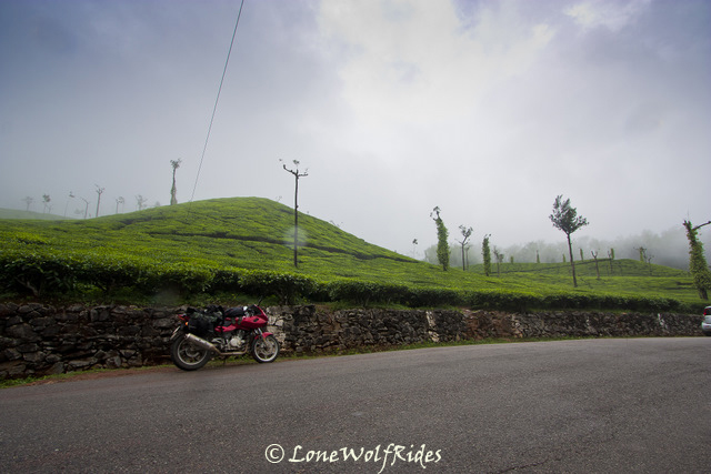
Tea estates are an odd sight in this region!
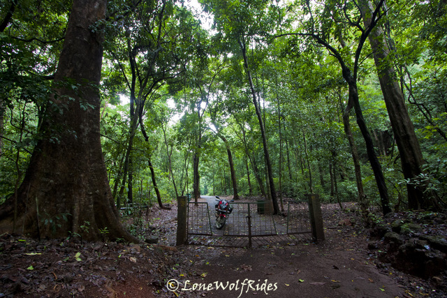
My plan was to take a route inside Kudremukh that I had never taken before, one that heads up north. Now there's a catch as you are taken through this exhilarating ride deep inside the Kudremukh national park. One gets a time stamped ticket at one entry point and has exactly 1.5 hours to cover approximately 40 Kms through one of the most scenic stretches of road around here, this is downright cruel as it does not give enough time to capture the beauty of this place. I received my pass with 4.45PM as the time stamp, I was prepared to pay the fine if I exceeded the time limit to cross onto the other side. Once inside Kudremukh you will see many lesser used roads leading deep into the safari trails of the forest, they seemed tempting to take but I knew better than to go poking around an already troubled region.
The Tunga and Bhadra rivers flow around this National park and it will be apparent as you pass through many bridges ranging from big to small on this stretch of road, also since the altitude in this forest varies from as low as 100 mtrs, to as high as 1830 mtrs the road twists through a series of ups and downs making for an awesome ride. The rains had so far been limited to occasional patches of light showers, infact I even got a little bit of sunshine on my way inside the forest.
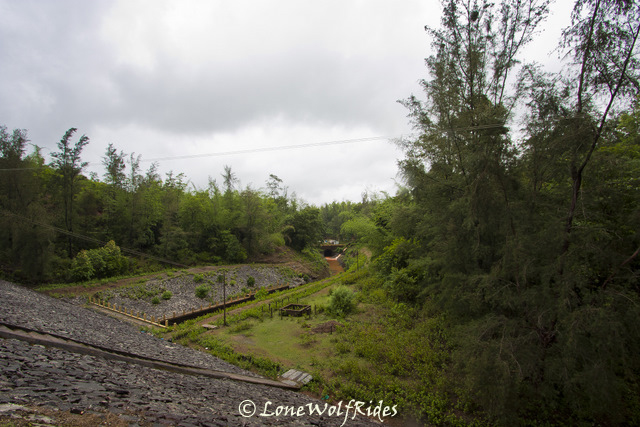
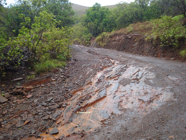
From my previous jaunt down this stretch I remember having some butter smooth tarmac, but it has all changed now. The roads are no longer what they used to be, there a couple of patches of broken tarmac which unsettle the bike as you approach it at higher than required speed. There are roads inside Kudremukh that diverge into the various living quarters of the KIOCL (Kudremukh Iron Ore Company) and offices inside the park. Given the setting of a dark cloudy sky and these buildings in various states of disrepair almost looking abandoned, gave this place an ominous look which looked like a perfect setting for a Hollywood horror flick. Through these roads you can sometimes get a glimpse of an even more creepy iron ore plant far off in the distance. And sometimes you see one of the previous used rails/pipes (I am not sure!) to transport probably iron to and from the plant.
I passed over a small bridge that gave me complete view of the mining plant to one side and an amazing view on other end. Beyond this section there comes a small dam built by KIOCL on the Bhadra river, it is said that it was built to dump the red slurry from the mines which in turn creates havoc with nature. Photography is prevented on top of the dam, as I was shooed away last time by a guard over the entrance of the dam. I did not dare try any antics this time either, I just got a shot of the dam and was off.
Lakya Dam
At this point it started to pour heavily, I hastily pulled the rain cover onto the camera bag a rode on. And this was when I was just thanking the weather gods for not giving my heavy rain so I can photograph this stretch in piece. I felt that if there really is a weather god, he was at times playing pranks with me and at times being genuinely good. There was on specific stretch where I wanted to take a picture as the last time I passed through it, I wished to my self I had a camera with a wider lens, partly this time my wish had come true, but whatever the scenery was to be seen was held captive behind the clouds as the rolled across the mountains covering them completely. Nevertheless, I tried my best to get as much of it as possible. But as soon as I as had gone about a kilometer or so ahead I found that it is just not possible to not stop to get pictures and I stopped to get some picture of a small waterfall falling behind a bridge.
This is my most favorite stretch inside the forest
By now it had quite literally started pouring and I decided to just enjoy the ride, whilst a small rumble in my stomach reminded me that my body needs more just ParleG for food to survive in the day. I thought that I'd stop to grab a bite once I complete Kudremukh, but in my hurry to get across the to the other side and the general enjoyment of the riding in the rains on one the most awesome stretches of road I missed taking the turn at the route through which I had not been before. There was another spot where I just had to stop despite the rains.
For the times when its raining like it was raining here, I use my trusty yet expendable 5 year old point & shoot cam as the SLR was to expensive a piece of equipment to be donated to the rains. As I continued down this road the rains intensified as now I was on the sea facing side of the mountain, the coastline was still a good 60-70 Kms away but it was enough to make his patch of road extremely rainy. I had decided not to stop anywhere till the exit, but could not resist stopping to get pics of the rain that I was riding through.
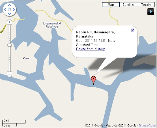
Map : Click!
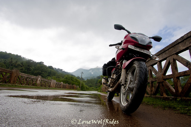
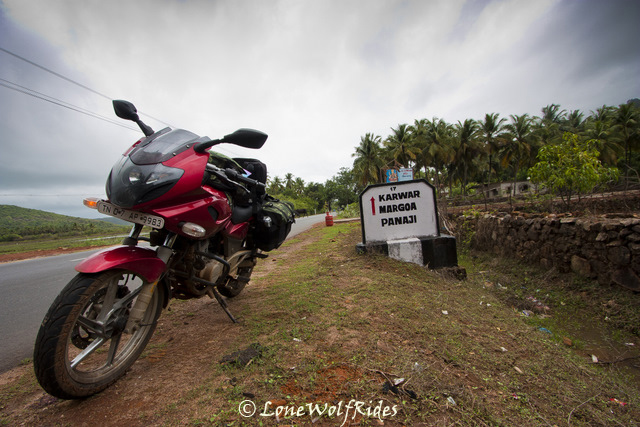
A ride on the Wild Side - Day #3
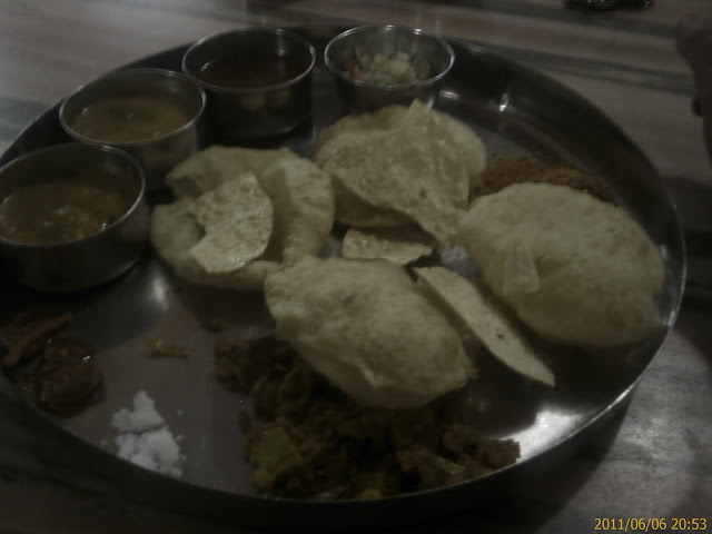
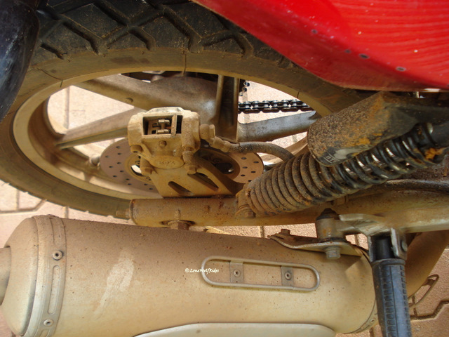
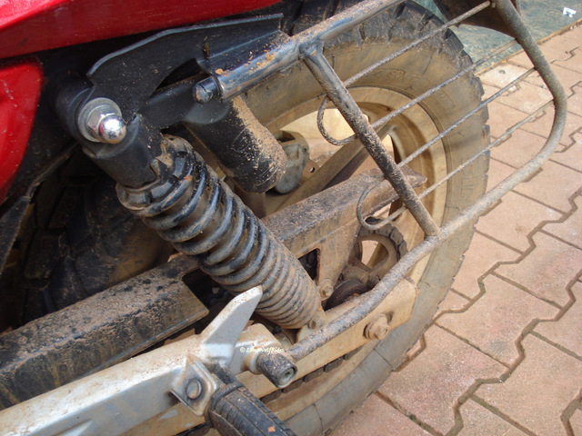
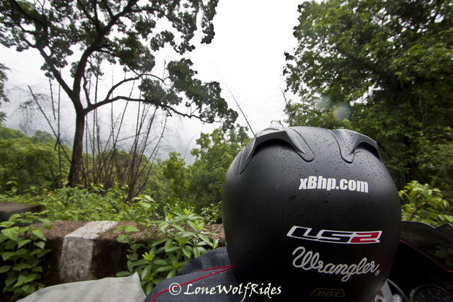
The Drying effect!!!
I spent the next few hours trying to catch up blogging about the previous day's ride, a very time consuming exercise. Which meant, even today I start almost as late as the previous day. The hotel where I put up did not have any restaurant of any sort, so a cup of coffee was the best they could offer. I asked them if there was any where along the route I was planning, they replied in affirmative. So I just packed up and left, on the way I did not spot a single place to eat so I thought to myself, that I'd eat once I've completed the short haul trip that I had lined up for now. As I headed out of Chikmagalur, a board read 'You are entering an oxygen rich zone, please do no pollute', if only such boards had any effect on the people of my country.
The plan for now was to head to the Baba Budangiri hills which form an impressive backdrop for Chikmagalur town. There are two peaks in this mountain range, Mullyangiri and Baba Budangiri, it is said that both these mountains form the shape of a crescent moon. I could not see any of this much talked about crescent stuff as the entire top of the hill was covered in clouds. I reached a forest check post where the police person was asking me if I was carring any alcohol, I replied that I don't even have water forget alcohol. He let out a small smile and let me pass through. Once past the gate I could see huge estates on both sides of the road, and what a smooth piece of tarmac that I let my right hand a little slack and let it roll up the throttle to decent speeds. Within a few kilometers the turn off for Mulliyangiri and Kemmangundi approaches, I took the one to Mulliyangiri as I had other plans for today and Kemmangundi owing to the distance would screws the said plans. The twisty roads now were a proper 'ghat' type of twisty road and Boy! it was fun. I did not click any pictures whilst climbing up as I thought I'd get more pictures on the way down. The road gets narrower and narrower and the beautiful landscape opening up in front of me just got better and better, my friend Veda had insisted that I visit this place since I had come all the way to Chikmagalur and with the scenery unfolding in front of me I had nothing but praises for insistence. Beyond a certain distance you quite literally IN the clouds, the sight of which made me chuckle once again as I said a mental thank you to him. By now I was quite literally in the clouds and visibility was down to couple of feet ahead of me. As I reached the top I could see a huge rush of people running amok, I took my bike off the road and onto some rocks perched a little higher than the road.
I got off my bike and as I took out the camera to start clicking pictures a few people were giving me odd stares wondering what I upto in this crazy outfit. A group of about 5-6 people were walking down the path where I'd taken up my bike and were a little curious, so one of them came asking me what lens was I using on my camera and the general series of questions such as 'where/why/what'. I explained to them the concept of Wrangler True Wanderers and how I was on a exciting 7 day ride wearing only one pair of jeans. They seemed more interested in the 'wearing one pair of jeans for 7 days' part more than anything else. So after we had spoken I got them to click a few pics of me. They wished me luck and were off. After clicking a picture or two another group of about 15 people landed up there who again gave me the 'who is this alien?' look. They all gathered around some rocks to get a group pic, and one of them walked up to me to ask if I could take a picture of them. He had a cell phone camera in hand, so I offered to take pictures from my SLR instead, with the promise that I'd mail them the picture that very night. After I clicked their picture, they all surrounded me and asked me the same who/what/where questions and after giving them all the story about True Wanderers they promised to get me the whole of Wipro's votes
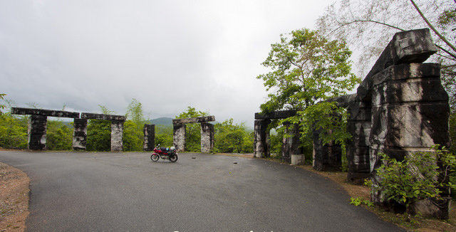
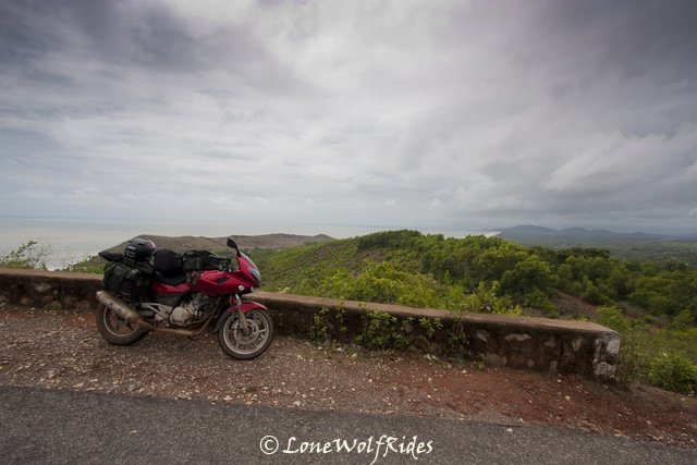
Atop Mullyanagiri, the highest peak in Karnataka.
The gang from Wipro, Bangalore
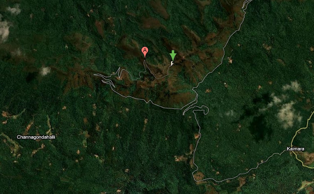
The green arrow is where I was standing atop Mullyanagiri as per my GPS
The gang from Wipro, Bangalore
The green arrow is where I was standing atop Mullyanagiri as per my GPS
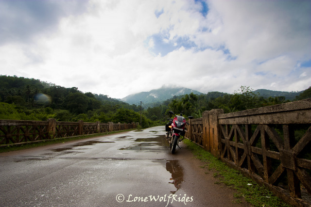
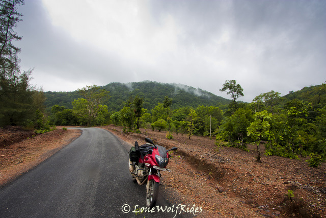
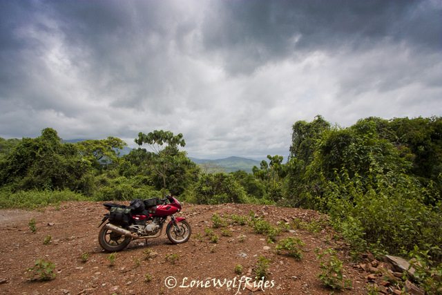
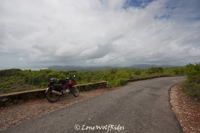
Mulliyangiri is the highest peak in Karnataka at about 1930 meters above sea level. I had not gone more than a few meters beyond the parking lot and I was definitely not at the very topmost part as that would involved me leaving behind all my luggage and walking up some distance. My GPS read out 1850 meters at the point I was standing on and it was good enough for me as this was the highest any motorized two wheels could go in the state of Karnataka. The wind was starting to pick up and it was strong enough to almost blow away my Wrangler flag, so I packed up and started descending down the twisty and extremely narrow route. I took a couple of pictures on my way down as the clouds played hide and seek with me, at times on some faces of the mountain I would extremely dense clouds and sometimes on the other sides I would have completely clear skies. So far it had not rained much either, so I was getting drier by the minute. A slight drizzle would set in at times, but nothing more than that.
Getting down Mullyanagiri
With the phase 1 of running the bike complete I was able to push the bike's performance envelope a little bit more and have much needed fun on the twisties on my way down. I tried my best to recollect some of the names of the homestay's on the way so I could come back a later time to explore this area in greater details but no such thing happened, forgot all the names I saw and absorbed so much in a day that it was almost impossible to recollect the finer details. I made my way quickly across Chikmagalur town to the other side as I wanted to do some deep diving into lush green forests. I filled fuel on the outskirts of town, by now the sky's were overcast in an ominous shade of grey. Not that I have any issues with riding rain, I love it. On day one I was saying 'Lil Johnny wants some rain to play' so I guess this was my wishes getting answered.
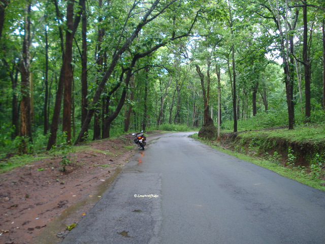
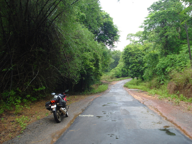
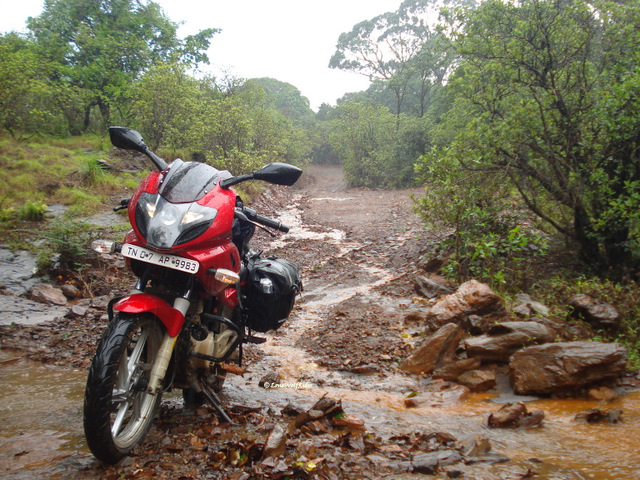
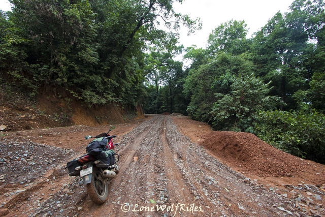
After tanking up and tackling a minor traffic jam, yes you read that right a jam even in a small town as this. I had been down this road about two years back and I wanted to experience something like that, but this time it was going to all alone not like last time when I had 3 other bikers accompanying me. The forests officially start a considerate distance away from Chikmagalur, but even at the outskirts the green cover is almost forest like. The road surface was no longer as smooth as I had seen earlier this morning during the ascent to Mulliyangiri, but this kind of road was right up my alley, it involved being alert and avoiding any oddball pothole that the roads suddenly throws up at you, all whilst you are going a sufficiently high speeds. As I progressed ahead the forest cover got denser and lot more wilder. The estates on the outskirts of Chikmagalur had long gone and now it was just pure wilderness all around me. I had initially thought about heading up all the way up north through the Bhadra Wildlife Sanctuary which apparently has tigers and leopards as well. About 3 years back I had been on a safari into the 'Tiger' reserve part of Bhadra, and all I saw was deer and a few monkeys. So I was pretty sure I wouldn't be spotting any wild fauna, flora yes but definitely not fauna. The rains by now had become a soap opera, they would come and go at their own free will put a little drama into things and be gone before you know it. But this is after all the Malnad region and even the rains for a short period are enough to make you completely wet. I took a solitary break in the Bhadra reserve to catch a little breather as I had been riding nonstop for long time.
Inside the Bhadra reserve
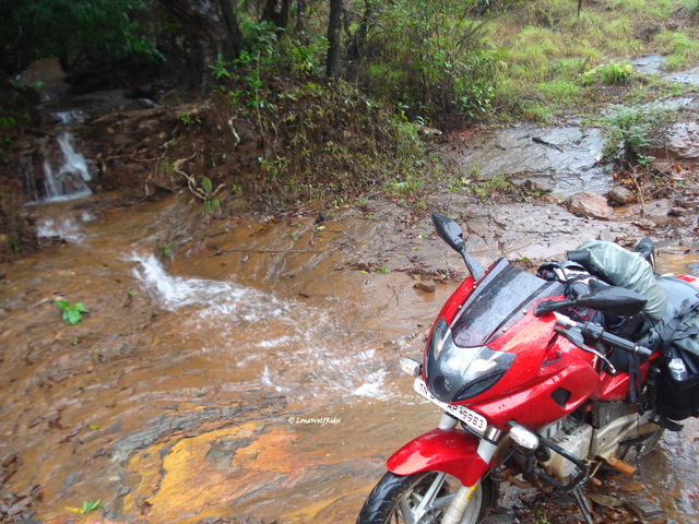
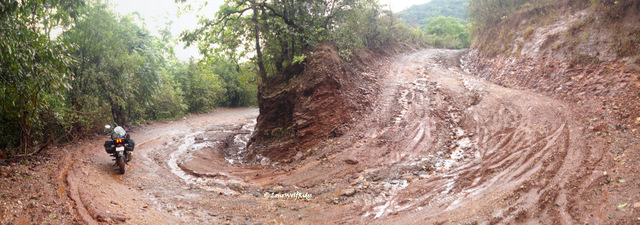
The intensity of the beauty of this region cannot be captured in words that I write, neither can I capture it behind a lens, it is something that one needs to experience it for themselves. As I got deeper and deeper into the forest the number of vehicles on the road thinned down and beyond a certain point even the villages stopped appearing, all together indicating that arrival of forest. And it was just around this time that the skies open the flood gates to let the water come down on an already wet planet earth. The rains, the beautiful lush green forest and spectacularly curvy roads had made me forget everything and I just had the time of my life riding without a stop, I missed a lot of great photography opportunities, but the pure joy of riding in this very setting just kept me going and going. As I reached a small town called Balehonnur somewhere in the middle of Bhadra on reaching this town there were two roads, one which went up north to where I intended to head to, another headed south but to a 'fun' place called Kalasa. More on Kalasa later, now I remember seeing the map to find and very small road on the map connecting these place and it seemed more like a village back road on the map. What the heck? I don't have anything loose
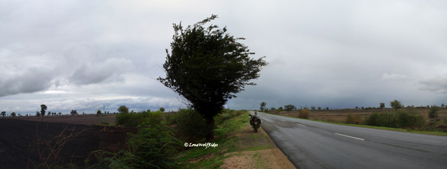
One Wild Ride!
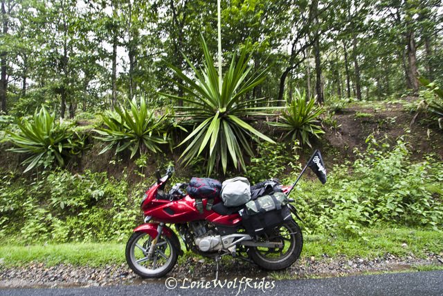
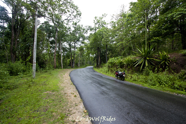
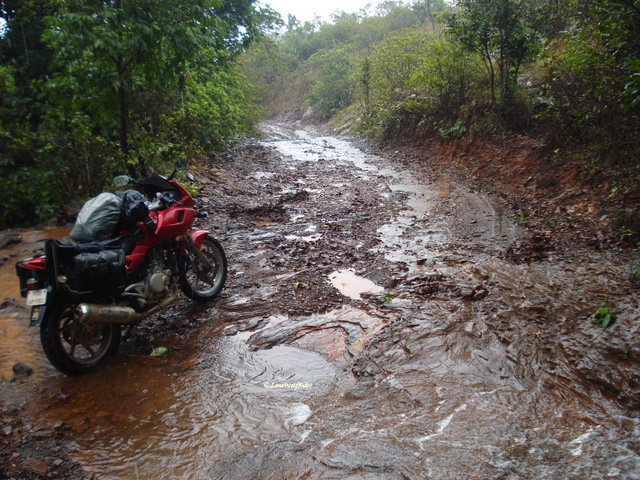
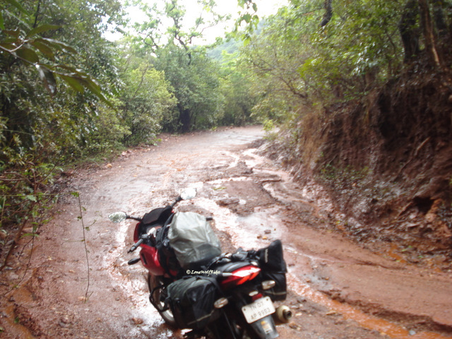
As I took a left on this route the first impression was pretty bad as it was immediately visible that the road is pretty bad and I did not want to go through such a sorry state of road for another 35 odd kilometers. But I persisted with my 'no wrong turns' funda and ambled down this road. Within a few hundred meters the road improved, and this would actually be an understatement. I was way better than the Aldur-Balehonnur stretch that I was doing, only difference being that the road was very narrow. The route started with the Bhadra river flowing right next to it and so far things were looking up. The setting was perfect for another round of crazy non-stop riding, this continued all the way till I reached the middle of this route to a village called Magundi. It had been a long time and I took a break at a small tea stall for a much needed chai break.
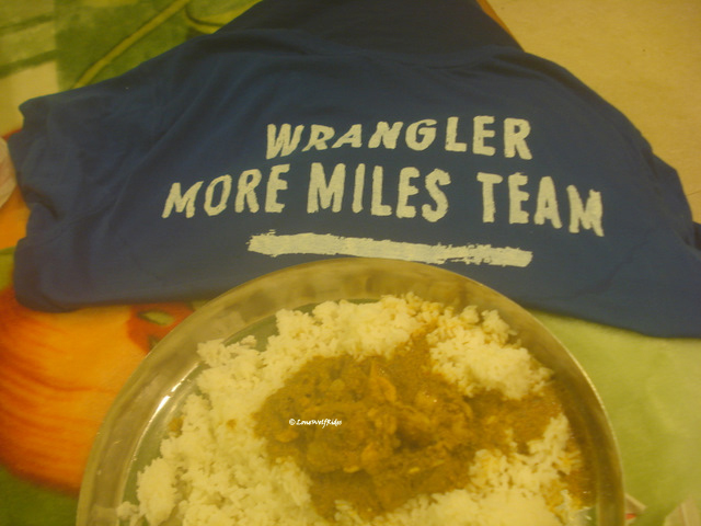
My first and only snack for the day!
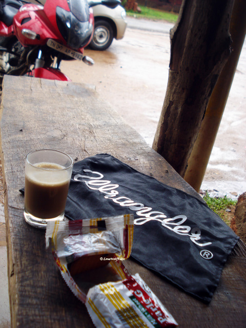
All he had was parle-G biscuits, I realized now that in my enjoyment of riding I had completely forgotten about breakfast and lunch so far, and this cup of tea and biscuits was the first thing I was eating after my morning coffee. Call me crazy, call me stupid or call me passionate, but once the riding rhythm is set food and drink become immaterial and the ride takes precedence over everything. Whilst I was having my cuppa, a curious auto driver siting a little distance away decides that curiosity does not kill the cat and he started mumbling something in Kannada, to my surprise when I told him that I dint understand what he said, he replied back in hindi. He was interested to know about my riding gear and why did travel so far. After a brief concentration with this auto guy I packed up and headed to leave. By now the rains had started to pick up intensity and slowly but steadily the non-stop mode was about to get triggered I stopped here as the sounds of the forest seemed to even overcome the drone of my bike's engine. I killed the engine just to hear the sounds of the forest here, but somehow the sound died out with my engine's sound. As I started my bike the rains came with a fresh vigor and hit so hard that I actually thought I was going to get washed away.
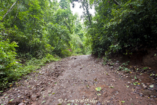
Some of the deepest forest roads I've seen
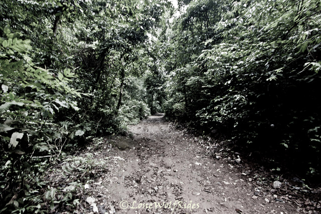
I cannot capture the beauty and essence of the Malnad region! Its too intense...

I cannot capture the beauty and essence of the Malnad region! Its too intense...
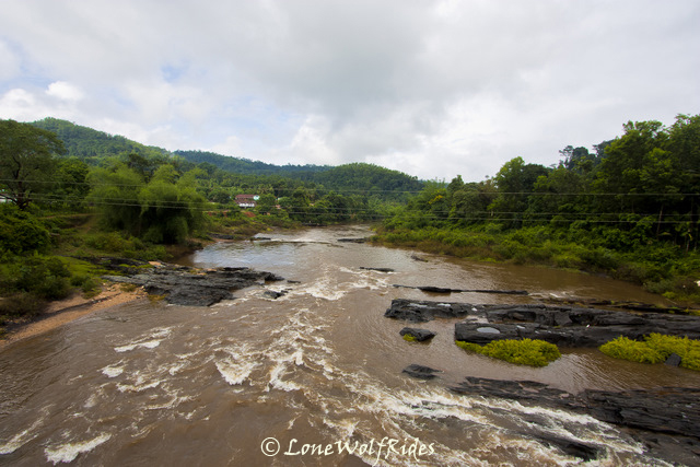
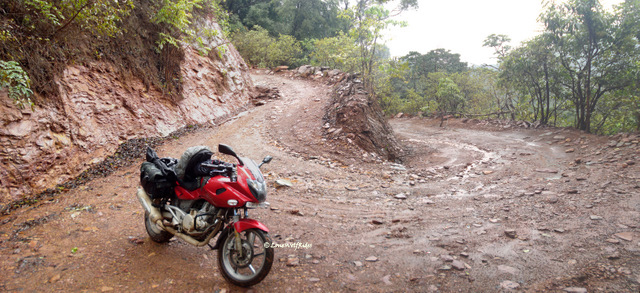
At the start of this stretch of road from Balehonnur, the Bhadra river had made its first appearance, but the it had vanished away. Now it was slowly making its presence felt as I could see it little bit of it as I rode on. Finally after some amount of riding an opening appeared showing as of the river as possible. Finally I came up a bridge that went over the river Bhadra just before touching Kalasa.
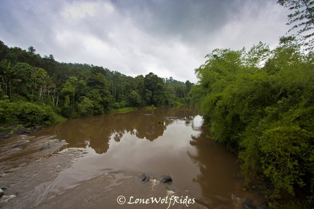
The western ghats all along this region maintains its standard of green 'foresty' type of environs, but the characteristics of this lush green cover change with as I progressed from Chikmagalur to Balehonnur and then had another change as I changed track and dived south into what I thought was a lesser used track via Magundi, and now as I approached Kalasa the kind of green further changed a little bit in character. The forest roads wherein the trees covered almost the whole part of the road, sometimes even forming a canopy of sorts had now given way to smaller trees that covered only a part of the view of the sky.
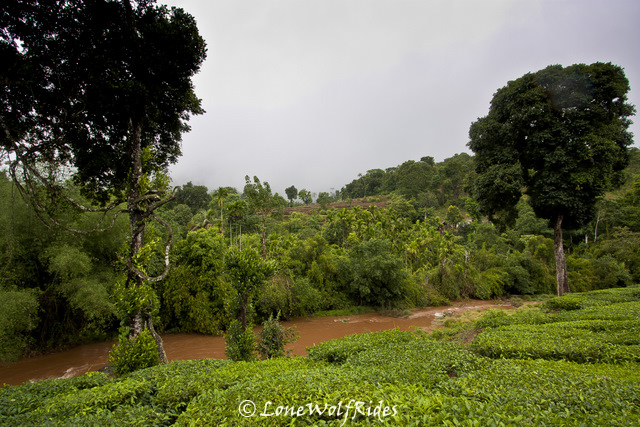
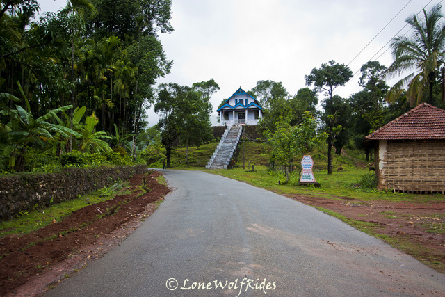
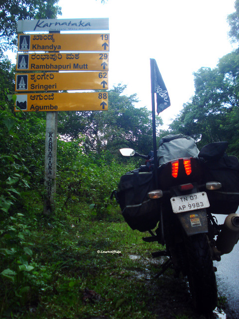
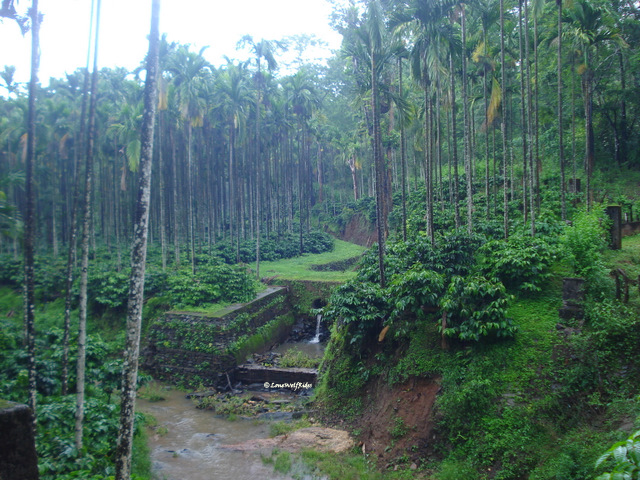
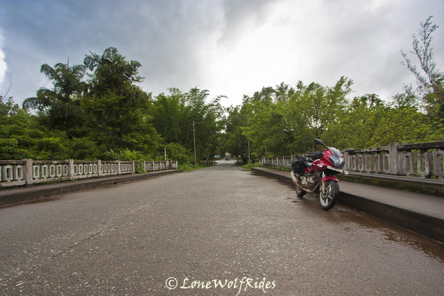
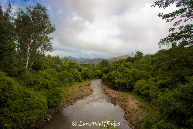
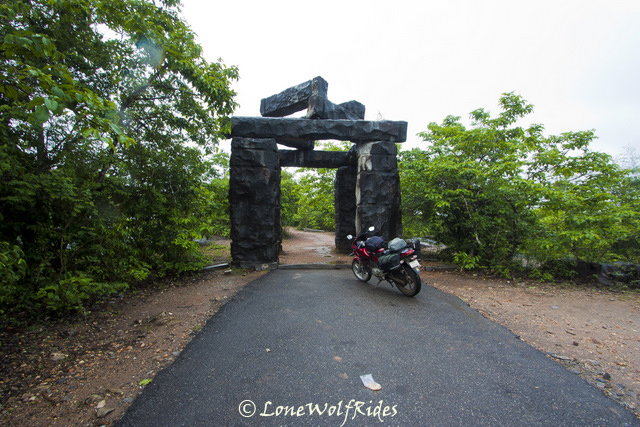
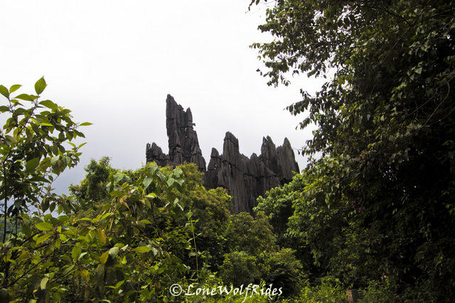
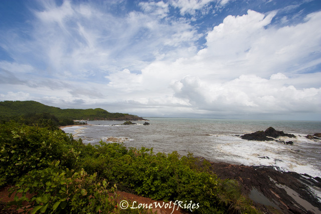
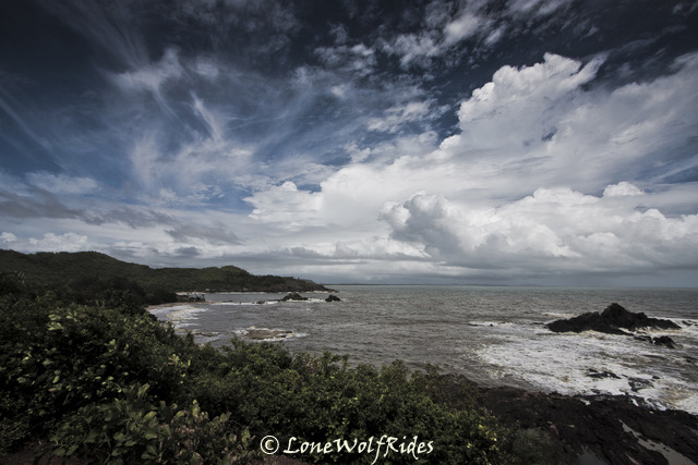
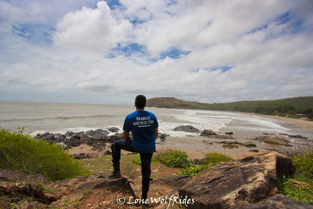
Kalasa, is a small temple town surrounded by the Bhadra river on three sides and a hill in the backdrop. I had passed through this town some time in early 2009, during one of my previous 'LoneWolfRides'. This town leads to one of Karnataka's most beautiful stretches of road right through the Kudremukh national reserve which is one of the few biodiversity hotspots in this region. Surrounded by controversy amidst this beautiful stretch is the Kudremukh Iron ore company which faced the ire of many environmentalists in relation of their plant being a threat to the flora and fauna of this region, which finally lead to shutting down of their mining activities in the region. The road running right through the heart of this national reserve is one of the most amazing pieces of tarmac I had seen, with super smooth roads and mind blowing scenery on both sides of the road there is not much more a bike could really ask for. I stopped for a couple of pictures just before the Kudremukh national park started.
Lush fields before Kudremukh
Tea estates are an odd sight in this region!
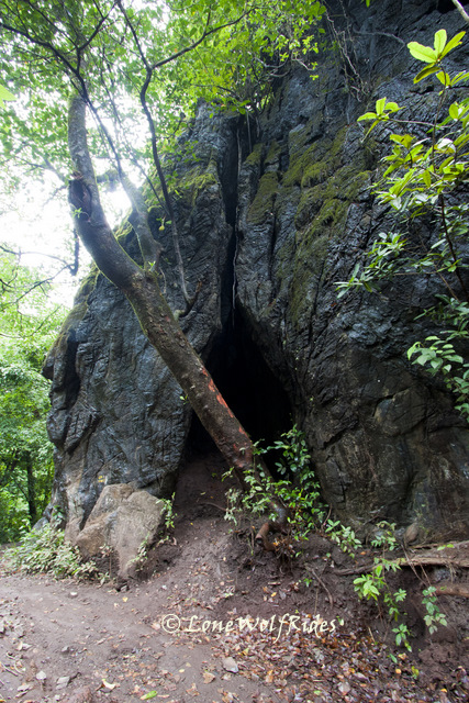
The paths leading deep into Kudremukh National Park

The Tunga and Bhadra rivers flow around this National park and it will be apparent as you pass through many bridges ranging from big to small on this stretch of road, also since the altitude in this forest varies from as low as 100 mtrs, to as high as 1830 mtrs the road twists through a series of ups and downs making for an awesome ride. The rains had so far been limited to occasional patches of light showers, infact I even got a little bit of sunshine on my way inside the forest.
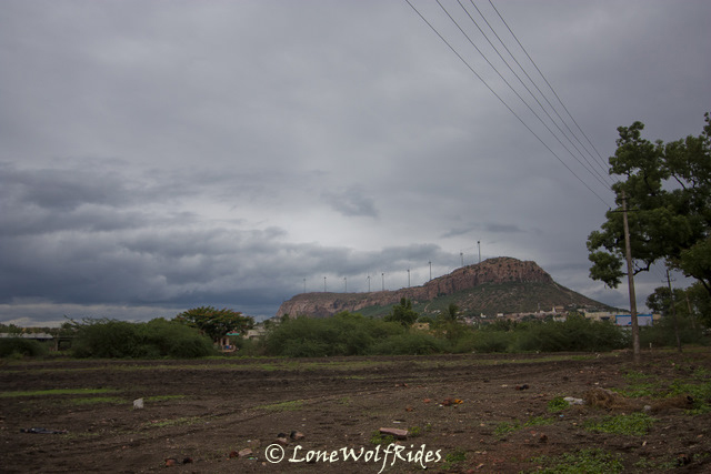
Can you see the rolling hills of Kudremukh in the background!
Eerie carriageways running inside the forest
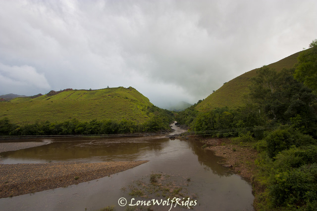
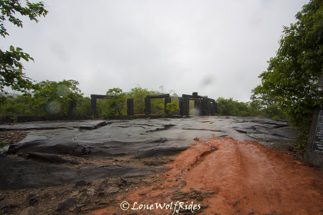
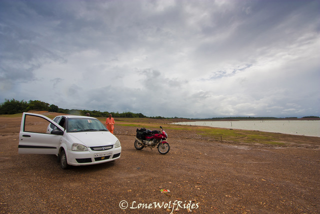
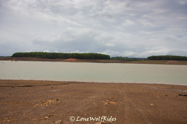
I passed over a small bridge that gave me complete view of the mining plant to one side and an amazing view on other end. Beyond this section there comes a small dam built by KIOCL on the Bhadra river, it is said that it was built to dump the red slurry from the mines which in turn creates havoc with nature. Photography is prevented on top of the dam, as I was shooed away last time by a guard over the entrance of the dam. I did not dare try any antics this time either, I just got a shot of the dam and was off.
Lakya Dam
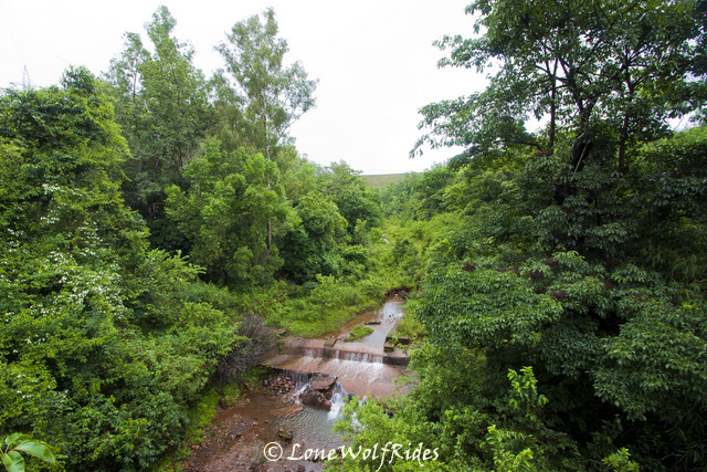
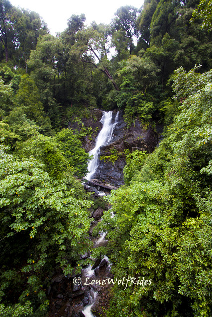
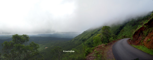
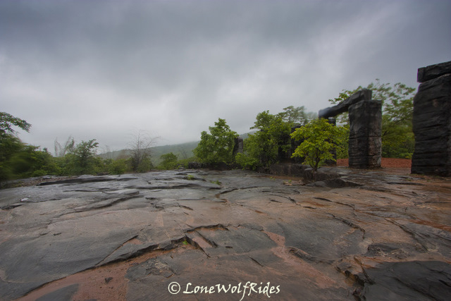
At this point it started to pour heavily, I hastily pulled the rain cover onto the camera bag a rode on. And this was when I was just thanking the weather gods for not giving my heavy rain so I can photograph this stretch in piece. I felt that if there really is a weather god, he was at times playing pranks with me and at times being genuinely good. There was on specific stretch where I wanted to take a picture as the last time I passed through it, I wished to my self I had a camera with a wider lens, partly this time my wish had come true, but whatever the scenery was to be seen was held captive behind the clouds as the rolled across the mountains covering them completely. Nevertheless, I tried my best to get as much of it as possible. But as soon as I as had gone about a kilometer or so ahead I found that it is just not possible to not stop to get pictures and I stopped to get some picture of a small waterfall falling behind a bridge.
Praise the Lord! For we have been gifted with this beautiful nature
This is my most favorite stretch inside the forest
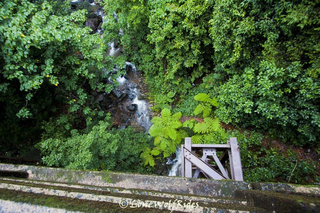
By now it had quite literally started pouring and I decided to just enjoy the ride, whilst a small rumble in my stomach reminded me that my body needs more just ParleG for food to survive in the day. I thought that I'd stop to grab a bite once I complete Kudremukh, but in my hurry to get across the to the other side and the general enjoyment of the riding in the rains on one the most awesome stretches of road I missed taking the turn at the route through which I had not been before. There was another spot where I just had to stop despite the rains.
Might not be apparent from the pictures, but it was pouring at this moment.
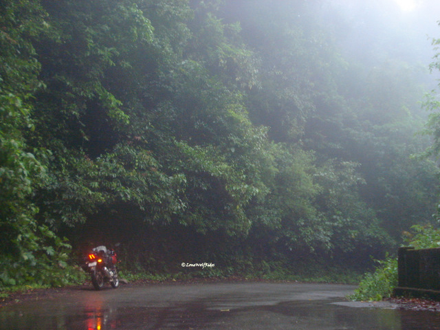
For the times when its raining like it was raining here, I use my trusty yet expendable 5 year old point & shoot cam as the SLR was to expensive a piece of equipment to be donated to the rains. As I continued down this road the rains intensified as now I was on the sea facing side of the mountain, the coastline was still a good 60-70 Kms away but it was enough to make his patch of road extremely rainy. I had decided not to stop anywhere till the exit, but could not resist stopping to get pics of the rain that I was riding through.
Rainforest =Rains (Lots) + Forest (Lots)
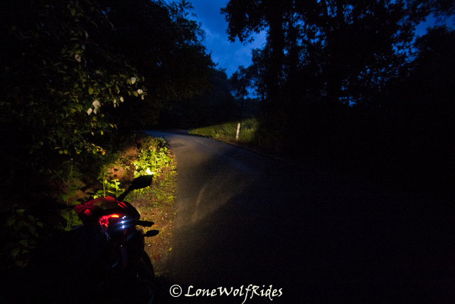
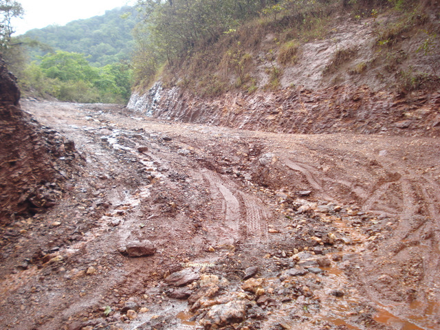
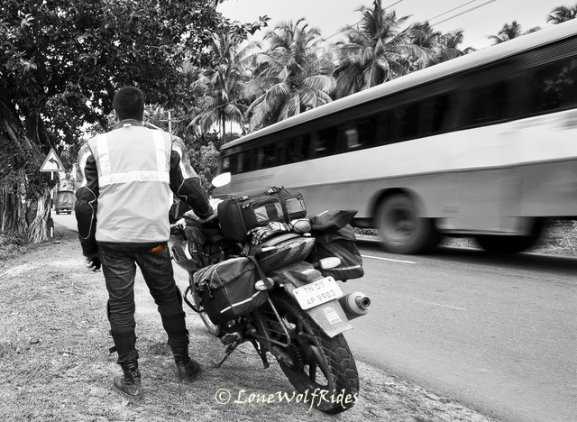
The problem with the LS2 helmet that I was using was that rain would trickle in on the inside surface of the helmet as well, now this makes things worse in the already low visibility of the rains. I was just glad that I was doing this when there was still enough day light on the road. As I approached the exit gate of Kudremukh, I slowed down and indicated to the guards if they would like to see the time stamp, but given the heavy rains they just let me go ahead, happy at not stopping I gunned the throttle and kept going ahead. Now some patches of road would be dry but as I reached the town of Karkala, the rain got so so intense that it made it impossible to see anything on the road. The drop were large enough to make loud racket inside my helmet. Ever since I got out of Kudremukh gate I had a nagging feeling that I was on the route that I did not intend to take. On reaching outskirts of Karkala when I asked where the route to Sringeri was, he pointed me in the direction from where I'd come from. I was dumbfounded, how can this be! I had not seen a single sign board with Sringeri written on it so far. At this point I had two options, either proceed towards Udupi or Mangalore which was pretty close from here or re-trace my steps back towards Sringeri. Not wanting to face coastal rain and not wanting to miss out on the opportunity to ride through a stretch of road that I'd never been through I just turned around and for the time being ditched my 'there are no wrong turns' funda. The want to cover an unknown stretch was far greater, but the odds were stacked up against me as it was nearly 6.15PM when I had exit Kudremukh and with daylight fast fading this was a going to prove to be a costly bargain if things went awry. I raced back towards Kudremukh in the blinding rain, this time I took probably half the time to reach the entry check post. Here I was given yet another time stamp, I asked the guard for directions to Sringeri. He said I have to go 12 Kms into the forest and then I will reach a junction where I need to take a left. Junction? What junction, I never saw a junction on my way down. What the heck! I just shifted gears and plowed through the rain climbing up Kudremukh has always been fun, but with daylight fast fading and rain and mist playing havoc I was just cooking up a recipe for the next blockbuster horror flick. The mentioned 12 Kms came and went by, nothing came no turns. For a moment I thought it may a hidden route which may have been obscured by the foliage around.
After about 15 Kms finally I reached a junction which indeed said that Sringeri was left and was just 35 Kms away. I had missed this turn in my hurry whilst passing through just an hour earlier, and as I turned to the road that went down on NH13 apparently was far far worse than the Kudremukh stretch. It was a narrow road, pockmarked with patches of road missing in between. I did not take a single break here as I was trying not to become an evening snack for a wild animal, though I knew something like that rarely happened around these parts but the possibility still existed. The terrible roads coupled with heavy downpour and to add to the drama the fading light made it a ride that I can never forget. I encountered a few vehicles on and off, but it was far lesser in number than the 'other' stretch of Kudremukh. After nearly about 1 hour of riding through these stretch of road I reached the exit check post, I breathed a sigh of relief. The guards were not as forgiving as the ones on the other side, they wanted to see the time slip. I knew that my jacket's "waterproof" pocket would have completely destroyed it beyond recognition in the kind of rains that I had ridden through. So as I gingerly took out the little piece of dripping wet paper he looked up to me and said angrily, "500 Rs fine!!!". I told him that it was raining and all that, he did not relent. As I went to take out my wallet I first drained my riding gloves of water by clenching my fists, what came out must have been atleast a mug full of water, the guard found that funny and I guess his heart melted at the sight of poor me dripping wet. He said "no fine!" go ahead. Phew! that was close, through the broken down stretch I was riding like a madman and this had taken a toll on my back. I took it easy through these last few kilometers, as it is with the dusk set in and it being almost dark by now there was not much more speed I could carry. About 10 Kms before the Sringeri the roads finally smoothed up and for once it felt like a National highway. I took a small break to just 5 Kms outside of Sringeri as the rains had eased up a little and I wanted a break badly.
After about 15 Kms finally I reached a junction which indeed said that Sringeri was left and was just 35 Kms away. I had missed this turn in my hurry whilst passing through just an hour earlier, and as I turned to the road that went down on NH13 apparently was far far worse than the Kudremukh stretch. It was a narrow road, pockmarked with patches of road missing in between. I did not take a single break here as I was trying not to become an evening snack for a wild animal, though I knew something like that rarely happened around these parts but the possibility still existed
. The terrible roads coupled with heavy downpour and to add to the drama the fading light made it a ride that I can never forget. I encountered a few vehicles on and off, but it was far lesser in number than the 'other' stretch of Kudremukh. After nearly about 1 hour of riding through these stretch of road I reached the exit check post, I breathed a sigh of relief. The guards were not as forgiving as the ones on the other side, they wanted to see the time slip. I knew that my jacket's "waterproof" pocket would have completely destroyed it beyond recognition in the kind of rains that I had ridden through. So as I gingerly took out the little piece of dripping wet paper he looked up to me and said angrily, "500 Rs fine!!!". I told him that it was raining and all that, he did not relent. As I went to take out my wallet I first drained my riding gloves of water by clenching my fists, what came out must have been atleast a mug full of water, the guard found that funny and I guess his heart melted at the sight of poor me dripping wet. He said "no fine!" go ahead. Phew! that was close, through the broken down stretch I was riding like a madman and this had taken a toll on my back. I took it easy through these last few kilometers, as it is with the dusk set in and it being almost dark by now there was not much more speed I could carry. About 10 Kms before the Sringeri the roads finally smoothed up and for once it felt like a National highway. I took a small break to just 5 Kms outside of Sringeri as the rains had eased up a little and I wanted a break badly.Outside Sringeri, it was 7.30PM and I scared a villager
As I took the above shot, I forgot where I had kept the lens cover and started searching for it like mad. In the rainy conditions like which I was riding through, the lens cover is absolutely necessary. In a few aborted attempts at finding I started click pictures with the flash ON so I could located the cover, and that what resulted in a shot like the below shot.
Lens cap hunting
Fearing the worst that I had lost the cover, I removed all the rain protection on my tank bag and rummaged around for my torch finally and after that finally managed to locate the lens cover. I forgot to mention that amidst all the flashing I was doing there was a villager who was rolling down the slopes with his moped's engine and lights off and talking loudly on the cellphone. At the exact moment that he neared me I flashed once to locate the lens, the bright flash of light from the other side of the road had scared him and he let out a loud yelp of fear.
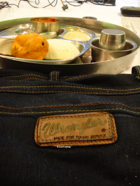
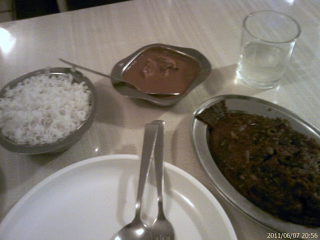
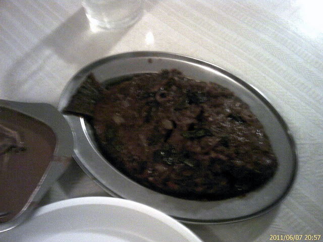
With camera bags packed I headed towards Sringeri to rest for the night as it was already 7.30PM. I just stopped at the first hotel that I came across. With all my riding gear I look like like an alien sight as it is, but now I was dripping wet alien, every step that I took would form a puddle of water in the hotel. At first I took their basic room which was about 8ftx8ft, this was okay with by all means but amount of dripping wet stuff I had meant that I would have no place to dry them so I upgraded to a bigger room. The combination of heavy rains and back breaking roads had taken a toll on me so I after I had set everything to dry I slurped away to some chicken curry rice and at this point my Point & shoot started showing up some funny issues with the colors. I presumed it must have gone kaput with all the rains that I am giving it.
Total Travel Distance : 260 Kms
Total Travel Time : 9 Hrs
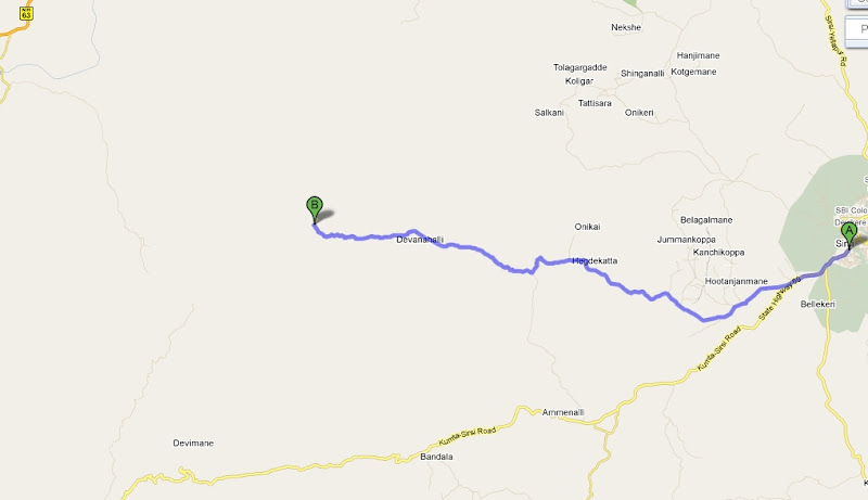
Route : Chikmagalur-Mulliyangiri-Chikmagalur-Balehonnur-Magundi-Kudremukh-Karkala-Kudremukh-SringeriWith camera bags packed I headed towards Sringeri to rest for the night as it was already 7.30PM. I just stopped at the first hotel that I came across. With all my riding gear I look like like an alien sight as it is, but now I was dripping wet alien, every step that I took would form a puddle of water in the hotel. At first I took their basic room which was about 8ftx8ft, this was okay with by all means but amount of dripping wet stuff I had meant that I would have no place to dry them so I upgraded to a bigger room. The combination of heavy rains and back breaking roads had taken a toll on me so I after I had set everything to dry I slurped away to some chicken curry rice and at this point my Point & shoot started showing up some funny issues with the colors. I presumed it must have gone kaput with all the rains that I am giving it.
Total Travel Distance : 260 Kms
Total Travel Time : 9 Hrs
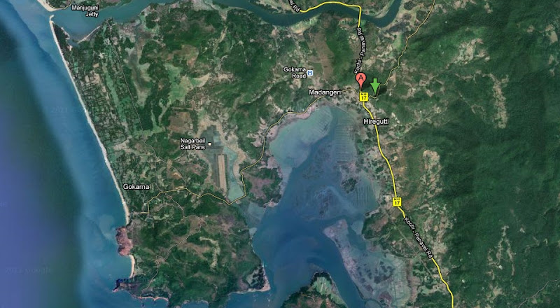
Map : Click!


Comment