


 Tweet
Tweet
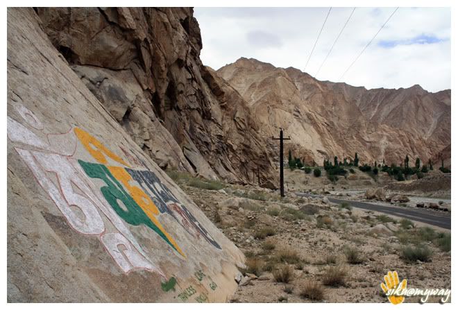
LADAKH & NUBRA: A cherished dream
-
Best Travel Blogger Contest Thread Approved.
Wonderful start to an amazing thread, I am sure, Archi. Please continue with the log and the pictures.
:)
Please continue with the log and the pictures.
:) -
Thanks Aryan... glad you liked it...
Comment
-
Day - i,ii,iii
Day-I (14th July ‘09)
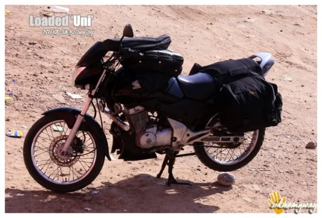
It was really a hectic day. Our train was scheduled to departure at 4 in the evening and not a single thing was done. There were mainly three works pending, Karolbagh shopping (it included some spares for Uni, saddle bags, polythenes etc), Uni’s engine oil to be changes and the whole packing.
Managed to reach Karolbagh at around 9.15 AM, but I was unaware of the thing that it wakes up at around 11 AM. So I’d to roam randomly for about 2 hours and after it(that) I managed to get the local made saddle bags from Chopra’s for 1K and some other small things like chain link etc. which were missing from my repairing kit.
Again managed to reach home at around 12.45 PM and we had only 45 minutes for the packing and all as we’d to reach Purani Delhi railway station before 2.00 PM. The thing is that if you have a confirmed railway ticket then you can carry your bike in the same train but you have to book it minimum 2 hour before the scheduled departure. Just make sure that the fuel tank is completely empty.
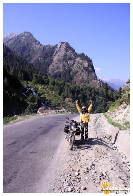
Things were done in ease and we left Delhi at sharp 4.10 PM.
Route – Home (Kousambhi)-Old Delhi railway station
Total distance covered – 20 Kilometers
Day-II (15th July ‘09)
A beautiful weather welcomed us at Jammu. I was happy just because there was no sign of rain. I was really scared of rain, just wanted it to be delayed for 15 days.
Got the bike unloaded and within 15 minutes we were out from Jammu-Tawi railway station. Enquired for the fueling station and Unpacked the bike. It took 10-15 minutes to reach at petrol pump. It’s hardly a kilometer away from the railway exit point. Uni gulped down unleaded petrol worth 750 in ease, some 17.?? Liters. Now our steed was ready for long run with full stomach. Not to mention here, we ended up with out morning tasks in the train only to save time.
It was about 7.30, when we asked the direction towards Srinagar. Because of the itch to ride we decided to have our breakfast after some riding hours but dint forgot to carry water.
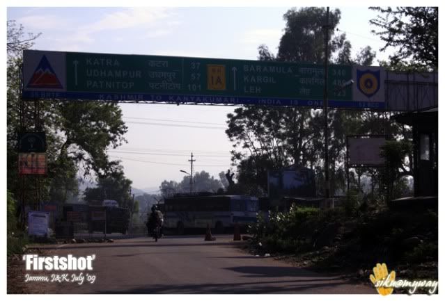
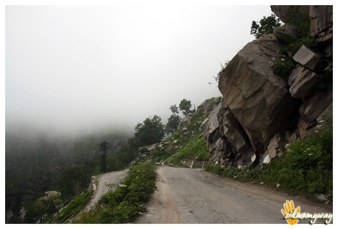
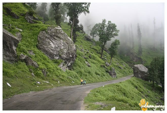
After the breakfast break at around 9, we continued on Jammu-Srinagar Highway (NH 1A). The beautiful road just invited to RIP on it. I don’t remember where we did our lunch, thanks to my volatile memory .
.
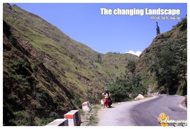
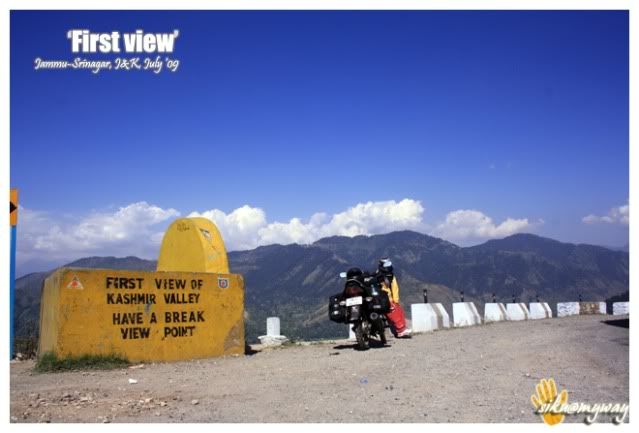
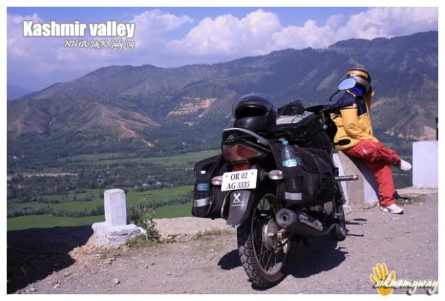
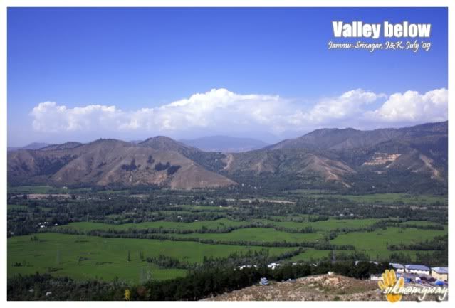
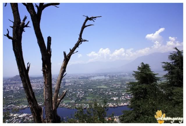
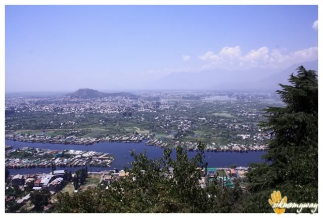
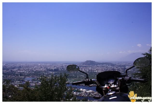
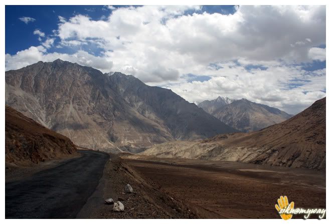
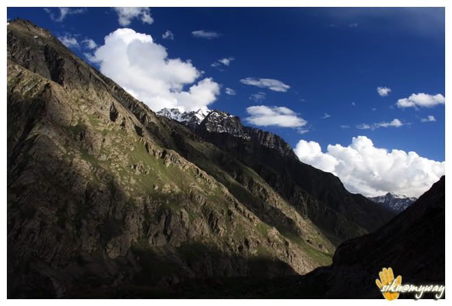
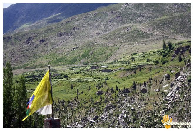
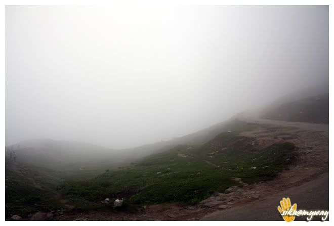
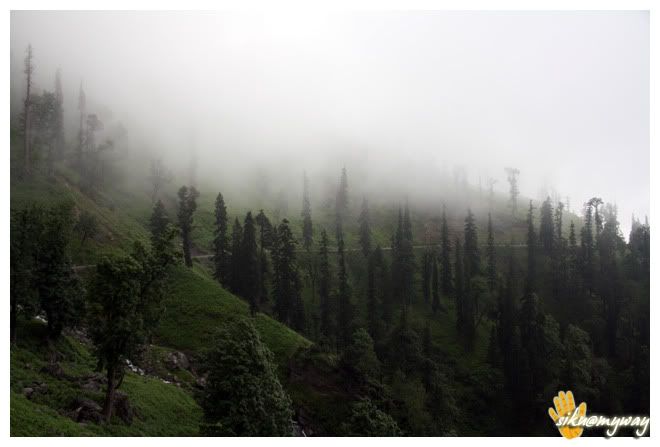
With many photo breaks we finally entered Kashmir valley at around 03.30 PM. We stopped at the first view point for quite long time and it was really beautiful to see the green sprayed valley below.
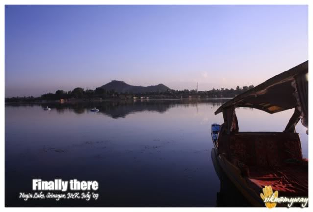
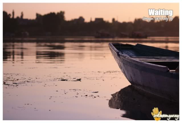
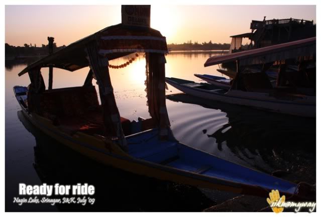
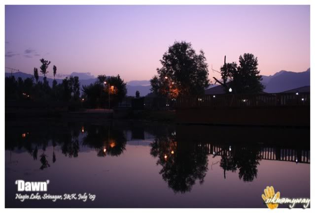
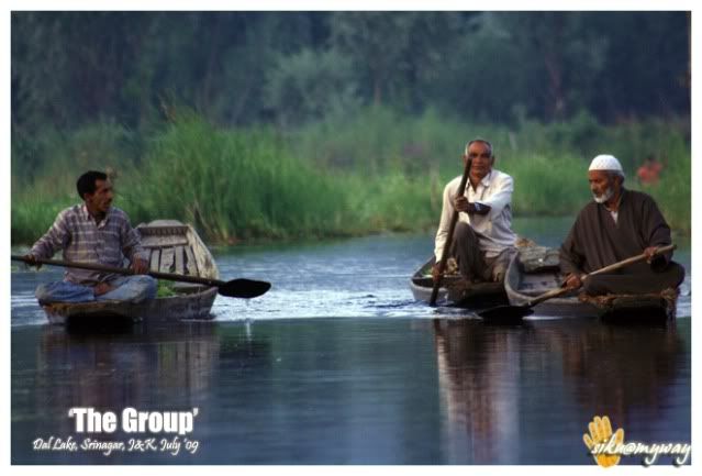
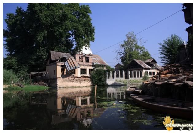
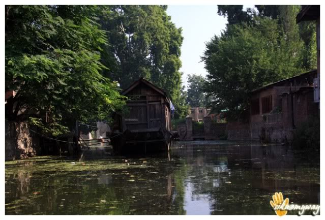
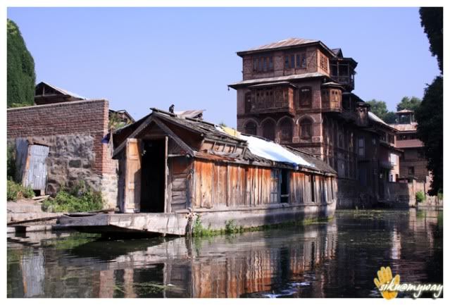
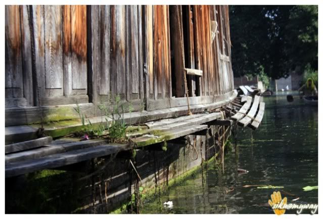
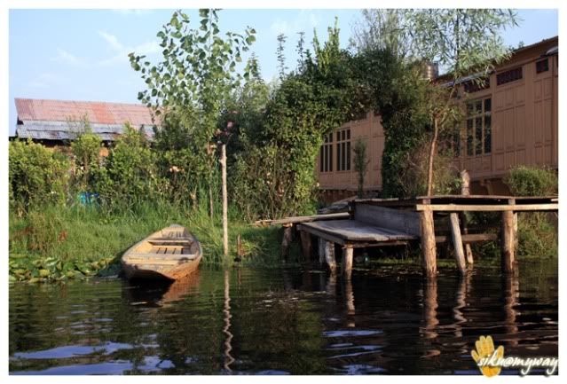
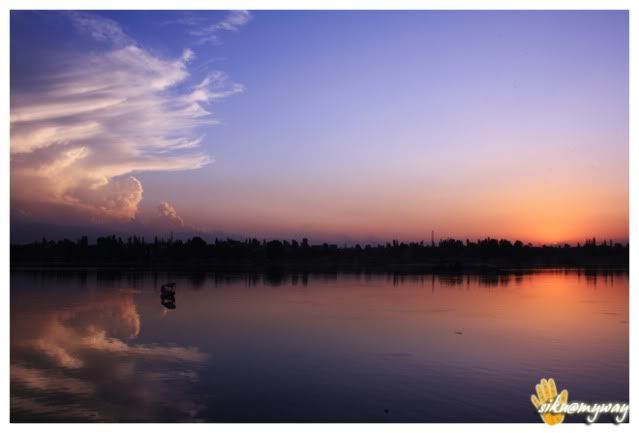
The next stop was Shinagar of course. We entered the city at around 5.30 PM. It was my third visit to Srinagar. We entered thru the chaotic Dalgate area. We had plans to stay there 1day before starting for Ladakh. So earlier we decided to stay 1 day in a budget hotel and one day in a Houseboat. The sun was doing his pack-up when we were riding along with Dal Lake and we had enough time before it gets dark. So we rode to Nagin Lake, another small but beautiful lake of Srinagar that I like most. It’s about 15 kilometers from Dal Gate.
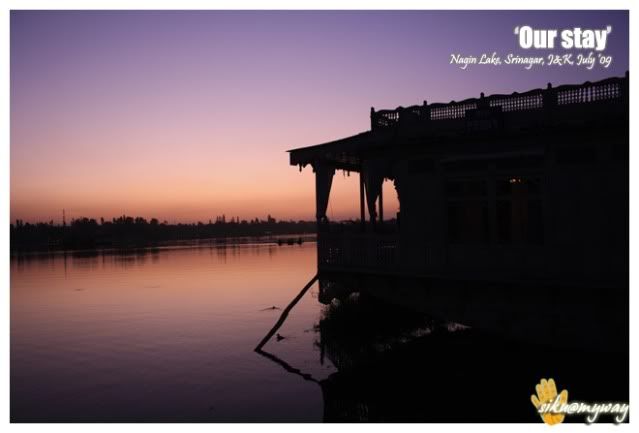
Parked the bike beside the lake and just sat on the steps leading in to the lake. Like any other tourist place we were surrounded by agents asking for houseboats. Actually there are very less/no hotels in that area as it’s off street. Requested them to leave me for half an hour so that I can relax a bit, then we got a cool offer, a Houseboat for 700 bucks with food. And the prices were as low as 300 per room. What we got was a real steal, one double bedded room with attached toilet, a dining area, a leaving space, a balcony and a terrace at first level. And it was the whole boat.

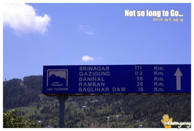
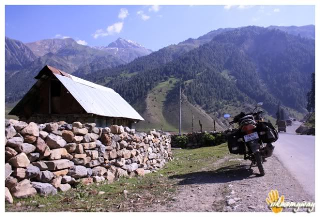
Route – Jammu-Udhampur-Batote-Ramban-Banihal-Anantnag-Qazigund-Srinagar
Total distance covered - 324 Kilometers
Road condition - Excellent (hardly 2-3 bad patches of few kilometers)
Important places - Udhampur (Each bike company’s service center is available, I went to Honda people and they were lightening fast. It took them 3-4 minutes to change the engine oil and replace the side stand), Qazigund (many shops and factories for cricket bats)
Tourist interest points - Patni Top (I really don’t know why people go there)
Precautions - Nothing special. Fuel is not a problem and there is habitation at regular intervals. Good road side dhabas for food. Just be little careful of monkeys on road, one really scared me.
Day-III (16th July ‘09)
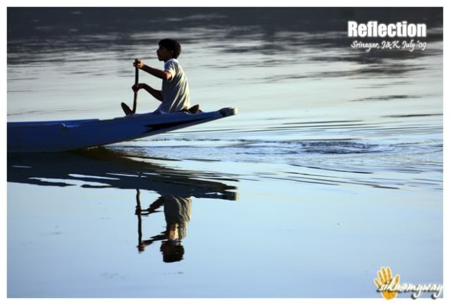
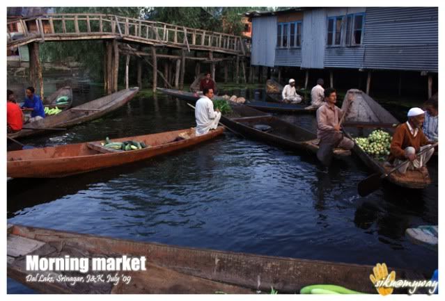
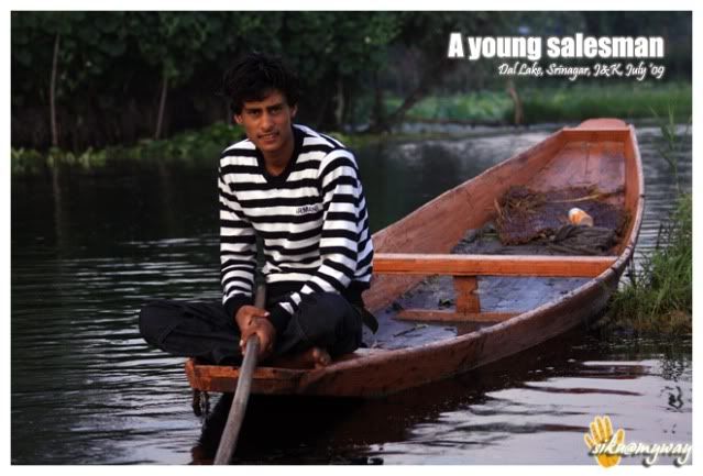
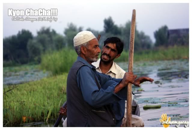
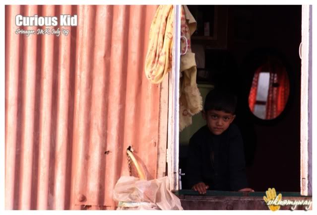
I always wanted to visit Old Srinagar, and what could be the best to take the water route along with a Sikara ride!!! It was an early morning start and we were back to the boat after 3-4 hours. And now it was time for some rest and then shopping for the things those were left from the essential list.
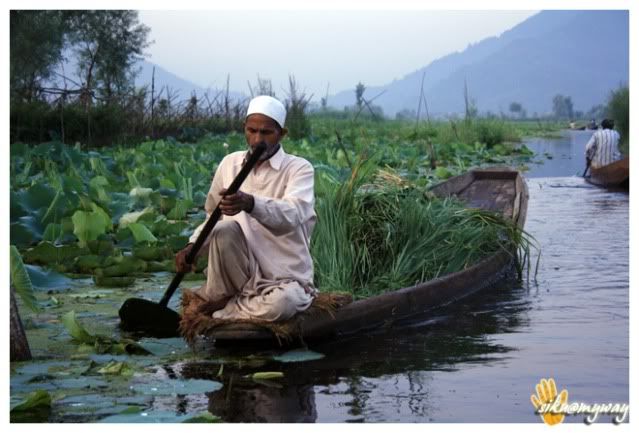
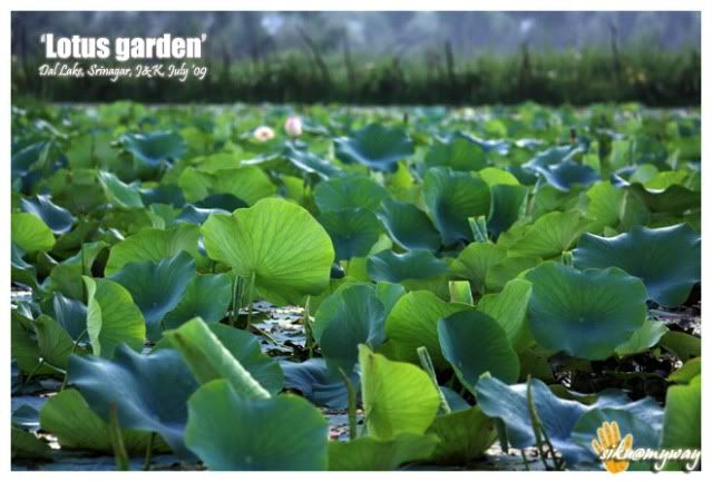
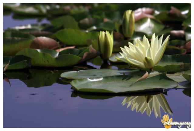
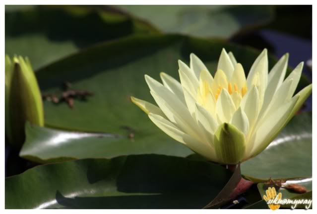
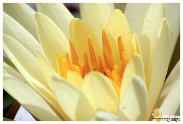
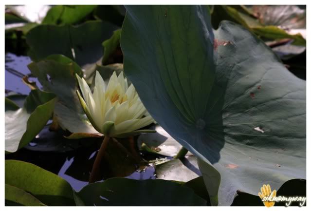
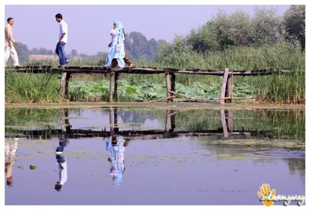
Lotus Garden…
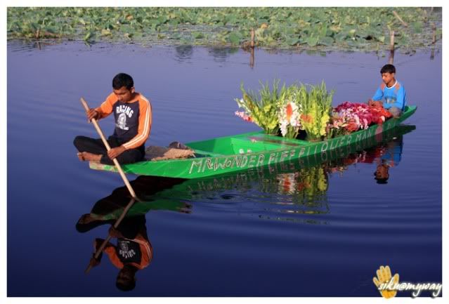
Old Srinagar…
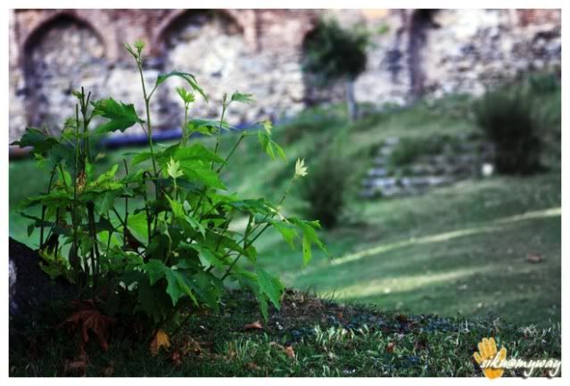
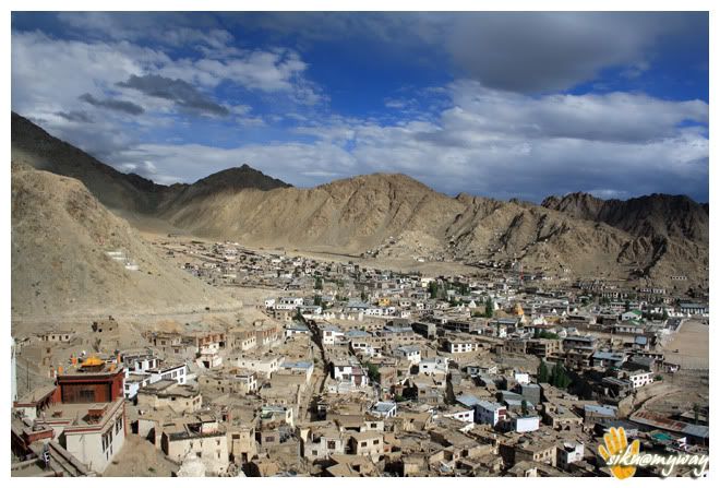
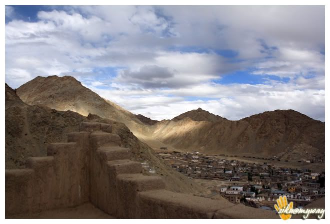
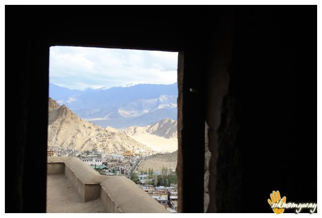
Bought polythine for luggage and proceeded to Shree Sankaracharya Temple. It’s under the control of Army because one can aim the whole city from this place. Another highest point is Srinagar Palace which is not accessible to the public for the security reasons.
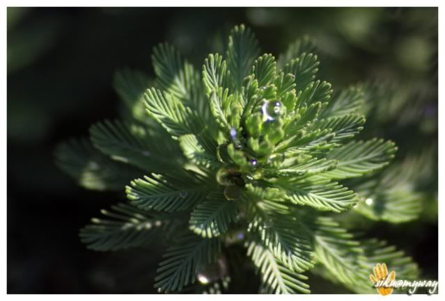
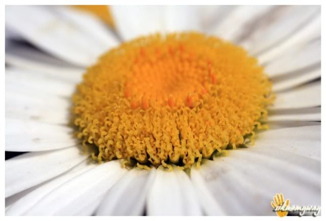
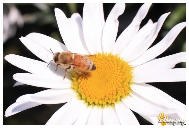
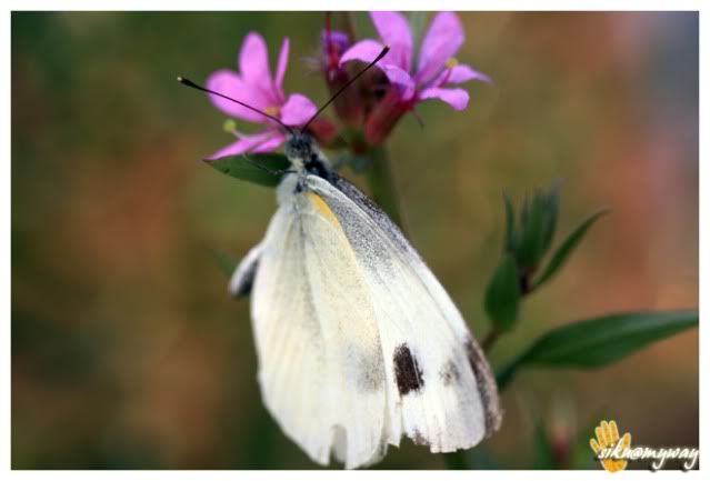
Some random snaps/macro attempt…
Next while visiting Mughal Gardens we met ‘Sourin’, a guy from Mumbai roaming in Ladakh region for more than 30 days on his ‘Yam FZ’. This decent guy became a very good friend in a short while and his inputs made everything easy and smooth. Thanks man, your plan came out really well. He made the final layout of our ride spending more than 2 hours on it.
Sourin and Om…
Sunset from houseboat terrace…
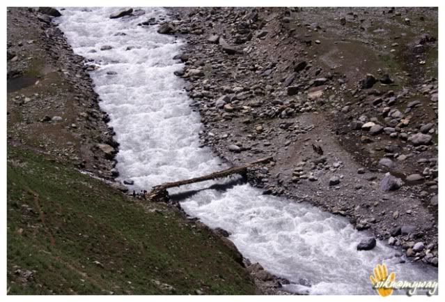
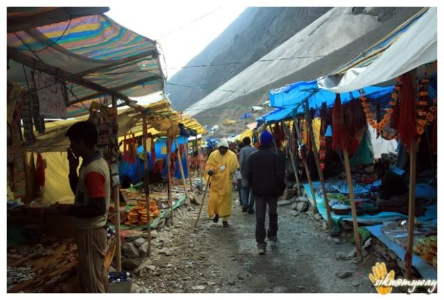
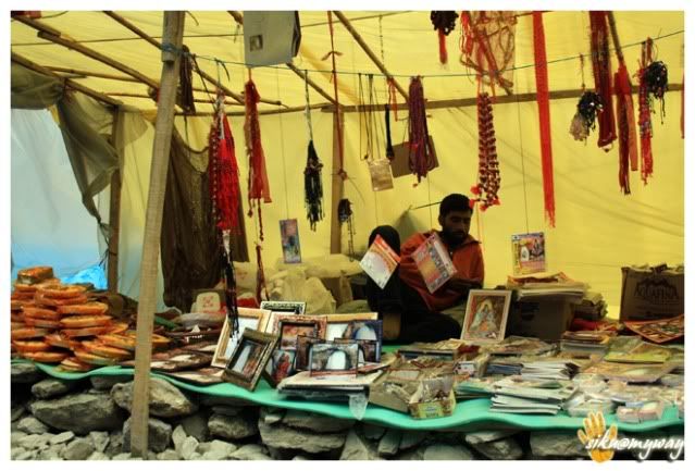
And here we decided to go Shree Amarnath Jee. It was a four hour trek route from Baltal, some 100 kms from Srinagar towards Leh. We planned to start early morning from Srinagar for Baltal, some 20-25 kms from Sonmarg. We thought we will be back by the same day evening but it was a different story next day.
Route – @ Srinagar
Total distance covered - 52 Kilometers
Road condition - Excellent city roads, some parts are very dusty.
Event of the day - Sikara ride at Dal Lake and watching sunset from the houseboat terrace.
Important places - Old city (can get all your necessary things)
Tourist interest points - Shree Shankaracharya Temple (beautiful aerial view of Srinagar), Sikara ride at Dal Lake, Mughal Gardens-Nisath garden, Chasmasahi, Parimahal, Old city)
Precautions – Polythene is banned in Srinagar, sales person may bother you, avoid roaming late in the city.Last edited by archistar; 01-08-2010, 02:53 AM.Comment
-
Cool...yeat another ladakh...Guess I have already seen the pics on Orkut but would be gr8 along with words...bring it on pal !!!
P.S: Few of your pics can very well be used by Kashmir tourism department
Last edited by happybiking; 01-08-2010, 02:56 AM....Back to HIBERNATE mode...
sigpic
1200kms : Across Tamil nadu & pondicherryl
To the end of land!!!
Breakfast Ride!!! Mulshi Lake...Comment
-
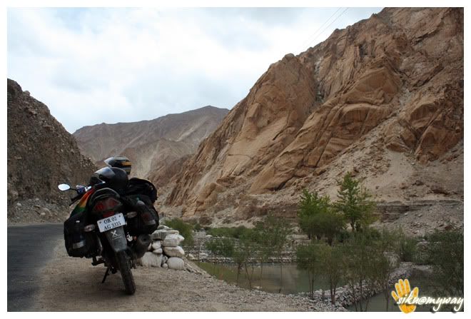
Day - iv, v
At around 7.00 AM we were on the road. And we had to reach Baltal as soon as possible. It was easy to cruise little fast in the morning. The morning view in the valley was awesome.
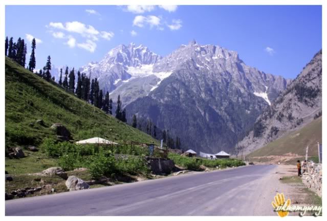
Gulmarg is a beautiful place with lots of horses gazing on the green carpet. I even dint stopped to capture it thinking that will back to the place by evening for the night stay.
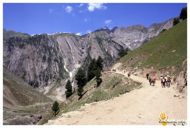
It was a task parking the bike (it was the only bike among around 1K vehicles), keeping the entire luggage before we start climbing. Public vehicle was restricted to go beyond a certain point. Shree Amarnath Yatra tips will follow later.
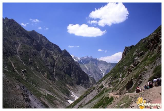
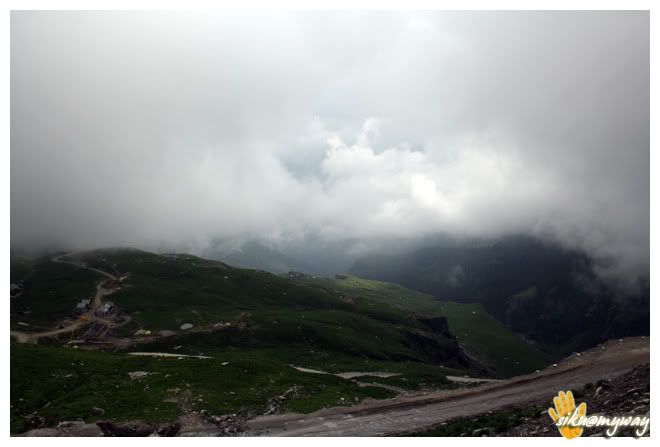
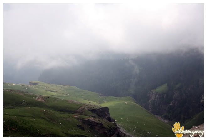
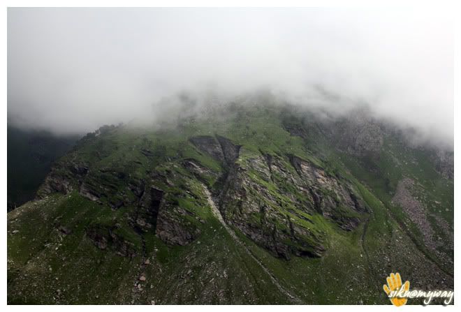
We started at around 10.30 AM. After trekking some 5-7 kilometers we were restless. It was little steep actually with big boulders. And it is tougher when compared with the route to Shree Kedarnath Jee. Before reaching half route we hired pony. And the route was more dangerous after it. Find them in the snaps and it was really scary at certain points.


RouteTotal distance covered - 92 Kilometers
Road conditionEvent of the dayImportant placesTourist interest points - Gulmarg
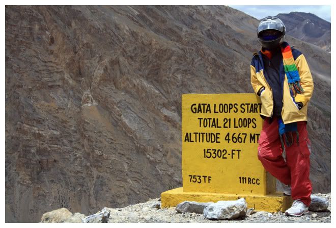
PrecautionsLamayuru was the point of attraction for me for the next day and for that we needed a quick start.
RouteTotal distance covered - 170 Kilometers
Road conditionEvent of the dayImportant placesTourist interest pointsPrecautionsComment
-
Day - vi
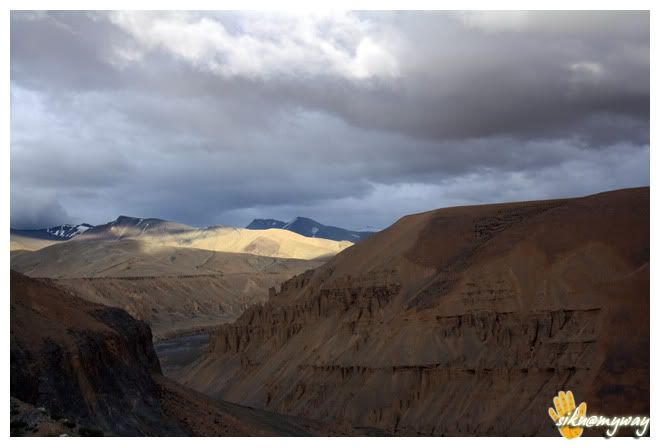
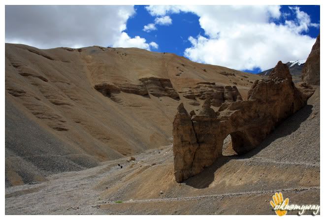
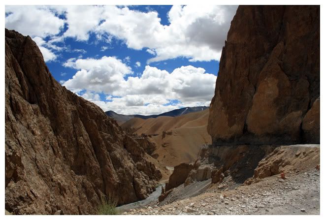
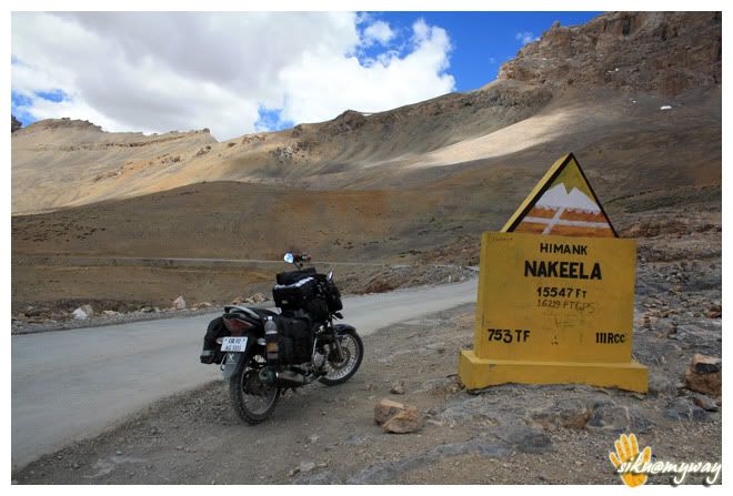
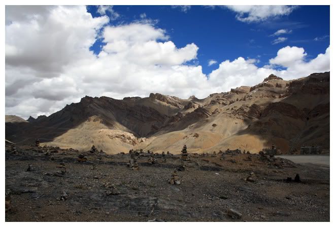
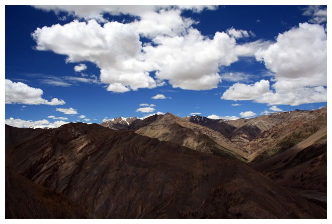
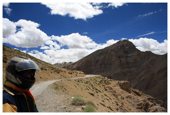
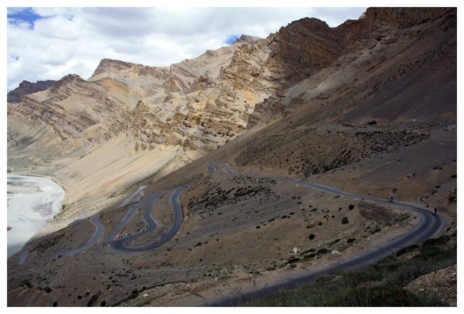
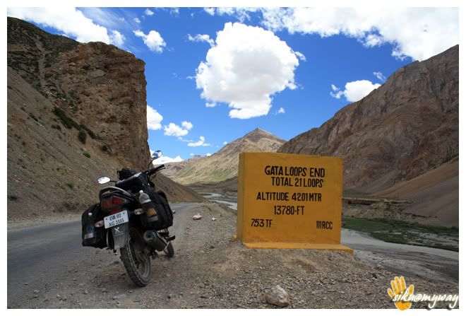
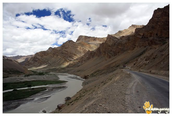
Lamayuru was in the mind. Namikala and Fotula were to be crossed before it.
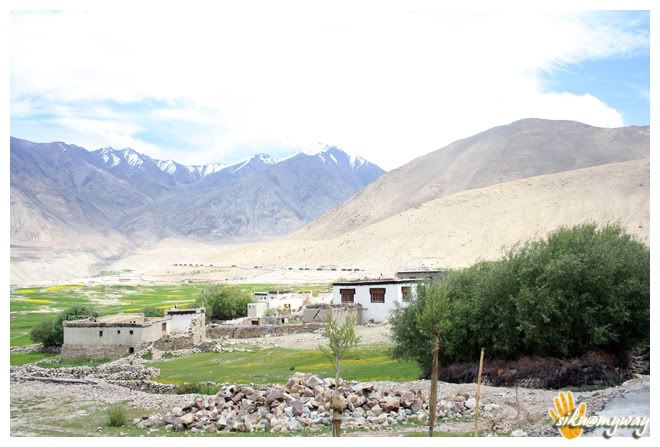
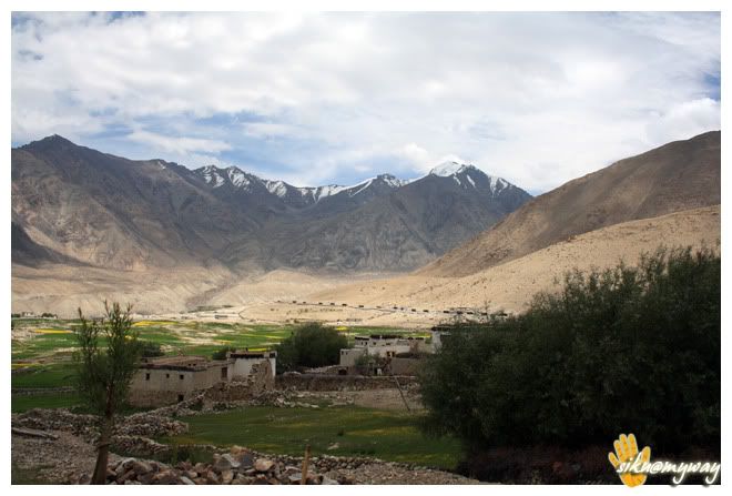
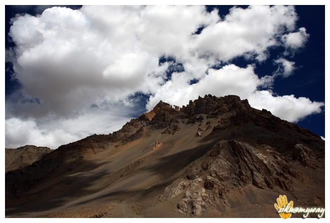
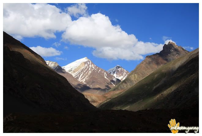
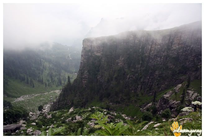
This was the most beautiful stretch of the whole trip with beautiful landscapes all around. Crossing FotulaPhi-yang monastery.
RouteTotal distance covered - 197 Kilometers
Road conditionEvent of the dayImportant placesTourist interest pointsPrecautionsComment
-
-
Day - vii, viii
It was an easy day. Woke up late and after enjoying Ladakhi bread in breakfast at around 10.30 AM we headed for DC Office to apply for inner line permits. It was only 5 minute walk from the place and close to Polo Ground. It took around 20-25 minutes to get all the work done and at about 11.00 the permit was in our hands. We applied permit for 7 days for Hunder, Pangong-Tso and Tso-Moriri, though Pangong was not in our list.

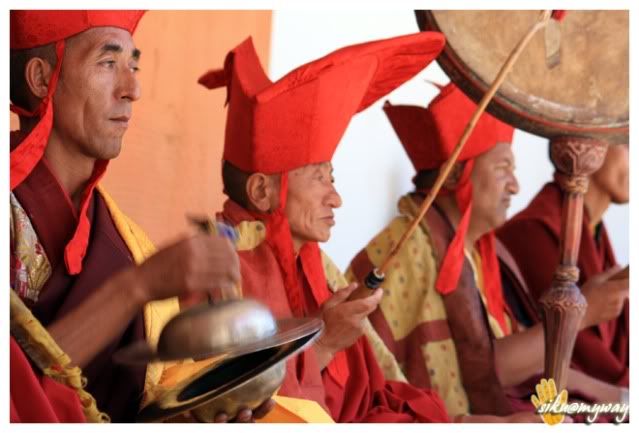
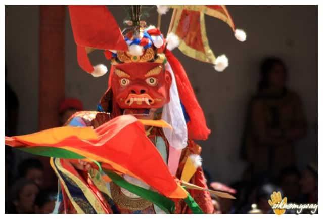
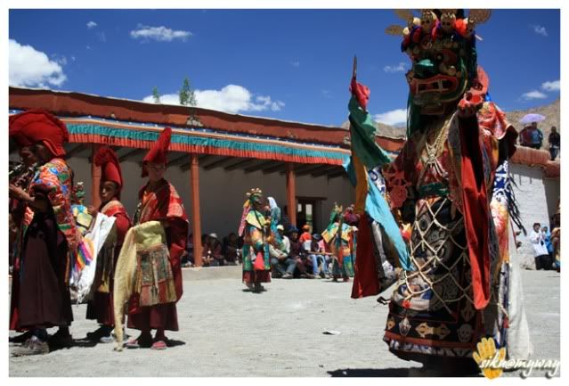
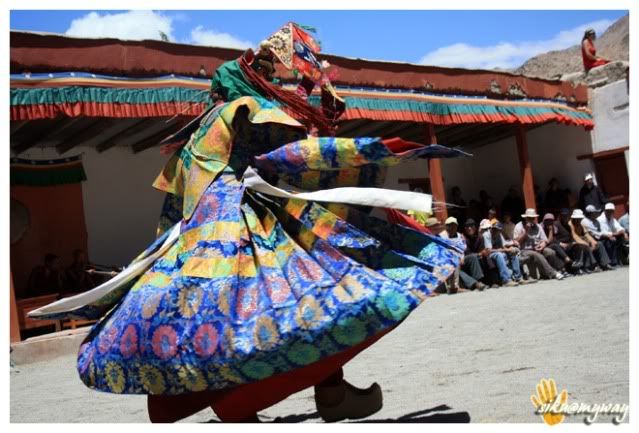
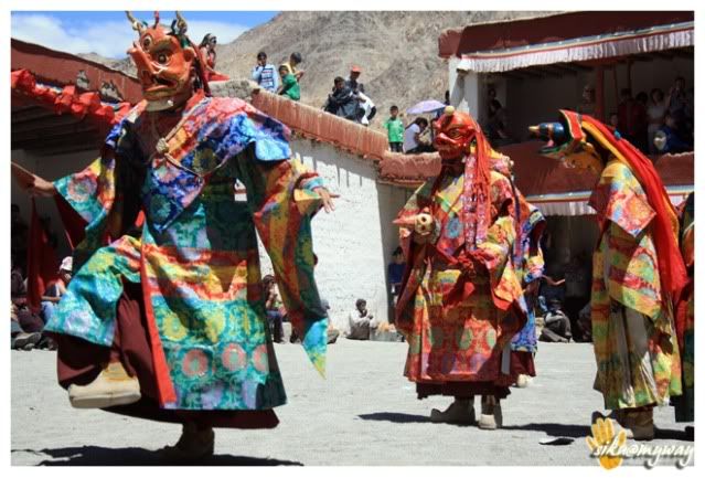
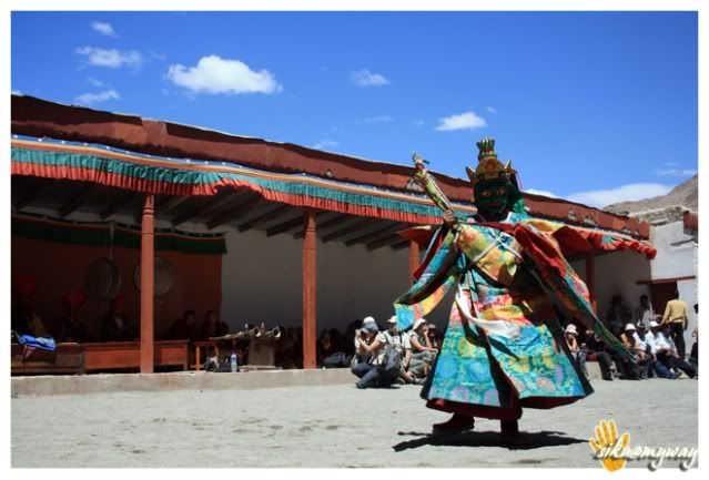
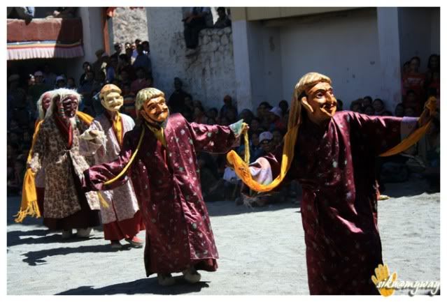
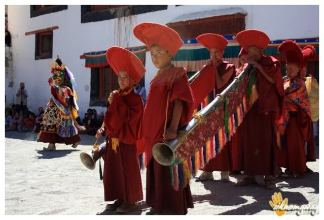
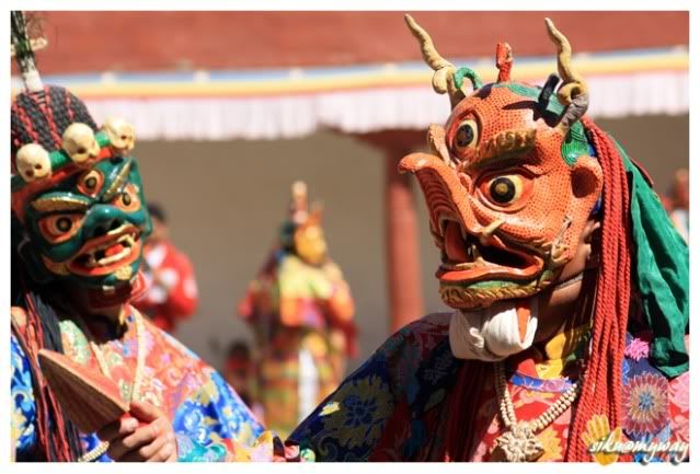
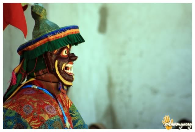
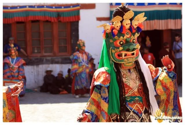
Next was Phi-yang monastery to experience their annual festival. It is some 20 kilometers from Leh towards Srinagar. You have to take the first right turn after the Indian Oil LPG bottling plant. It is a small but beautiful monastery. I spent more than 5 hours there and it was a great experience.

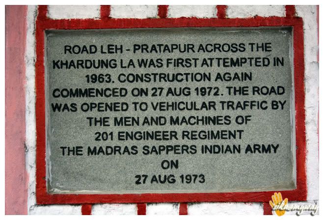
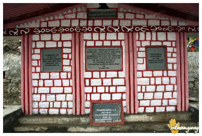
Then we came back to room to take some rest and then headed for ChangspaShanti StupaKhardung La was to be conquered next day and we planned to do our night stay at Hunder as Panamic was the other option. Both are the last points till where tourists are allowed. PanamicHunderRouteTotal distance covered - 71 Kilometers (34597-34668)
Road condition - Excellent
Event of the dayImportant placesTourist interest pointsPrecautions
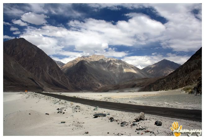
Another easy day was ahead, only to cover some 130 kms to reach Hunder. We decided to skip Panamic which is famous for hot water spring. Khardung La was the target and I dint know how the bike will behave with a pillion on board. We started at around 10.30 AM after breakfast.
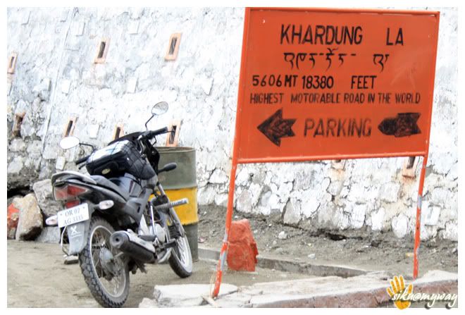
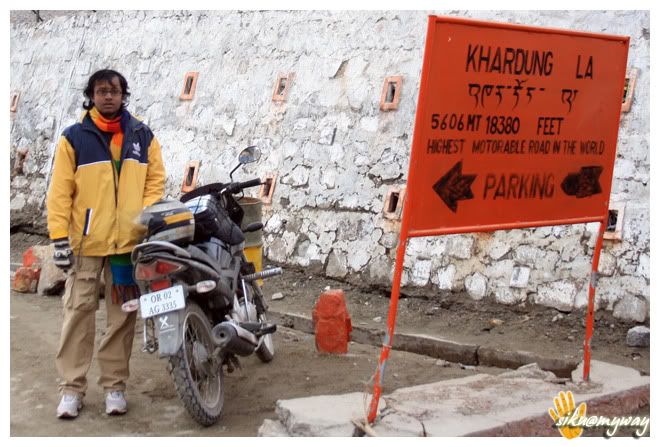
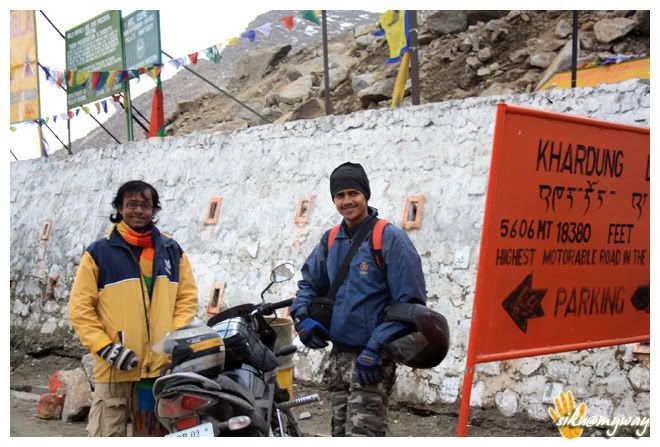
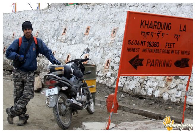
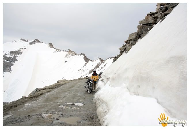
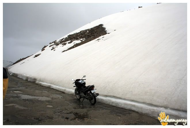
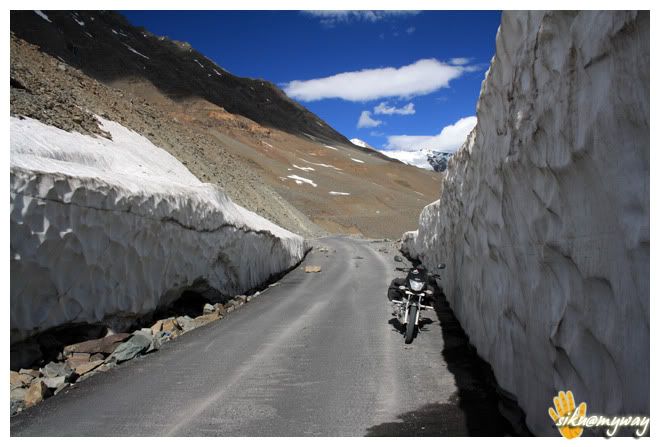
The road was really inviting and there was an excitement for Khardung La. We met some bikers on the route who were returning from the top. I even saw 2 guys on a platina, then I thought if it can do so why not Unicorn!!! At North Pullu we had to submit a copy of our permit along with the registration number of the bike.
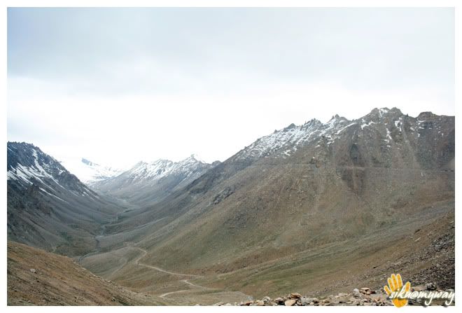
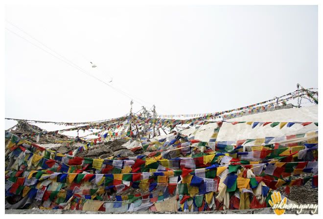
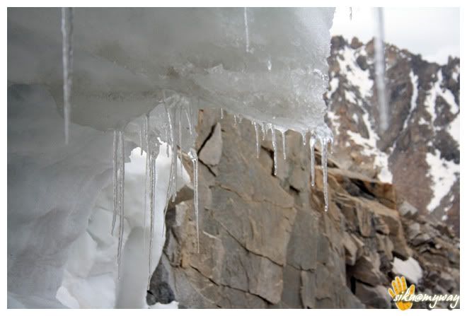
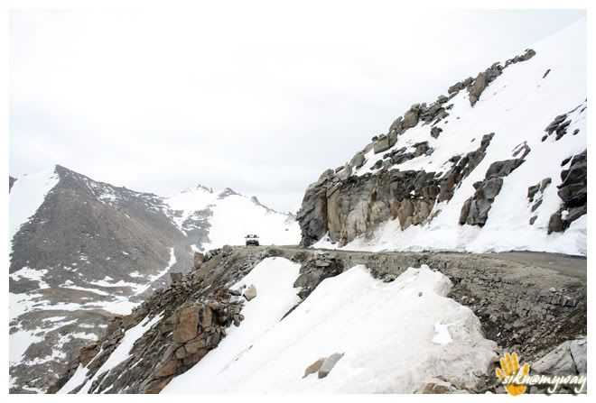
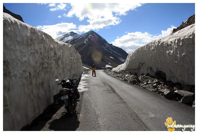
After North Pullu the road came to form and there was an army consignment ahead of us. Managed to overtake all of them easily, the army guys are so cooperative that I dint even blow the horn once. It was little cold and windy when we reached at the top at 11.15 AM. And it was quite easy. Many people suggested us not to stay at K Top for an extended period but we took our own time. It also drizzled a little and it made us to proceed further. But it was again a small break to capture the ice crystals.
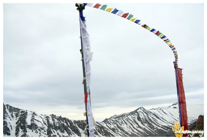
Some posing sessions
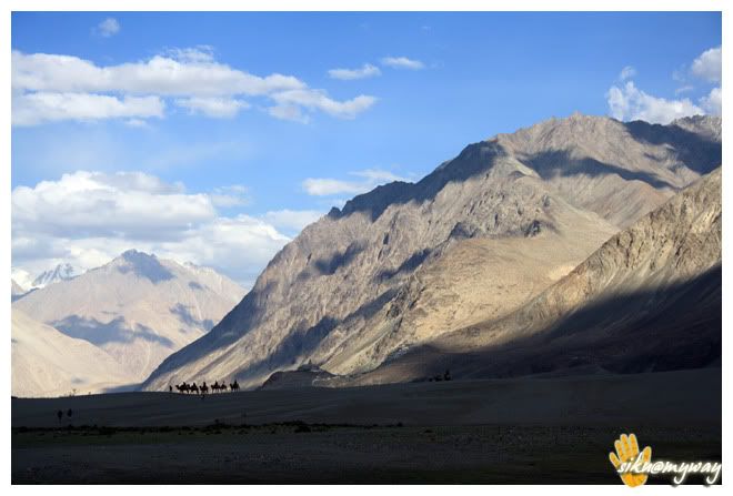
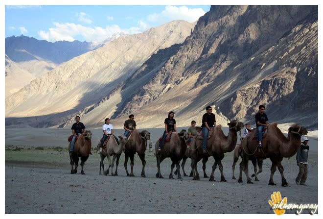
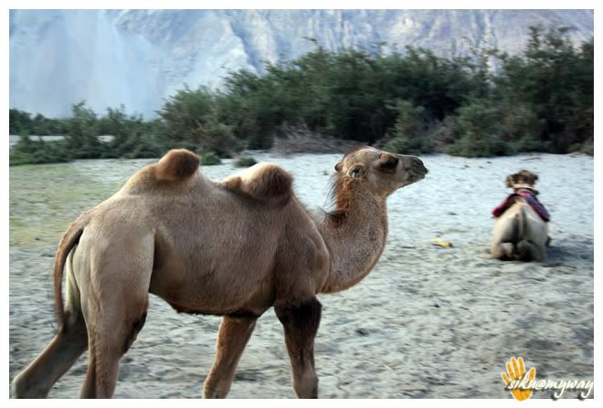
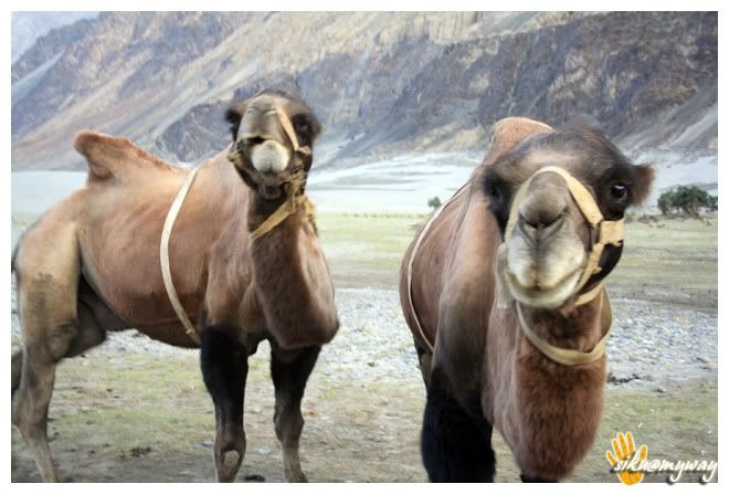
The next stop was for Lunch but I forgot the name. The view of the mountain range and valley was just breathtaking. Next we stopped at Diskit monasteryKhalsar LoopHunder at 5.00 PM, we went to Himalayan Guest House. It was a beautiful place to stay and especially it has a beautiful vegetable garden. Then we dumped our luggage and went for the double humped camel ride, though it was not a great experience for us.
Only BSNL mobile works here. And there is a STD booth at 125 RCC premises.
After a good dinner we were off to bed. It was quite cold there and there was also no hurry for the next day as we had to return via same route.
RouteTotal distance covered - 148 Kilometers
Road conditionEvent of the dayImportant placesTourist interest pointsPrecautionsAMSNo Network CoverageComment
-
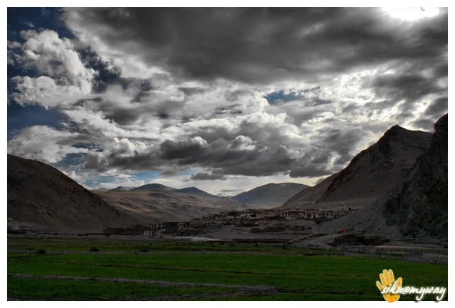
Day - ix, x, xi
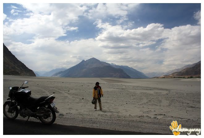
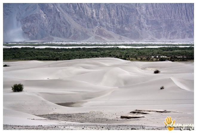
Another easy day again and Khardung La was to be conquered again. Panamik was cancelled because none of us found any interest for the hot water spring. Thought for some shootout session in Sand dunes but was not in a mood to walk to an extended distance and also wanted to reach Leh ASAP.
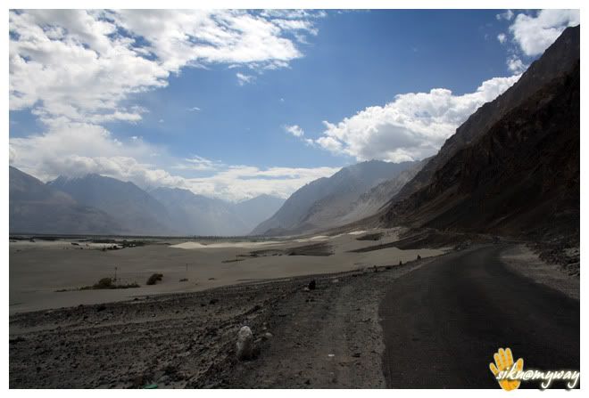
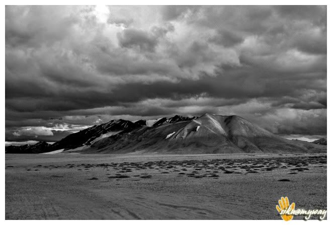
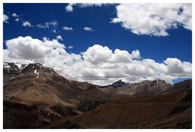
Tso-moriri was the only thing striking in the mind and there was some confusion on Korzok-Pang route. I was not even sure that if that route exists or not, though one taxi driver assured me before that one can reach Pang via Tso-kar.
Anyways with these wired thoughts we started at 10.00 AM. Met 2 guys from South Africa after a kilometer from Diskit, who were out of petrol on their RE. And they were finding some problem in communicating with the local guys present there. After few enquiries a boy guided them to a shop in the main market where Petrol was available.
Then we started for Leh and with occasional Photo breaks we reached K Top
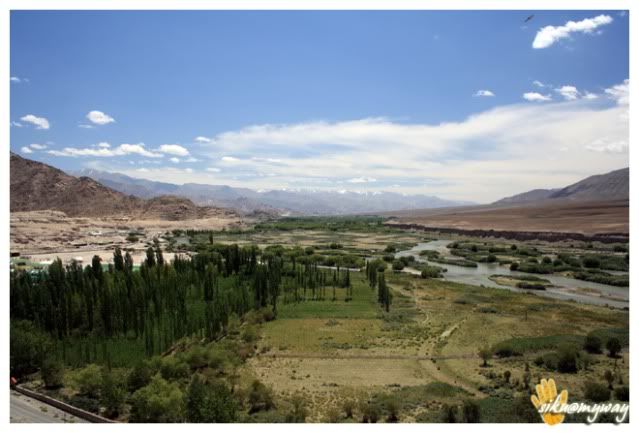
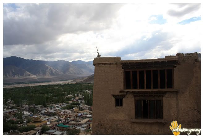
After 1 hour stay there we started. Stopped at India GateLeh Palace directly as it closes at 6.00 PM. There is nothing much to see in the palace except the temple inside but the view of the Leh city is spectacular. But I liked the place very much.
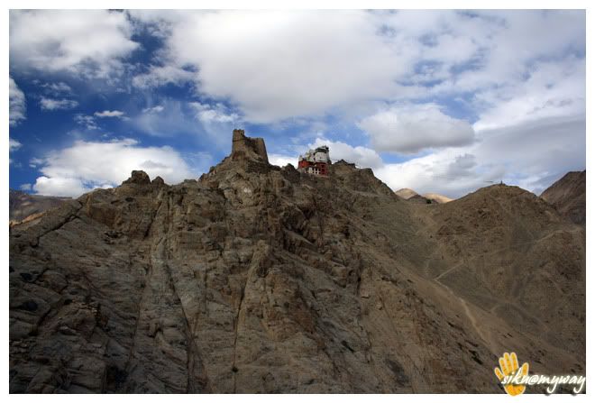
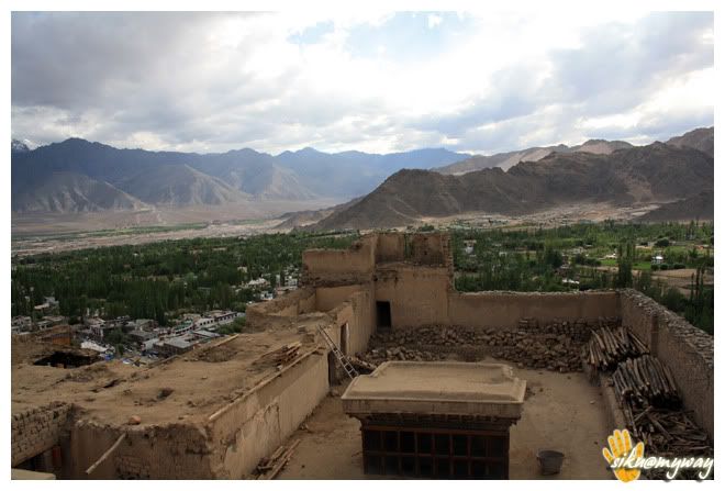
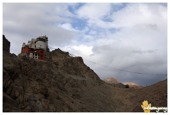
Then dropped Om at the home stay and headed towards market to search the spare. But unfortunate, Santi Stupa
Changspa is the place dominated by foreign tourists so every kind of facility is available here with a wide range of staying options and a wide variety of food.
RouteTotal distance covered - 142 Kilometers
Road conditionEvent of the dayImportant placesTourist interest pointsPrecautions
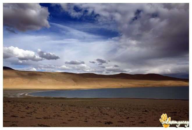
This was the day of the trip. There were many excitements including taking a wrong turn, riding alone without seeing anybody, riding in sand, riding on burger size boulders and finally reaching at Tso-moriri.
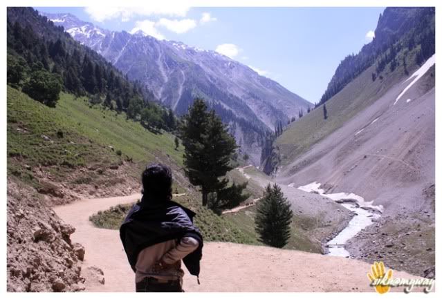
We were supposed to start early because I was aware of the non existence of road in last 25 kilometer stretch to the lake/village Korzok. But we started at around 9.30 AM. Got the tank full at Choglamsar and again at Karu. And also got 2 liters of extra fuel for emergency. After Karu we followed a wrong road sign and went some 40+ kms towards Pangong. Pangong was not in our list so nothing was in mind about the route. Though we enquired at Shakti but everyone directed us towards Pangong, later I came to know that lake means they (local people) understand Pangong. Anyways finally one army personnel guided us the proper route but we had to return some 30+ kms. This is how we wasted 2 precious riding hours.
But before this we already had skipped Shey Palace and Aalchi Monastery due to lack of time. And I was little upset for this too.
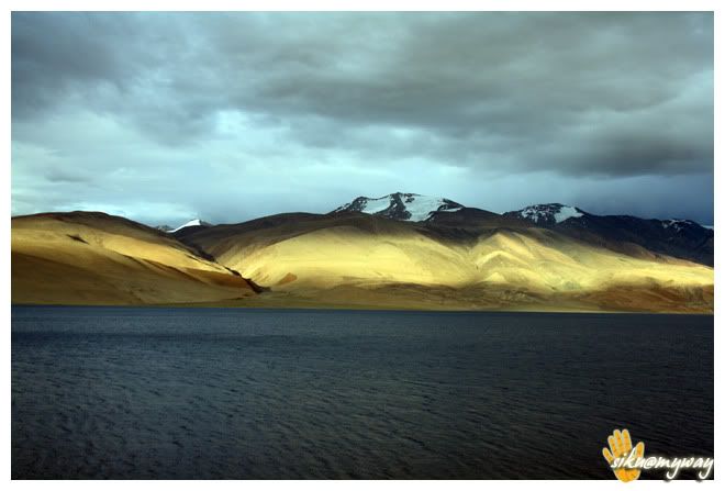
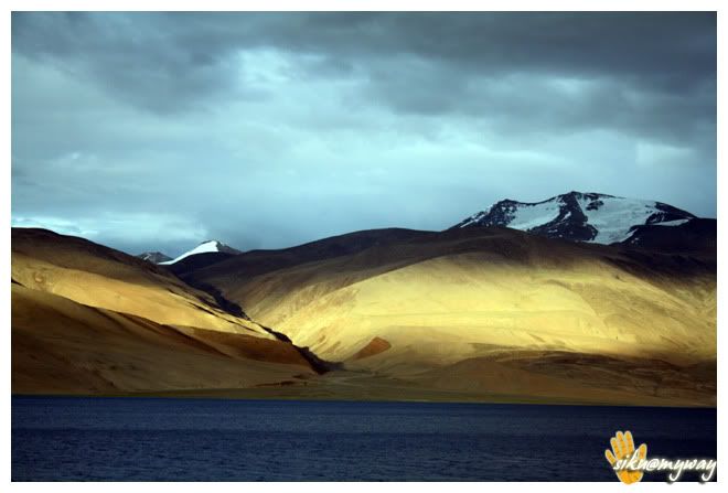
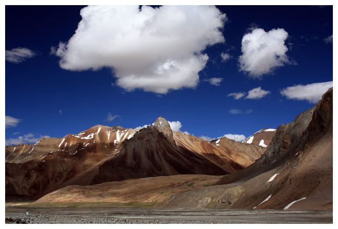
The proper routeChumathang, here you need to deposit a copy of your permit and the lake is 60 kilometers from here. The guard also told that there is no road for last 20-25 kms and one need to follow the Jeep track to reach the lake. But after riding few kilometers and seeing the road condition I was unable to believe that there is no road. The road was newly constructed and butter smooth. But it was hard to ride because of the cross winds. But at a point suddenly the road ended and I had to believe that there is really no road. And we were the alone there and it was going to dark so the only option was to practice off-roading with a pillion. After 14-16 kms we got the first view of a lake and it was not Tso-moriri as there was no symbol and the track was also leading further. After 5 kilometers we got the first glimpse of the lake and it was amazing but the sky was fully covered with clouds. After reaching at Lake we found co symbol of civilization expect few boards describing not to camp at the lake side. What the hell is this!! Where is village Korzok then!! There was no one to whom we can ask about the road or village. It was the festival time in the Korzok monastery but there was no symbol of it. But the jeep track was going somewhere along with the lake and we decided to follow that. After 5 kilometers we got in to Korzok village which was hidden by the hills. It was a relief.
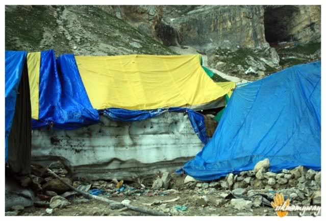
There was a camp site at the first lot of the settlement, and they charge 3K per night. We went a kilometer ahead to the Korzok village and there are plenty options to stay including tents, camp sites and home stays. We opted for a home stay with a nice view of the lake. It was almost dark by then and it was quite windy and cold at 15000+ feet. And Om got a bad headache so we decided to take rest at the home stay after having roti n omelet, as our initial plan was to stay a day or two to capture the sunrise and sunset and also to see the festival at Korzok monastery.
RouteTotal distance covered - 266 Kilometers
Road conditionEvent of the dayImportant places - Karu (last petrol pump)
Tourist interest pointsPrecautions
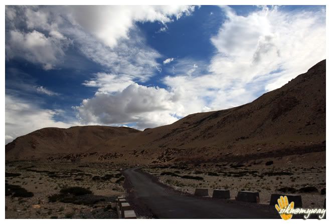
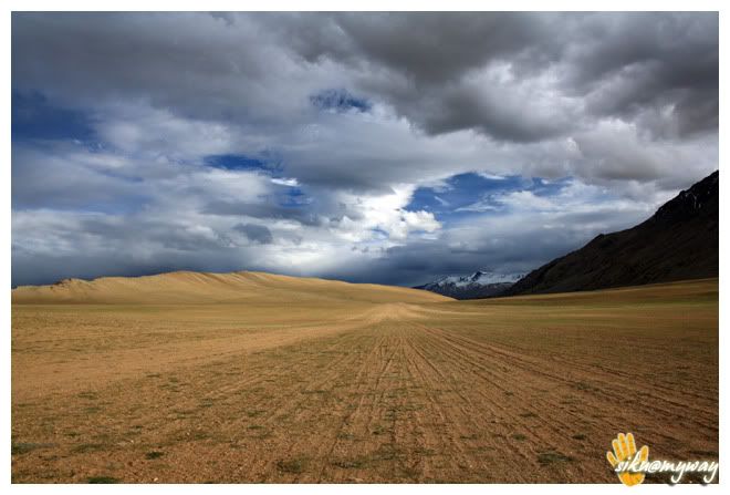
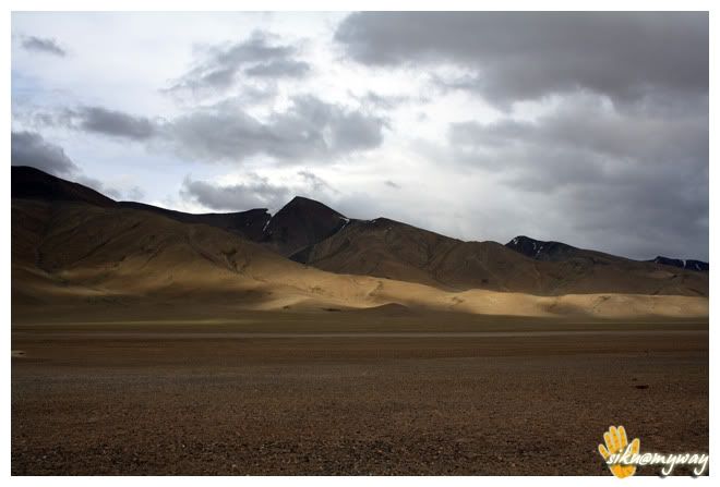
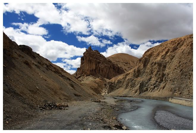
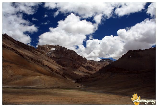
Last night was simply horrible. My whole body was aching like any thing and Om got a very bad cold and tired too. I was doubtful if AMSKorzok Festival behind and started for Pang, the complete unknown route. Asked the owner of our home stay and he told that there is good road/tar road after Tso-kar. And the road diverts after 40+ kilometers from Korzok. I was just expecting not to get bad roads like the 25 kms stretch.
But the road was literally bad beyond my expectations. It was literary a task to cover 25+80 kilometers in off-roading track. There was everything on road, big boulders, dirt, mud, salt dunes, sand, rocks and even bushes. The road work is in progress and by next season we can expect Pang-Tso Kar-Tso Moriri tar route.
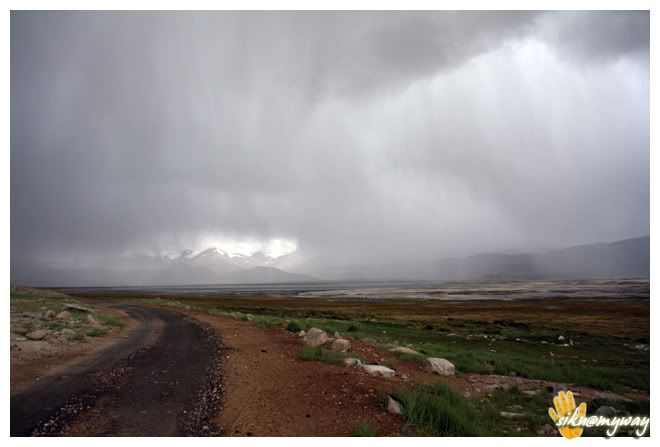
Some 20 kilometers before Tso-kar we were chased by rain. Though we were geared with rain suit and the luggage were also under rain cover, but we were afraid of the road condition ahead. Tso-kar was visible but there was no sign of road but finally we reached at Tso-kar village and from here the tar road started. Kind enough rain god poured all his blessings once we entered in to a tent-hotel for our lunch. It was 3.20 PM then and we were seeing human beings after some 70-80 kms.
One interesting fact here, there are total 20-30 houses in Tso-kar village and at that time there were only 3-4 people in that village. Asking about the others, the only dhaba wala, where we took shelter replied that all are shifted to Manali-Leh highway with their assets (sheep) to feed them. And every individual have more than 1000 sheeps/goats. I did not believe this until I saw them later.
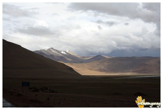
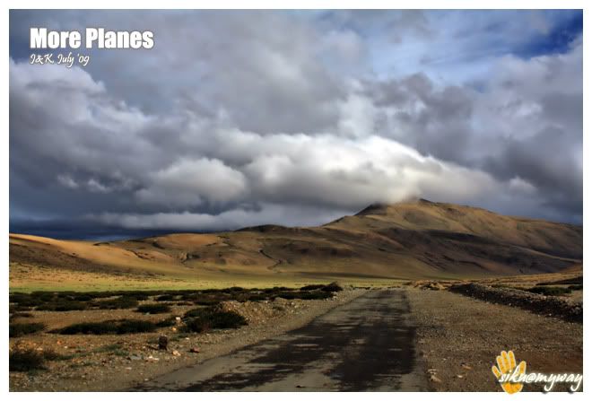
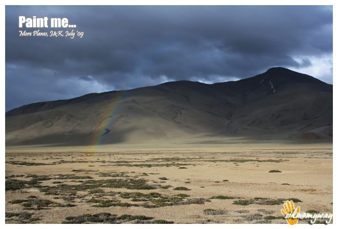
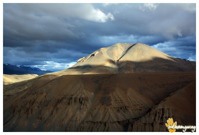
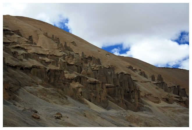
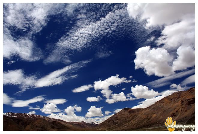
Finally the rain slowed down and we decided to go further, we had to reach Pang. After 15 kilometers we touched Manali-Leh highway. The right goes to Leh and we took the left for Manali. The view after the rain was amazing. We were running short of time and had to reach Pang for our night stay so we took very less photo breaks. After it we entered More Planes, a 40 kilometer stretch at high altitudes. Again bad roads as the road construction work were in progress. Truckers made their own way in the planes and were zipping with dust trails.
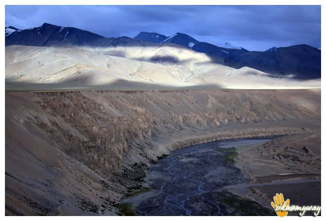

Finally managed to reach Pang at 6.40 PM and there were still some day light left so after arranging accommodation I wanted to return few kilometers back to capture some photographs but after dumping my luggage I noticed the front flat tyre. But there was a tyre repair shop in the front. So no photography as it was dark by the time got the tyre fixed. Finally the off-roading took its toll.
RouteTotal distance coveredRoad condition - Bad
Event of the dayImportant placesTourist interest pointsPrecautionsComment
-
Day - xii, xiii, xiv, xv
Another beautiful day and nothing to say more about the ride, let the pictures speak.
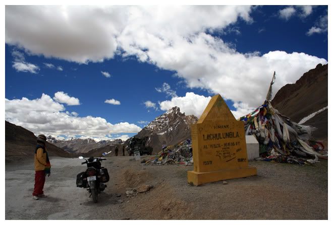
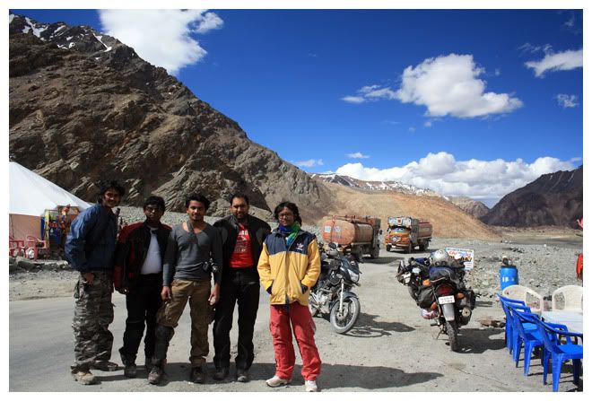
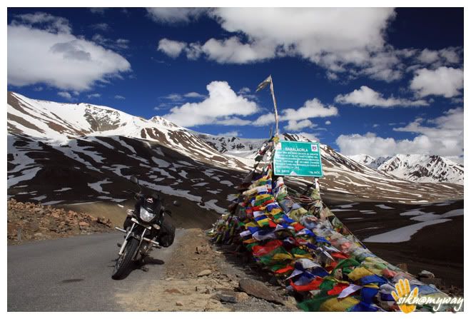
Met Aswin, Vinal and Rahul few kilometers before Baralachala, Om noticed their bikes with xBhp stickers in front of a dhaba and no one was around. On enquiring we got to know that they are resting inside. There I found 3 guys laying and on asking about one guy (Rahul) showed his fingure towards another guy and he turned out to be our very own Aswin (Rockyy). I knew him from his posts in xBhp and Flickr. The feeling was really great and we both were equally excited as we were meeting an old friend after a long gap. We discussed for some time and I almost forgot that we need to reach Kaylong same day until Aswin remembered me the same and told that they took quite long as they also started from Kaylong.
A quick capture and we bid them goodbye.
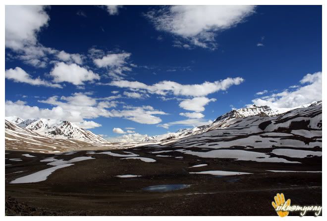
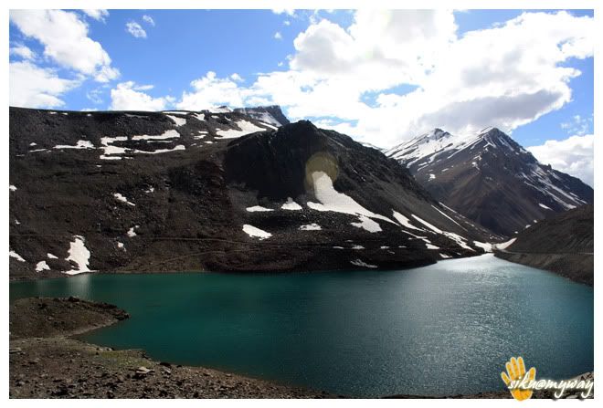
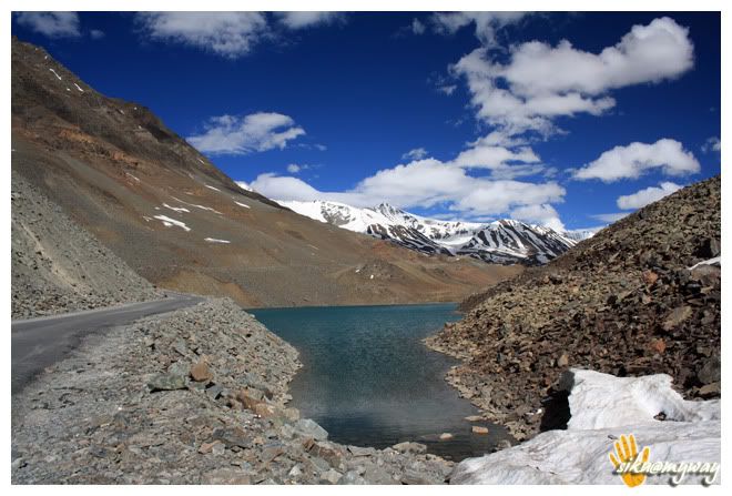
Then we only stopped at Baralachala and Suraj Tal to capture the magnificent nature and then we hurried for Kaylong with very less photobraeks. My 1000D also started showing Error 99, so it was another task to remove the battery every time to capture a photograph.
Reached Kaylong at around 7.00 PM. The HPTDC rest house was full so opted for a hotel for 350 bucks. It was a Saturday. Do remember that the whole market remains closed on Sunday so it may difficult to find any necessary stuff and even telephone booths. My Idea was showing Limited service there. Only BSNL and Airtel works here.
RouteTotal distance covered - ___ Kilometers
Road conditionEvent of the dayImportant places -
Tourist interest pointsPrecautions
Keylong is the district headquarters of Lahul & Spiti, quite a big area and every facility is available except petrol. For petrol you need to go to Tandi, 7-8 kilometers towards Manali. I personally loved the Keylong-Manali route. This route shows so many varieties of roads that I really enjoyed it.
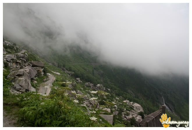
Riding Rohtang La was another experience and the worst roads with slush added some more fun to it. It was quite foggy and visibility was dropped sharply. From Rohtang onwards we got sprinkles of showers continuously. From Rohatang the hoch-poch of tourist started.
The road was excellent after Marhi but still there were some bad stretches near Gulaba. Nothing special to say about Manali, only had to spend a night there and had to buy tarpaulin sheets to cover the luggage because I got one of bad quality from Srinagar. We both were in no mood to go to market in that evening and it also started pouring. So complete rest time. Though, we got it next morning.
RouteTotal distance covered - 117 Kilometers
Road condition - Bad
Event of the day - Rohtang
Important places Tourist interest pointsPrecautionsRouteTotal distance covered - ___ Kilometers
Road conditionEvent of the day -
Important places -
Tourist interest pointsPrecautions
Nothing much to tell about this day too, woke up late and started from Chandigarh at around 2.00 PM. And then it was a non stop ride to Delhi except a lunch break at Karnal. Rain god was king enough throughout the trip until we entered Delhi border. But it started pouring heavily after crossing the border. We got ourselves covered with rain wear after lunch so there was nothing to worry.
And finally reached home at 6.45 PM and the trip came to end. First I thanked God for making the trip hassle free and without any incident after parking the bike. And then thanked Uni for being with us once again. Om was happy like anything and was yet to believe that we did Ladakh in the way we dreamed some two years before.
In the lift we stared at each other,
RouteTotal distance coveredRoad conditionEvent of the dayImportant placesTourist interest pointsPrecautionsAND HERE THE TRIP LOG COMES TO AND, WILL POST THE STATISTICS ASAP.Comment
-
WOW
that was long ! wonderful trip log.
+1Ride Safe :)
Canon 5D Mark III + Canon 550D + Pulsar 220 Dtsi
What else do you need ?
My Website
Facebook PageComment
-
wow!!! its like the entire of laddak and JK exploded on my screen...amazing log and pics dude...sigpicGirls are like roads, more the curves, more the dangerous they are.
To ride or not to ride?? is a....
very very stupid question....Comment
-
Fantabulous Archi full marks KUDOS brother Pics are awesome... Most attractive thread...
Ride Safe & Ride Long-->
ZaynComment
-
Superior post! the first post I have read completely word to word in over 5 years while in xBhp. Amazing!Are we there yet?Comment


Comment