


 Tweet
Tweet
luvly... keet it coming !!!
-
this the best write up and the pics pics of Mtop ever.praveen you are the man.Comment
-
Thanks KrishnaOriginally posted by kri$hna View Post Hard for me to believe too
Glad you are liking itOriginally posted by Yamaha_Gladiator View Post
Yes yes now i remember. Harpreet Singh. will updateOriginally posted by kirosh_03 View Post
Glad to have got you Nostalgic. Things turned out well and i was thereOriginally posted by sumit.pannalall View Post
Yup that too from more than a yearOriginally posted by pads View Post
I spoke to Gaurav and he suggested me the same but, the trail seemed to be sandy and no way i can man handle my bike if its gets stuck so gave up on that.Originally posted by darkknight View Post
In comingOriginally posted by burnoutz View Post
Glad you are liked it steveOriginally posted by steveburnside2001 View Post
Comment
-
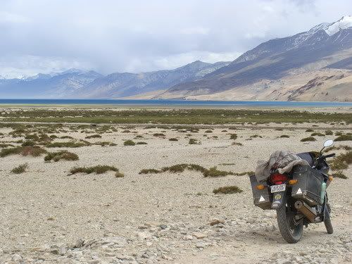
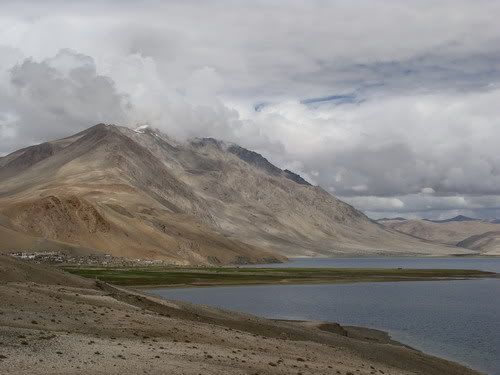
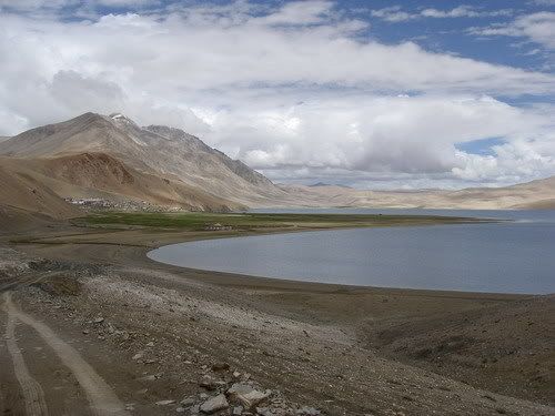
Day 139 - July 25 - Chushul to Hanle
July25 at EveryTrail
Map created by EveryTrail: GPS Community
133 KMs Trip Meter 17975 KMs
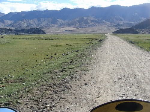
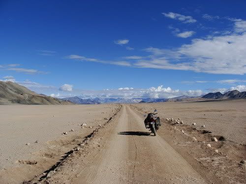
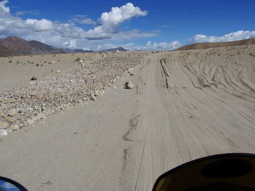
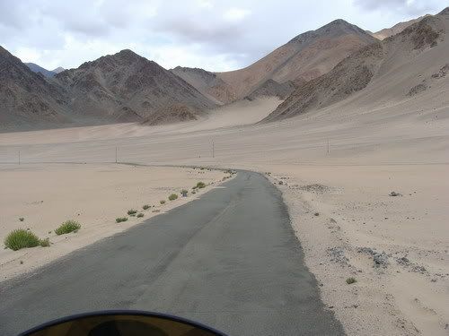
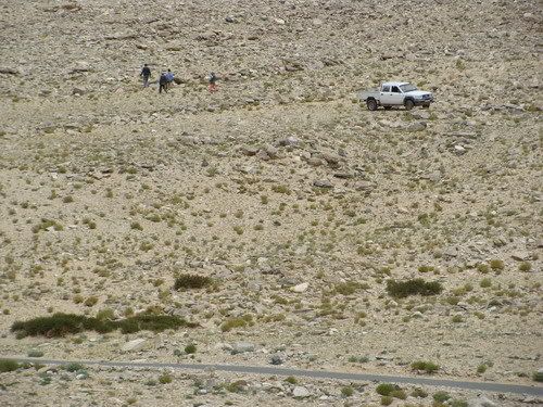
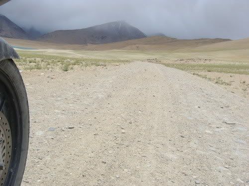
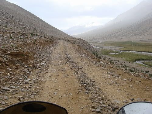
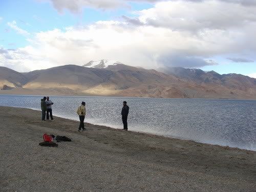
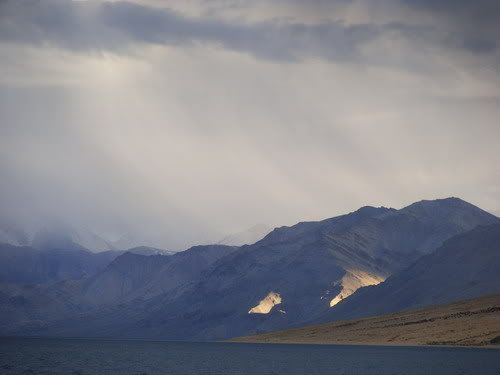
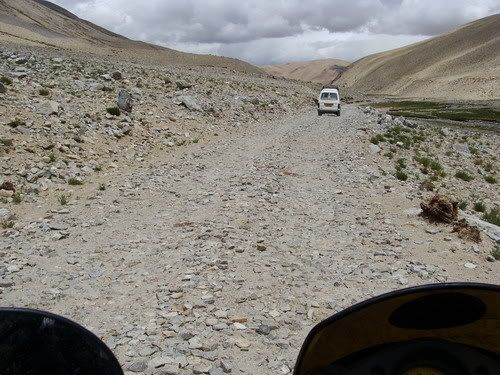
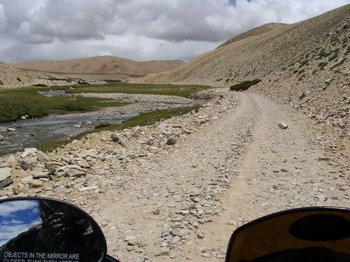
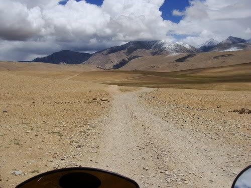
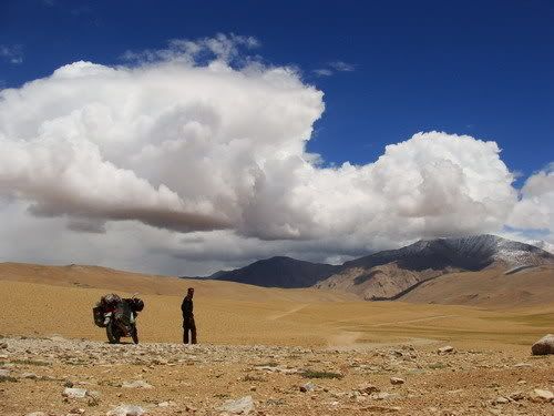
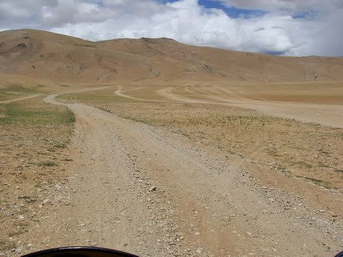
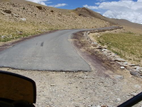
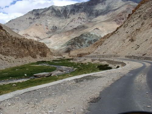
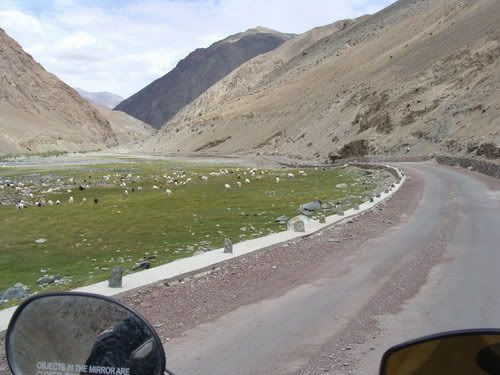
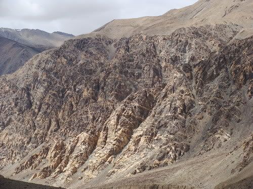
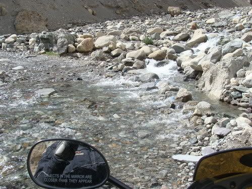
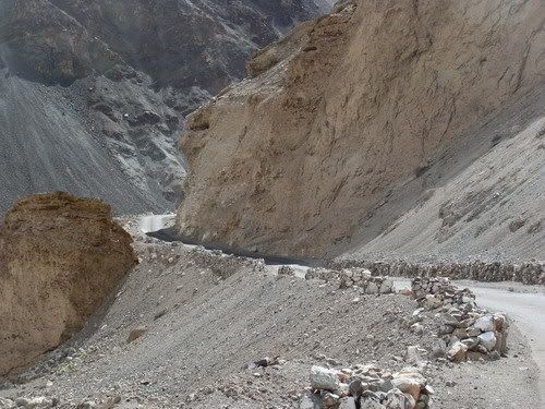
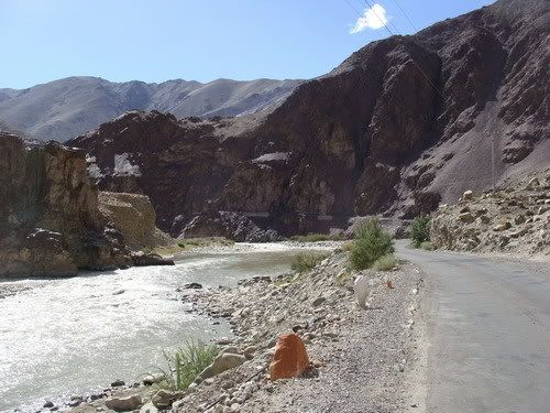
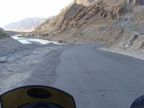
5 am is the alarm and after a few snoozes i get into action. Mr Tashi was kind enough to cook me maggie else there was absolutely nothing to eat till like Hanle! Leave by like 7 am just thinking about the path less taken. Will i get lost? etc. I was given directions like 'stick to the black mountain to you right and dont go towards white mountain to the left, else you will go to china' but all the mountains looked the same to me. Just out of the town, there was a big water crossing, luckily there was enough slant space to the right to take my bike by dry land. And i am out in the open in no time. The path though offroad felt smooth. Soon i see a war memorial to my left. After visiting the memorial all i see ahead is a flat space in the valley where the left mountain ridge is India and the left one is supposed to be china. Though in the map the border should be some 20-30 kms away, the LAC is like a couple of KMs from the road! I stick to the most used track. There had been army truck just before giving me fresh tracks. The wide open spaces are really mind blowing. Never seen any where so far. The ride is getting bettor and there is fear also. Though the skies were clear in the morning, the clouds are coming over the mountains. Though i have started early its the fight between stop for break or ride on. Progress is very slow as i just keep stopping or pix and gaze around. Pictures dont come so good due to cloudy weather. But what i could see is just for me i guess. I reach a deviation to army post to my right and a lil ahead there is a deviation to the left towards BPM hut that is Border patrol meeting hut, used by ITBP and Chinese military for meetings! It was hardly couple of kms and i was that close to the LAC. Needed permission to go to the hut. So i carried on straight. I have already visited a BPM hut at Bum La any way. I take pix of the place cool'ly though there was post with bunkers above. As i ride ahead i see a Army truck coming down from the post. I thought i am in trouble. After all there was no 'no photography' board any where. A couple of KMs ahead is the Rezang La memorial for 114 Indian soldiers of Kumoun regiment, who chose to fight till the last man and last round. It was an army water truck that just passed by. I am fine . Rode ahead and the dull weather really irritates me. Wish the cam could see the way i see. Even have a couple of water crossings. And confusing tracks. Tried to stick to the ones with stone piles on either side. but some times they were not used a all! Then the path became all rough with stones and all. Well the near by land scap is not rocky. The path is just made off surroundings. So will have to ride out the rocky mountains befor i get smooth path again.
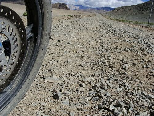
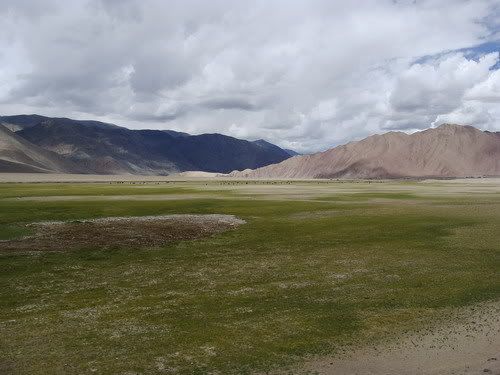
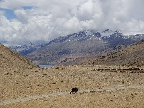
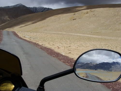
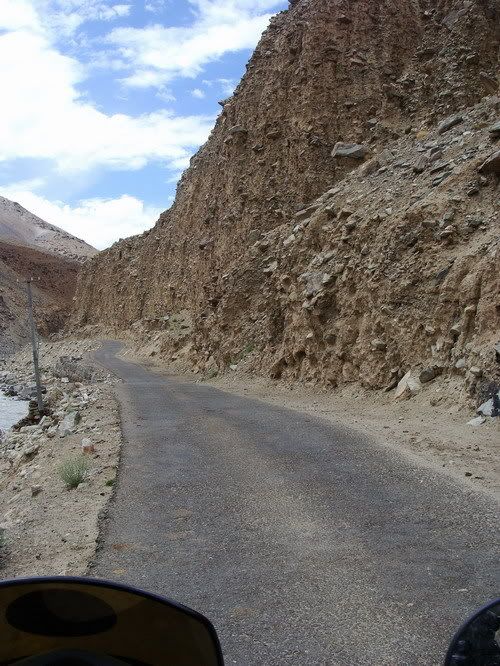
There is like 1 foot water crossing with sand! And i my front wheel is already near the water. No way i could push back the bike. So with a struggle i unlucky the right pannier, pull out the gaiters and wear them all while sitting on the bike cos couple not put it on stand in sand! Throttled on to cross the stream with shoes safe. Then there was fork and the left one actually had the stone piles on either side and both paths seemed to be equally used and they kinda deviated from each other quite much. I just picked the right one and soon i am riding at the bottom of the left ridge of the valley all wonder where the other path went as i could hardly see it. Then i see some people's hut ahead and the tipper which had over taken me. It was all sandy trail now and detoured towards the huts. On Enquiry i am on the correct path and there are no switch backs to Tsaga La, its gradual over a couple of kms. Never road straight to the top of the pass. Unknowingly i was ont he ascent actually. I was told by the hut people that no more Nalas so i put the gaitors back into the pannier. After some distance there was one!! Man these locals sometimes. I had no patience so decided to cross it any way. It was around a foot but with large rounded stones and just like 6 feet. I just gunned the throttle and the back wheel propelled the bike across and landed with a thud on the opposite side on sand digging it self in! Took some clutching to get my self out. Phew! In some time i was at Tsaga La top. Just around 4600 meters. There was a path going much above but leading to a army post. But this the pass. Do what i do on passes, Pose with my bike and click the gps reading. Take one last look at the wide valley i have been riding since morning and start rolling. still cant stop for clicks. Crazy shaded mountains. Sightings of Wild asses. Then i am on the half made road! Man hate these. Full offroad path is manageable but his half made road with stones and mud layer is very very irritating. I reach a village and its confirmed i am in Tsaga village. Supposed to be out of danger of riding into china. Expecting black top soon. But the bad roading continues for few more kms. Its been like this for quite some time that ppl have made alternate softer paths beside the road. I gladly take them. At times there is more sand there but atleast its not bumpy with sharp stones. Reach a check post and i am told will get black top after 4-5 kms. ok some more. Finally i am on it. Now i can see the surroundings more while riding. Huge i mean Huge wide open spaces kinda flat. Wish i had a dune buggy which i could ride all over the place in high speed. It looked pretty as well with light shrubs and scantly growing desert grass, giving a green color to the flat space. Hardly rode a couple of kms with out stopping for pix. Dunno what to write about the place but that there many places i wanted to camp looking around. Weather was also intermitantly good.
Reach Loma bridge and the check post. The same questions and the same surprise and get treated well. I am even given lunch as nothing is available ahead. The people at the post just wonder why would any one come here with all the effort as nothing is here. One guy even said you sit in my place i will go to Bangalore! Well i guess if i stayed there for months i would feel the same. But its all great to me now. Hanle is 50 kms and half of it is offroad err.. i mean bad road, the same half done road. The section is pretty dry and even desert like with many small dunes and even sand blown ont he road some times. Just ride looking around the vast expanse. Its also clear in high altitude and one can see real far with out haze. The dreaded bad roads are in coming and boy have to put loose sharp stones. That really gets me worried about tire going flat. But why do they do such things, they could have just left the trail road alone of completed the road. But these stony paths are nasty. There are many alternate paths but less used and kinda prefer to be on the main path though bumpy. After a few kms there's sand on the stones and its bit easy. Any way get to Hanle and getting inside the town have negotiate some sand sections. There is no sign of any hotel of cyber cafe. Go straight to the observatory.
Well i had heard that they are tired of hosting bikers, but atleast i hope to get some info on stay and some internet usage. I am escorted into the main observatory room and i am obliged the internet. Which was very slow and irritating. SMSed my father. As expected cant accommodate in the guest house, but i was told i could find some home stay at the town below. Was given a tour of the telescope and i even saw liquid nitrogen which was like -140 degrees! Rolled down to the village and the said house was a shop actuall. Went around where there were some more houses and enquired a passer by for stay. Well he told me to follow him to his siter's place and after some chat i was allowed for homestay. Well this is great else dunno where i would be sleeping for the day. Settled in pretty early and worked on the logs. The kids as innocent they are and as insensitive i may sound, they are dirty and smelly Just tried to act boring so that they would loose interest in me. Even the cat was invading my privacy. Any way the dinner was very nice and hope to get to Tso Moriri tomm. Lets see how it goes.
What Joginder Gave me the other day at the check post... i had already finished couple before this pic

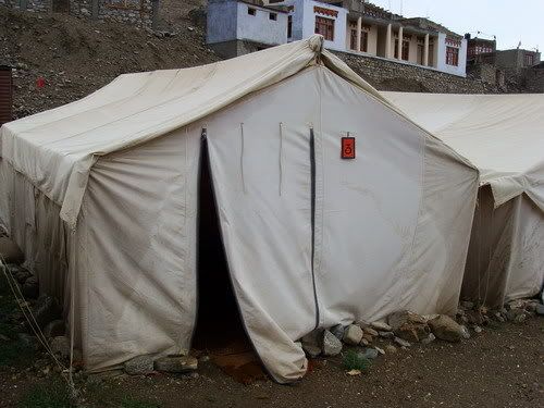
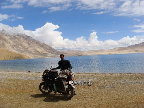
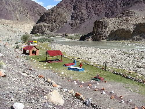
My cosy stay at the pwd guest house at Chushul..

Had a dining area as well! Was practically a house!

Thats Mr Tashi, who helped me with food and petrol and ofcourse stay...

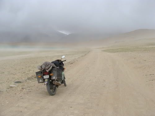
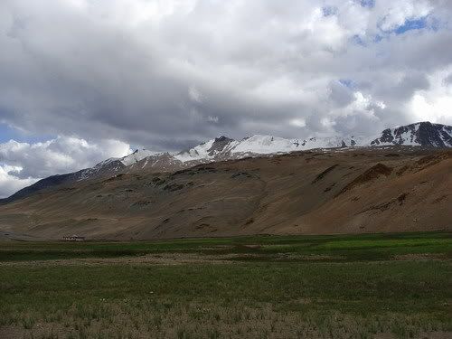
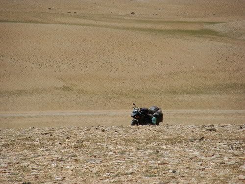
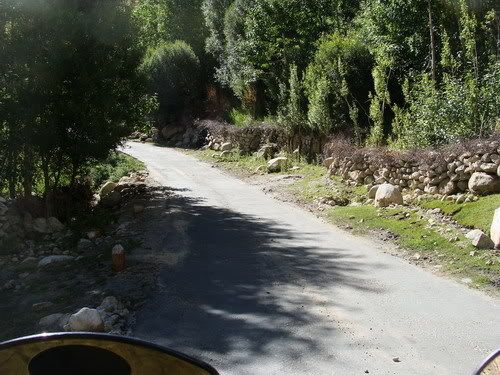
Heading out of Chushul...

Some Greenery...


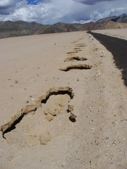
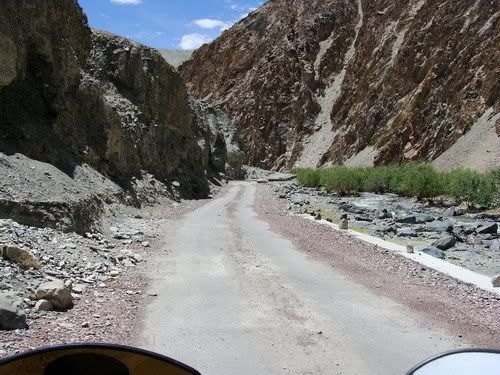
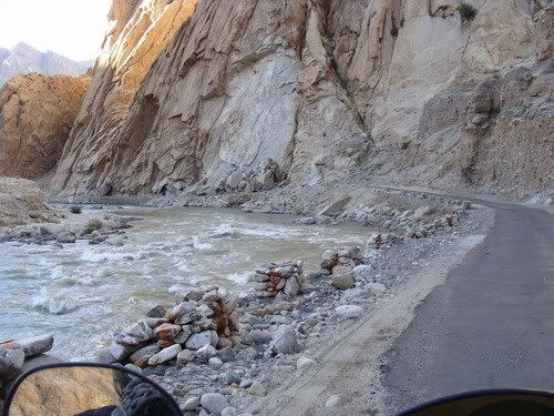
A Nala right in the beginning!

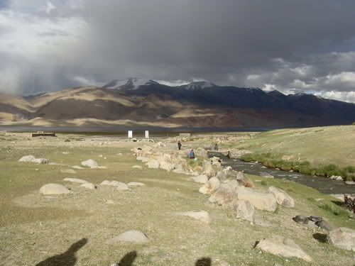
There is a memorial for the Martyrs...

Many unnamed soldiers who gave their life...


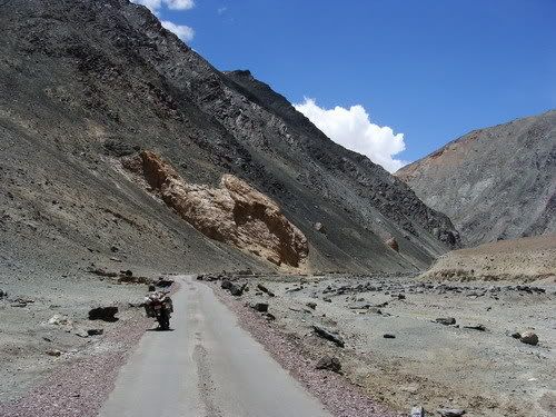
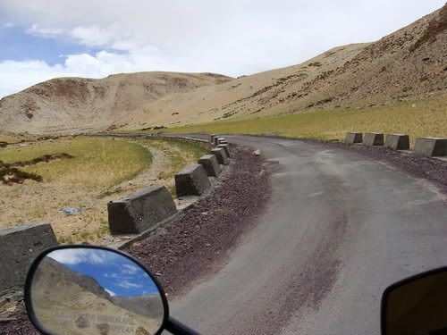
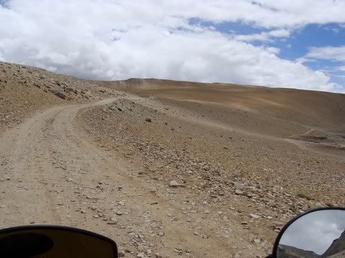
Track towards Tsaga La

The boards tells me i am on the right track...

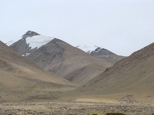
Those are Chinese mountains...which they took from us in the war...

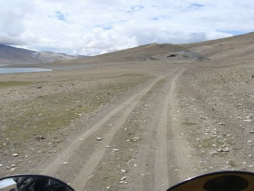
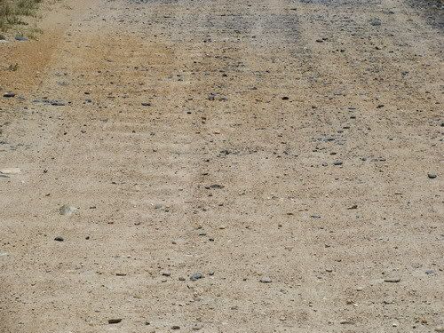
Its all about following the tire marks....

Looking back mountains to the left are indian and to the right are chinese....

A small break...

Rare uninhabited houses...

There is a post...

A BPM Hut!! Thats when i realized how close i am to the LAC...


The track going to the BPM Hut...

Hardly a KM i guess... Had visited a BPM hut at BumLa any way...

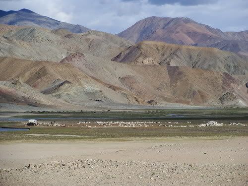
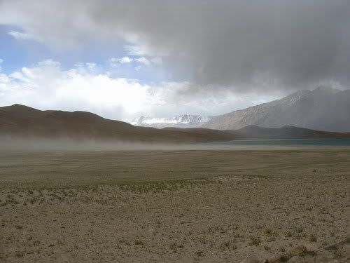
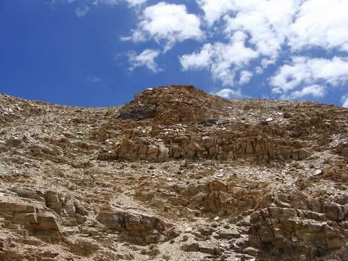
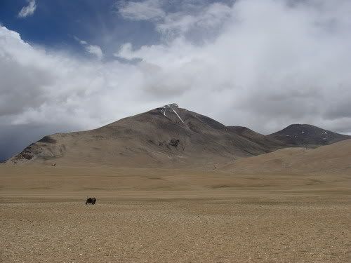
The landscape is pretty beautifull...

As advised i pick the track to the right...


Nearing Rezang La memorial...

At the memorial...


Quite a history of these brave soldiers...

Just tire tracks ahead and weather seems to be catching up....

The cam is inline with the Horizon its the land thats slanted!

One long Nala crossing, i hate Nalas!

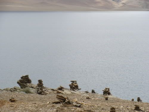
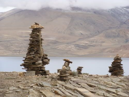
Stick to the track with these stone marks on either side but not always reliable...


One more big one...

Where am i going?

Happy to see some humans....

Transporting their yak dung!

I was told i am on the right track and ride out...


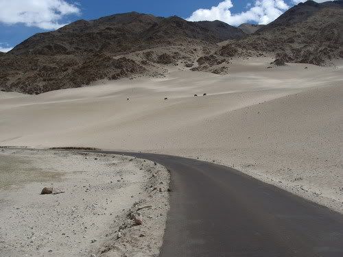
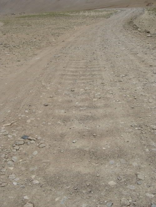
Then comes the ripple ride! its so uniform.. do they actually make it?

A great place to have a break....

Guess i invaded their territory....

This was a small nasty one... Can see where my back wheel dug in... Had to do some clutching to ride out of there...

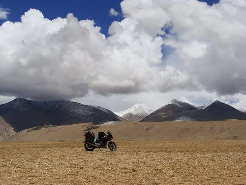
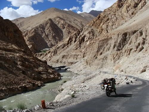
Riding up to Tsaga La.... There are no switch backs to this Pass, you just ride up straight and ride down straight the other side!

Looking at the valley i have been riding all day...

At Tsaga La

15252 feet says my fone...

The other side...

Its beautiful cloud play...

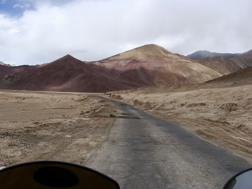
Red road??!! Any thing can happen in this strange place!

Colorful mountains....

Reach some village...

Its Tsaga village alright, supposed to be out of danger of riding into china....

Some village houses...

In search of the promised black top..

Then find these poser Wild asses...


It was a great place to have a break, kind make your own road as people drive off the stone half built road..


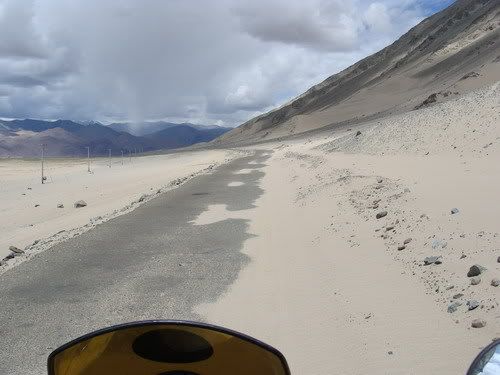
The confluence of the good bad and ugly roads!

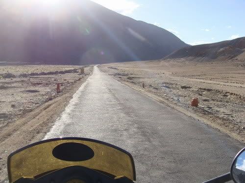
Tarmac lovely, now i can gaze more around...

No matter how many times i have said, love these wide open spaces....


Some meadows as well....

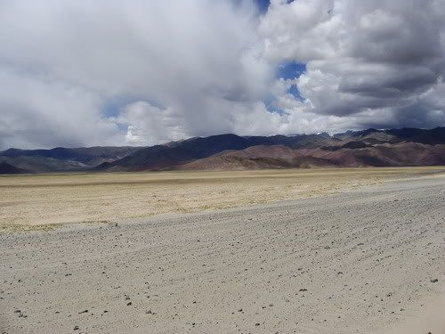
Some desert section as well...


Approaching a ITBP post, empty tin cans adorn the fence...

Comment
-
Parveen ur surely a gutsy and daring rider to ride all this area(Leh) alone. I really appericiate ur efforts. U r the man for me and u r inspring me to take a plunge to do adventure riding as i have not done anything in my life like this. Best of luck for ur rest of the trip. May GOD bless u.RED DEVILComment
-
Rest of the pix for the day...
The Loma bridge...

Riding to Hanle...

Its more desert'y here...


Barren beauty again...

More wild asses spotted...

Desert is beautiful...


Spot the bike...


Some nomadic houses and they have two wheelers too!!

The road ends 20 kms short of Hanle!

A local...

What nonsense!

Looks like the tarmac wont come up any time soon!

Such is the state that i am actually doing a road crossing!

The bone rattling ripple ride....

Getting nearing Hanle..

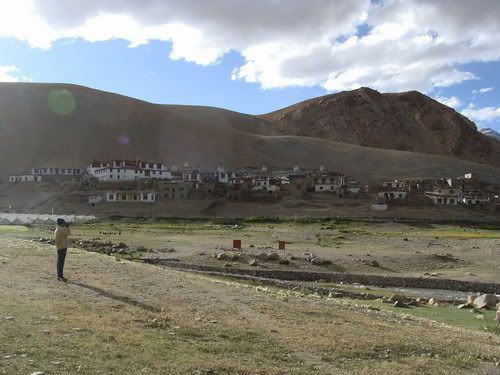
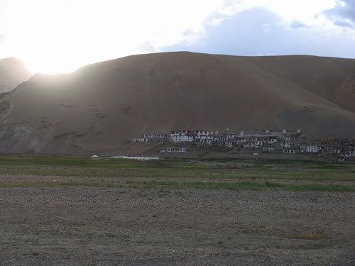
The Hanle monastery....

Have to negotiate some sand sections to get to the town...

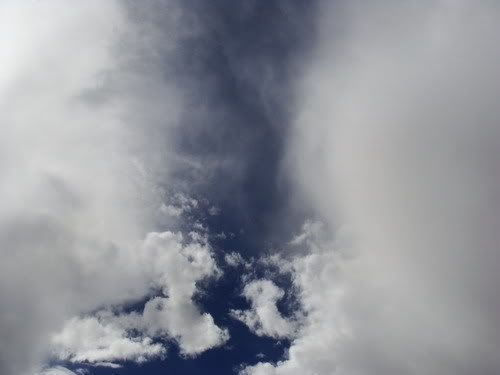
Clouds taking a dump!

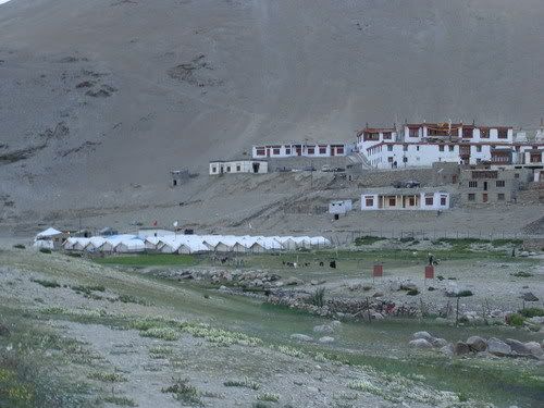
The Hanle Observatory....

Am at Hanle...

Ride up towards Observatory....

No short of solor power i guess...

The main observatory....

Bike waiting below...

It does a 28k kms!

Viewing the plains below from near the observatory...

Its bright here but the near by mountain being washed!

The telescope...

The second stage mirror...

The doors...

A smaller telescope...

Thats a can of liquid nitrogen!

Its boiling at -140 Deg Celsius!!

Me there...

Trying out the liquid nitrogen

Dorje who gave me a tour of the place...

From the top of the observatory... 14826 feet says my fone...

Looks from above...

The kid and cat at my homestay...

The cat not much of a poser..

My homestay for the night...

The kid who would not let me work He even showed me his tiffin box expecting me to show my laptop in return.. Nice try kiddo :P

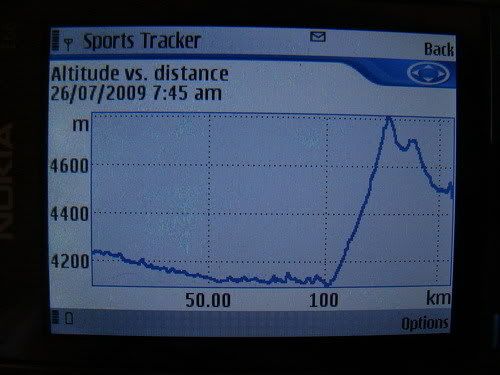
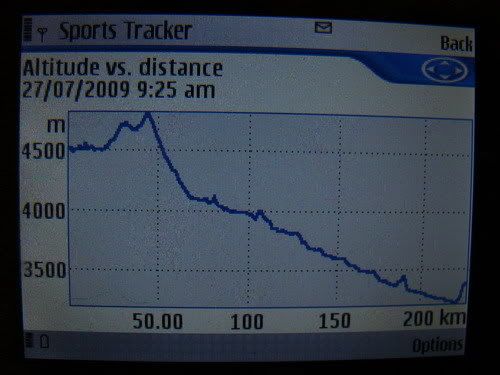
Vertical travel for the day...

Comment
-
Day 140 - July 26 - Hanle to Karzok (Tso Moriri)
July26 at EveryTrail
Map created by EveryTrail: Share GPS Tracks
153 KMs Trip meter 18129 KMs
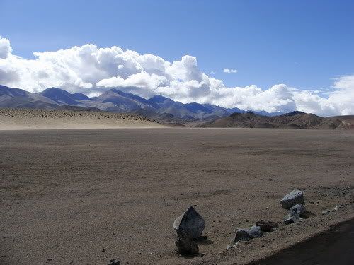
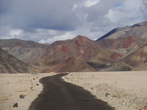
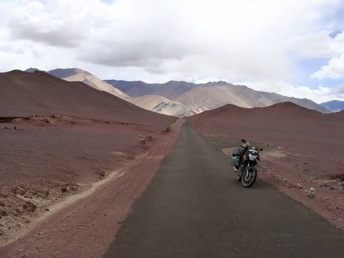
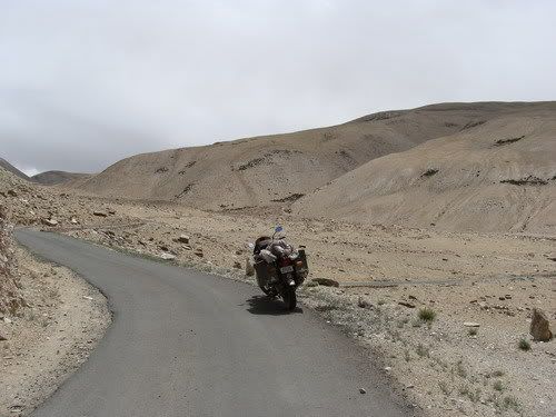
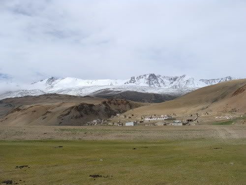
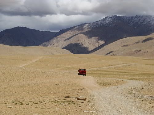
Karzok is the target for the day and i am not sure how many KMs the offroading is going to be. Try to leave Hanle as early as possible. The home stay place had their own shop and even had fuel! Again i was 25 ltrs rich. Rode out of Hanle and the 20 kms was a pain for sure. But just have to keep going. Took a couple of breaks where it felt nice to walk around. Soon i was riding on Black top and reached Loma bridge in like 3 hours from when i started. There were entirely new set of people at the ITBP post. Carried on towards Mahe. Its riding on new road now. At the beginning it was like ride in a desert and then things changed. Wide open spaces, colorful mountains. Some hard to believe. Looked like somebody had played with a gaint paint brush! How can adjacent mountains be of different colors!! The progress was very slow cos no 5 kms i rode continuously with out stopping for a gaze of pic. Wide open spaces where i felt like just keep walking till the mountains. Cant really explain the ambiance but felt great there. Took my time and took break where ever i wanted.
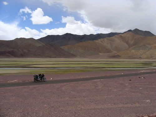
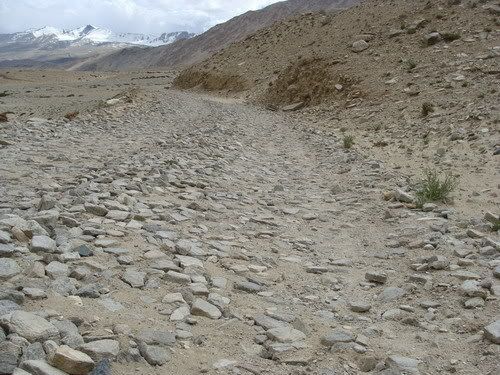
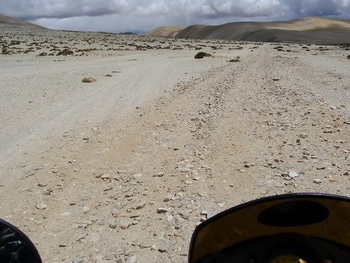
Reached Nyoma and guess what, like the ITBP post at Loma had said BSNL works here. Made much needed call home. Spent like an hour and ofcourse had Maggie. Have been practically living on Maggie since 5 days. Ride till Mahe was also interesting. Reach the mahe bridge where i submit a xerox copy of my permit. I was told that only 20 kms of the 60 kms is offroad. As soon i as cross the bridge, its a ride in a small narrow valley. That to for quite some KMs. Must say felt a bit claustrophobic after riding in open spaces all this time. It was still pretty but. After like 20 Kms the road starts to climb up. Its switch backs into the open and its gets pretty windy. Bike starts struggling! Reach the top of the ascent marked with typical prayer flags like on passes. It was pretty high at 4800 meters. The green grass every where and color full mountains makes everything pretty. Its decent ahead and i am approaching a lake. Its a green one. Definitely not Tso Moriri. Looked pretty for pix but there were dark clouds on the other side of the lake and it was not that big. The road ended and offroad begins. Weather also goes towards bad. Looks like its inevitable to avoid a rain ride and i start to waterproof myself and the luggage. While i am in the process, suddenly there is a lot of wind and dust storm. Cant face the wind at all. Threat of rain and all this. It was scary for a few mins. The winds died down and down came the rain drops. When the road was good it was sunshine and when the road got bad coincided with bad weather! Well gotta keep going. Not sure to take tracks off the main path cos of loose sand and i stick to the gravel road. After i pass a plain on the top and descend to a valley its rocks and when i say rocks i mean rocks. Like side of 3 X 3 X 3 inches! Have no other choice but to ride em out. Had been warned about it by Yogesh. But hotel owner had said that it was three years ago and now maruthi van goes. So the Dhud dhud dhud continues for quite some Kms in rain. Suddenly its all sunshine now making me look like an idiot in all the rain gear. I had no patience to get of em so decided to sweat it out in the rain gear till i reach karzok.
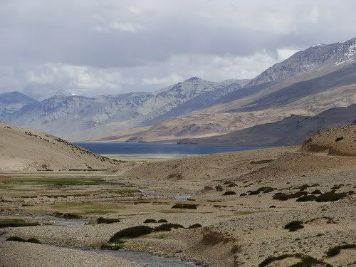
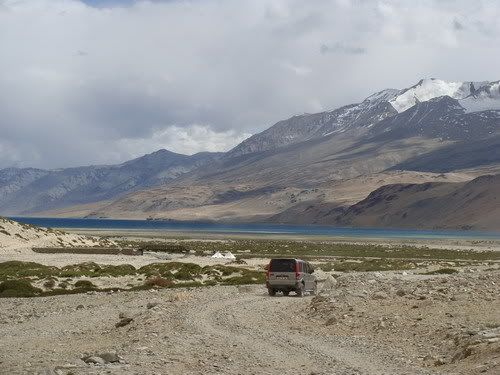
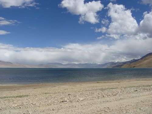
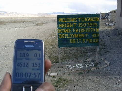
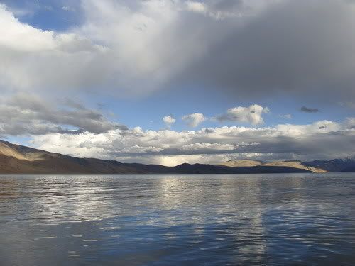
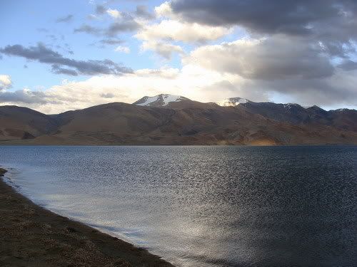
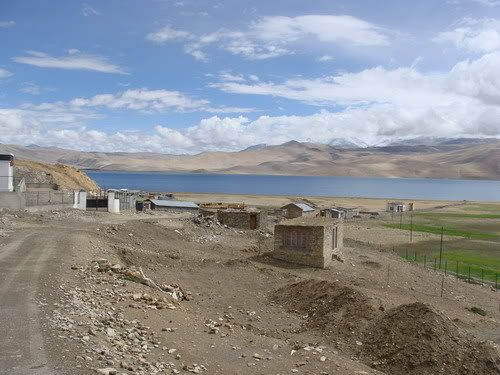
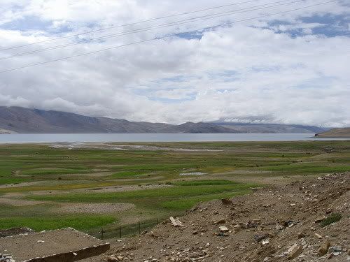
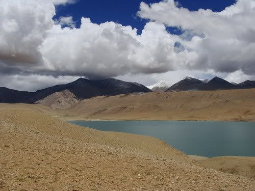
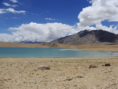
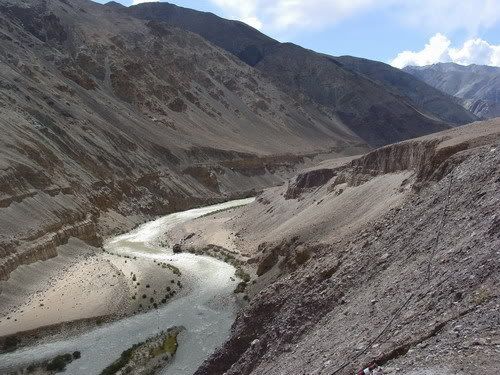
Then then i get the first view of Tso Moriri. Its so beautiful with its deep blue color. The path eases a bit as i get near the lake. Take a few pic stops and now its a ride by the lake for the last 5 Kms. Path is a bit smoother here. The lake in its bright deep blue color just as the promised pix i had seen on net. Made all the effort worth it. Well its a fresh water lake 1000 feet above pangong! Reach karzok and unlike i expected not many options for stay. The first tented acco was prohibitively expensive at 2500 and 3500. The best i got was 1500. Any way its town go in look out. There was one guest house inside the town but it was too dusty. Get out on the other side and saw the Nomadic Camp tents. Got one for like 300 bux and those were good ones. The toilets outside were plenty and clean. Had great dining Tent and i settled in. Met a 4some who had biked to Leh but hired a taxi for the lake trip. They were my company for the evening. After having a fill we went out to get near the lake. Went through a fence and walked a bit before we can get to the water. Then it was all pix and jokes etc. Clouds would let the sun through very rarely to give a couple of good pix. It got windy and chilly and we moved back to the tents. Had a dinner over travel talk and crashed for the day. Will i get to Leh tomm. Things have gone well so far in this circuit. Doze of in the tent.
Ride out of Hanle...
Looking back at Hanle...

The observatory....

The Hanle monastery again....

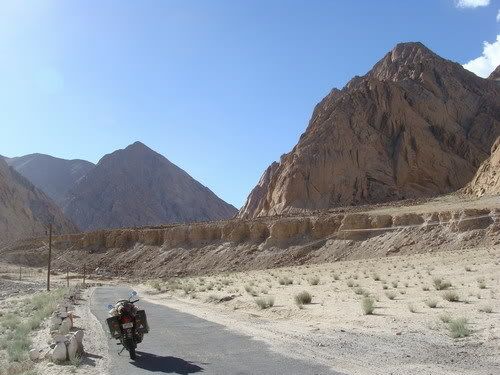
Just me the bike and the path...
Some Goat herder women...

Their all weather homes!
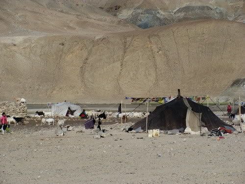
Quite some livestock they got...
I am getting off the road, any one wants to try the road?

Again making own road...

Some sand monsters on the way...
And stone monsters!
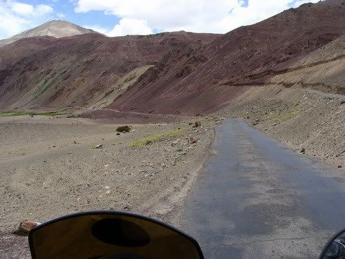
Colorful mountains...

Great plains...
I find tarmac as well....

What can i say??
Wonder if they are natural of man made!! Was kinda expecting to sink in when i was walking on the sand for some time!
There i go...

He's a eighty year old man!

Cows finding grass on sand dunes!

the big picture....

After Loma bridge off towards Mahe....
A cloud taking a dump....

The colors begin!
Was much more pretty to look at from the naked eye...

Landscape keeps changing....

Time to add some colors!

A village with huge walls!

Some ride in the desert...

Check to the left,- red, yellow and green!

Took pix in vivid mode, so colors may be wee bit enhanced.. but they are straight off the cam... and looked much pretty to the eye!
Now who spray painted the place???

Reached Nyoma....

Heading towards Mahe...

Quite a contrast on the mountains due to cloud play...

Some more colors...
Get in to the deviation to Karzok...
Its ride in a valley now...

And its a long one...
Love cant be stopped by binding hoofs!
Climbing up to the open...
The tata just went off the road on to the stone'y slope!
Great colors riding up the pass kinda place...
Some white heads....
Is this actually a recognized pass?

Its high at 15886 feet!

Lot of prayer stone piles i guess...

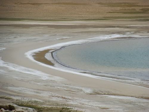
Nearing the weather changing lake!


Road ends and it sure is gonna rain...
But not before a dust storm... it was scary!


The wind dies giving way to rain... First time i get wet in Ladakh... i mean my rain gear...

Then the bone jarring ripple ride....
Pretty plain above... want to take a break here but its raining and sneak out a pic....

The stones are getting bigger..
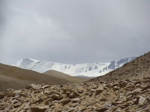
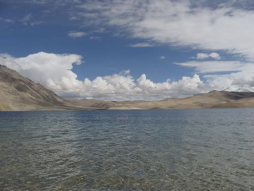
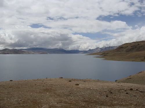
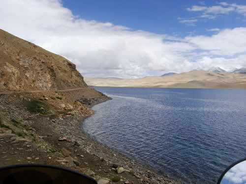
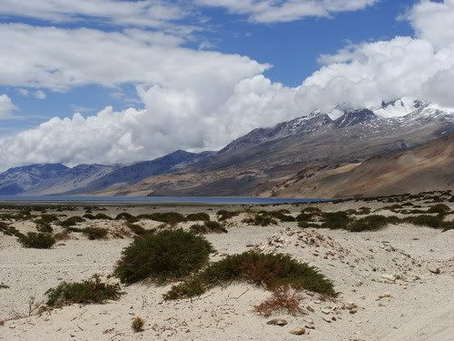
First view of Tso Moriri lake...
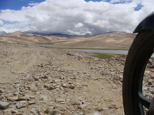
Thats one nasty path....
Getting nearer to the lake....

Now what animal does that belong?

Near the lake now...


And i touch the waters...

Glowing blue color...

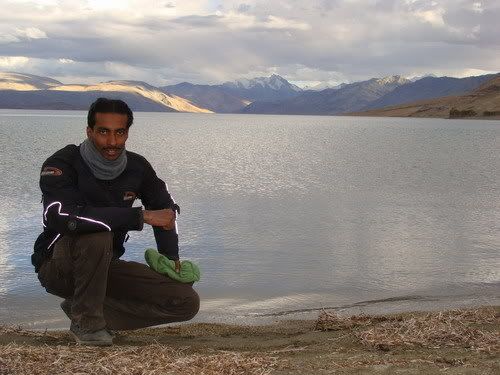
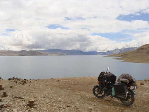
Me and my steed there...
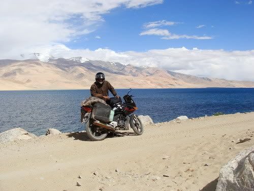
Ride by the lake...


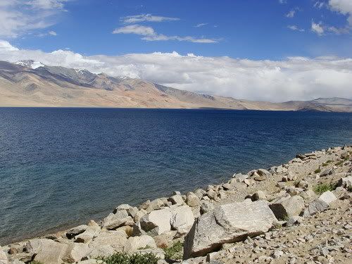
The lake at the height of 14889 feet says my fone... approx 1000 feet higher than Pangong!
Typical Tso Moriri pic...

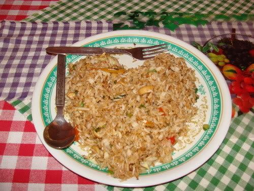
Not only good food other than maggie, its presented well as well!
Comment
-
Rest of the pix for the day...
Walking up to the lake...
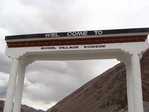
Karzok town...
Flowers every where...

White heads around....
The lake looks ordinary without sunlight...

Me there....
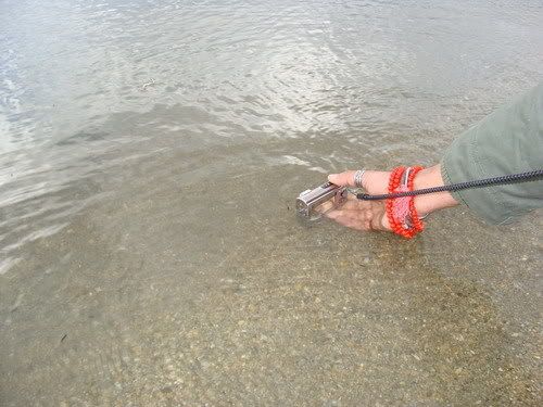
Rahul trying out his water proof cam!
The guys there...
I am wearing neck warmer and Amit is shirt less!
Karzok again...
Some more lake pix...


Thats the Nomadic life camp site where i stayed...
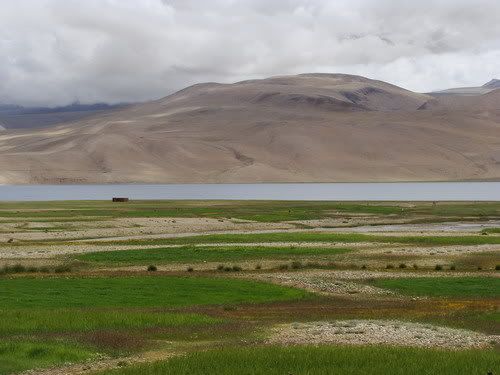
A small dam...

Flowers by the channel...

Vertical travel for the day....
Comment
-
Day 141 - July 27 - Karzok to Leh
July27 at EveryTrail
Map created by EveryTrail: Share GPS Tracks
228 KMs Trip Meter 18356 KMs
Morning was quite unexpected. Something woke me up before the alarm did. It was the sound of rain drops on my tent! Raining outside!! All these it used to be great in the morning. This is kinda depressing. Just lie on the bed thinking that the rain would stop soon. But its going on and on. kill the alarm and wait for the rain to lettof. I keep waiting till like 7.30 and its still raining. Two hours rain and still going on. Now i lost my patience and thought what the heck will ride out any way. One look outside the tent was discouraging! It was cloudy and misty every where and could not see any mountains. Its going to take some time for weather to clear. Could not take pix as my battery was with the owner for charging. Water is dripping into the tent. Lucky that it dripped only to the edge. But it got real cold. Uncomfortably cold.
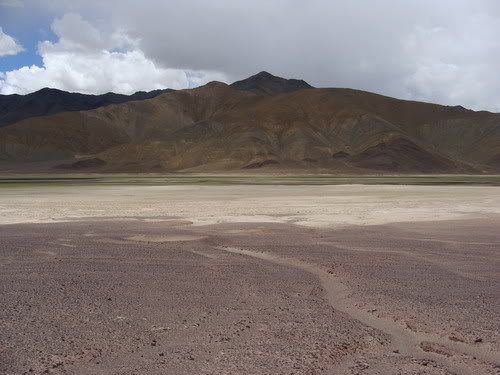
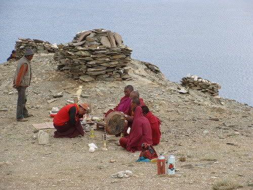
Get to the dining hall and see the 4 guys also feeling the teeth chatter. They are moving out in their taxi and dont want to get stuck here with bad weather and nothing to do. I just prepare myself so that i can ride out the second i decide. Have some food and things get bettor outside. Rain is fully off and i start loading the bike. My hands are pretty numb and it takes long time to load up the bike. Ride out towards ITBP post and its sunlight now! Man the weather changes quickly here. Offroad till the edge of the water for some pix. Two ITBP folks and start a conversation and i just cant get the pix right. Least they helped in taking a pic of me with the bike. They fancied the bike and took pictures of themselves sitting on the bike, with their fones. I bid fare well and started towards Mahe. It was already 10.30 and the weather was clear now. I got curious about the road that led to the south of the lake and ended. Even the ITBP folks said about it to get a bettor view of the lake. Well in order to stop the war in the head i turned back and crossed the slushy town again and got on to the path heading south. It was all offroad with smooth sand and hoped i would not drop the bike. It was a bit of a climb and i came up to a opening. They were right, can see quite a bit of the lake from here. If only the sky was clear could get bettor color of the lake. But have to take what we get. There was a Bhuddisht ceremony going on and there were lot of piles of stones.
Time to head back and it was like 11 am when i exited the Karzok. Now i can ride out with one mind. Now where are the stones? Just tell myself keep going keep going. After i climb up the valley the path eases out and the weather is once again great!! I stop at open space for a break. Loved walking around. Walked up on the hill top to my left and i see Tso Moriri! Felt i had left it far behind. After some pix session i ride down and there is this plain surface and i get off the path with the intention to ride till the edge. But it was soft sand all the way and handling the heavy bike was difficult stopped the bike mid way on some stones and walked to the edge. And i see the green lake! Its still a few kms. Things are not far noticaly but just that the winding roads increase the distance. Now that i see the lake it means Black top is not far behind. It was great place and spend some time there. But have to move on. Get to the black top and soon the sun is snatched away by the clouds. No sooner the sun is out, it get chilly and wind picks up too! I pick up my pace and ride at around 60-70. The road is just 2-3 feet wide for me cos there is a sand and gravel at the center of the road all the way! Thats makes riding with tricky. Ride down the valley with out stopping much and get to the mahe bridge. No need for entry and i proceed towards Leh via Chumatong.
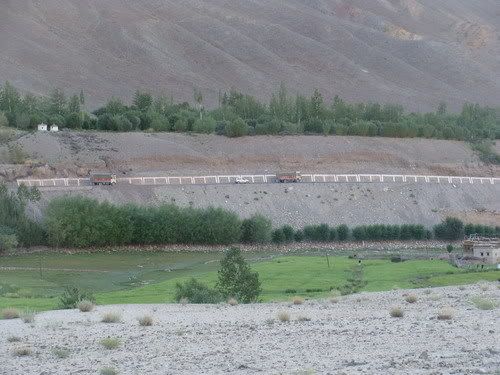
I am hungry by now and Chumatong is like 20 kms. The ride now is in a valley following the Indus river. Though the surroundings are dramatic, they are kinda unimpressive to me as i am coming for pretty good places the last couple of days. The ups my pace and Have a break at chumatong. All the while wishing for some sunlight. Have maggie there and what else? The sky to the north looks clear and soon i am riding in sun light. Its ride always beside the river Indus switching across sides now and then via bridges. Soon i reach the water crossing i was told about. Not much deep but some looks like some stones in disarray in water. wear my gaiters and cross it. The road climbs up and again down and continues beside the river Indus. Its more like a canyon ride rather then a valley ride. Things are huge and dramatic but some how does not interest me much and i keep riding at a brisk pace. As the sun gets lower its now getting to my eye. Couple of places i would have liked to take a break but the lighting and wind was not good so carried on. 10 Kms to Upshi, near a village is see a brand new BSNL tower. It works said the keeper. Good! Set the fone to access network and made the call home. BSNL is putting up towers every where. In few years ladakh must be well connected to the rest of the world i guess. Reach Upshi by 6 PM. And its a fast ride to Leh but a pain full one. i know i craved for sunlight in the morning but do not want it to hit directly on my eye. It was hurting even through my goggles. Reduced my pace and many curves kinda went blind cos of the light. Only reaching Leh i get relief from it.
Finally i am in leh and the Eastern ladakh circuit went well pretty well. I was happy. am happy. Had decided to rest it out the next day. Did not want to spend time on bike work. As soon as i entered Leh got the engine oil changed, chine set and fueled up. The bike is ready to head south just that i have to get ready. Its still a bliss and cant believe that i managed to do the circuit. Now i can say Ladakh is the best place i visited in the trip. EBC trek was great too, but in trek one would be confined to limited space. Will just laze and blog update the next day.
At the camp waiting for the weather to clear up..
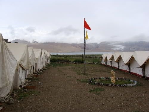
Thats my tent...
The dining hall tent... the Special seat in the center is reserved for Dalai Lama only...

Some last clicks of the lake i think....

The ITBP helps me with a snap...
There they are....
Riding up to the view point...
Yes can see a lot of lake from here....
Some Buddhist ceremony going on there..
The Karzok town...
Quite a pile of stones!!
Riding back to the town...
Last ride by the lake...
The stones again....
Last gazes of the lake...
Avoid taking the smoother looking by paths, they might as well be sand traps...
The hotel owner at Leh was right, maruthi wans now make it here, Just that the roads have not improved but the driving skills have!
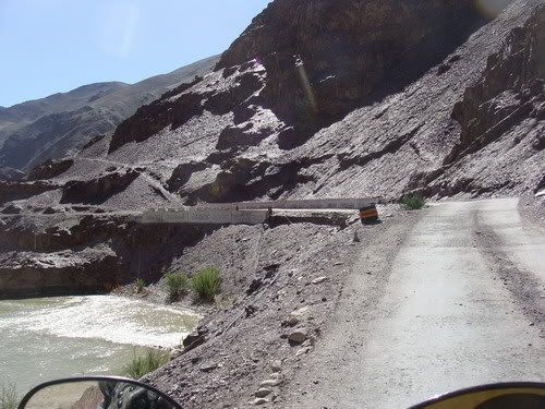
Looks like chunks might fall off any time....
Get off from the huge stone path....
Nice place to take a break....
Can still see Tso Moriri....
Trucks making their own road....
Lot of options ehh???
Ride to the plains....
Can see the weather changing lake below... it also means black top is nearby....
Steed waiting...
At the lake...
Looks like salt!
The ripple ride again...
Aaaah black top!
Weather did change at the lake sun's out!
Ride back towards mahe....
Back in the narrow valley....

Candy mountain again! yes i was hungry again!
Riding towards Chumatong... and looks like the wall might fall off any time!
Precarious stones above!!
I have a narrow corridor to stay dry, lucky the road falls under that corridor!
Nala crossing again!
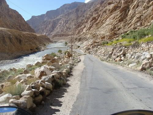
Ride by the Indus canyon....
Now who did this?
Following the river....
An army memorial near Kairi...
Road through shining stones!
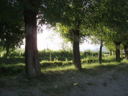
In between trees out of no where!
Just ride along Indus....
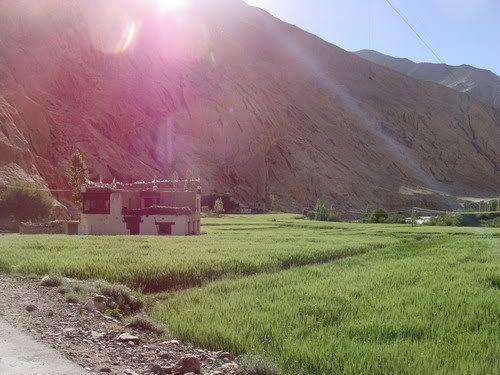
Green carpet at Himya...
Dramatic mountains...
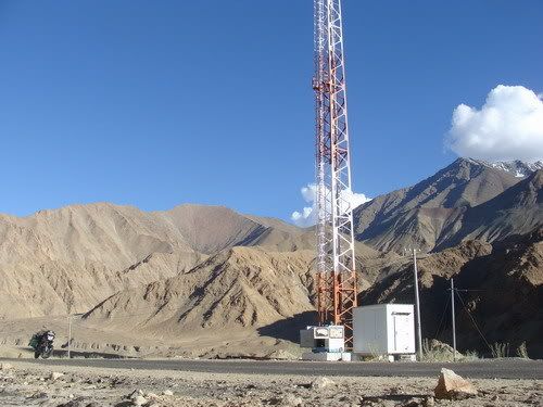
When you see a BSNL tower, you stop and make calls!
Its sun glare ride for the rest of the 60 kms... very pain full !
Reach the Leh Manali highway....
On it...
Strange flower...
Some trees after Karu....
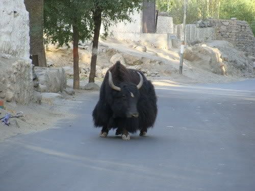
A stray yak... pic is bit shaky cos i was afraid it would charge! have seen them do it!
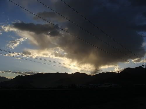
Lone threatning cloud near Leh....
Vertical Travel for the day....
Comment
-
What on earth!!!!
I have been following u since i first read the reports on BCMT.
Deep respect. I mean, we so called 'tourers' are nothing in front of your feet. Every day, u have been putting out outstanding pics, going to places most of us will never every even dream of going to. Man!! Seriously, u r doing one hell of a thing in your life. Kudos.
PS : check ur PMComment
-
Thanks Bunny, but there is no need for comparison those are too great a words. I have taken inputs from many bikers before riding in the respective areas and others experience has helped me a lot. Just that i got a opportunity and i am making use of it. Sure many would do bettor provided situation and commitments in life allowed.
Comment
-
just amazing ....am speechless!!My Wish To Ride Whole India On Two Wheels .Comment
-
Undoubtedly The finest pictures of Ladakh i have ever seen. Kudos to you and your ride !
And Your log and pix are quite informative... thats impressive too! doing this kinda trip and updating the log in real time is not easy !
btw, my plan is to come to Tso morari from pangong through the route you have traveled, except that ride upto chusul, which i have planned through the bank of the pangong... But that's may be tough... You can tell better actually ...
And from Tso Morari, i dont want to ride back to the leh, instead i want to get on to the Lah - Manali highway at Debring(not sure about the spelling) near pang. Map says this route goes via Tso Kar... Any update on this route?Comment
-
Praveen - This is really hard core adventure stuff. Kudos to you and your high spirits. Besides, we all owe you big time for the very fact that you take the time out on most days after all the tiresome riding to keep us updated with your report & pics (uploading so many pics is no easy job!).
Your Discover India trip is no less than a round the world trip as it has everything from beaches to mountain passes to forests to deserts to....
Great going. As always our good wishes & prayers are with you brother.
Growing old is compulsory - growing up is optional
So many roads, So little time
Comment
-
how are you able to bear so much offroading
whats your backs condition ??Hope is a good thing ,
may be the best of things and
no good thing ever dies .
Get busy living or get busy dying .
- The Shawshank Redemption .
Comment


Comment