Since '02 xBhp is different things to different people. From a close knit national community of bikers to India's only motorcycling lifestyle magazine and a place to make like-minded biker friends. Join us

Castrol Power 1

Check engine oil level before every ride.

Our Partner

Announcement

Collapse
No announcement yet.

LADAKH & NUBRA: A Cherished Dream

Collapse
X
 
  • Filter
  • Time
  • Show
Clear All
new posts

  • #76
    Too gud man !!! you are a genious with the cam(and ofcourse PP)
    ...Back to HIBERNATE mode...
    sigpic


    1200kms : Across Tamil nadu & pondicherryl


    To the end of land!!!

    Breakfast Ride!!! Mulshi Lake...

    Comment


    • #77
      Originally posted by happybiking View Post
      Too gud man !!! you are a genious with the cam(and ofcourse PP)
      thanks Soumen...
      most of these pics are SOOC (straight out of camera), the PPed ones are yet to come
      sigpic

      www.archi-star.net
      www.theindianexpedition.com

      http://www.flickr.com/photos/archistar

      Comment


      • #78


        This was the day of the trip. There were many excitements including taking a wrong turn, riding alone without seeing anybody, riding in sand, riding on burger size boulders and finally reaching at Tso-moriri.

        We were supposed to start early because I was aware of the non existence of road in last 25 kilometer stretch to the lake/village Korzok. But we started at around 9.30 AM. Got the tank full at Choglamsar and again at Karu. And also got 2 liters of extra fuel for emergency. After Karu we followed a wrong road sign and went some 40+ kms towards Pangong. Pangong was not in our list so nothing was in mind about the route. Though we enquired at Shakti but everyone directed us towards Pangong, later I came to know that lake means they (local people) understand Pangong 
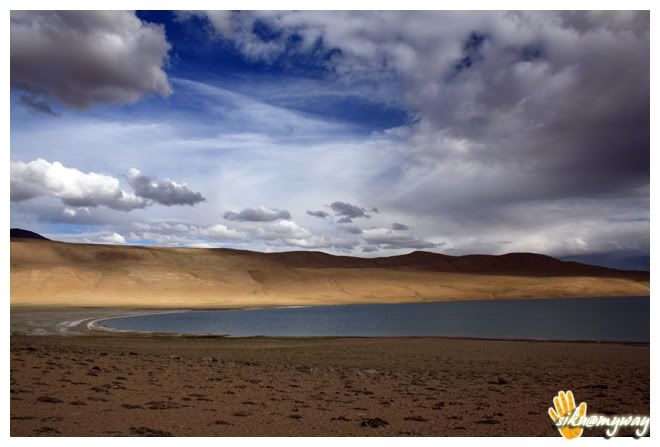
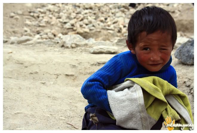
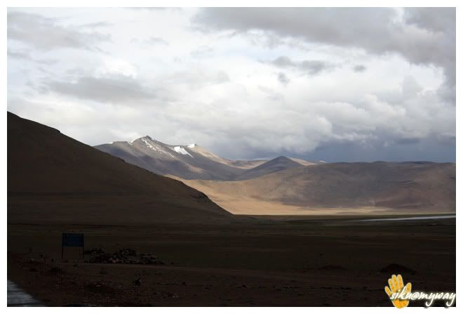
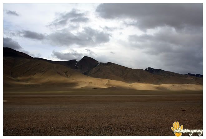
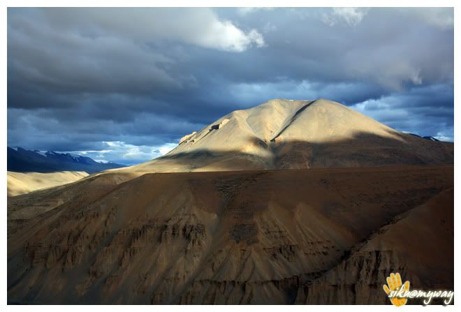
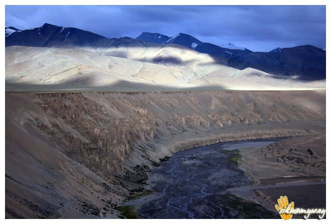
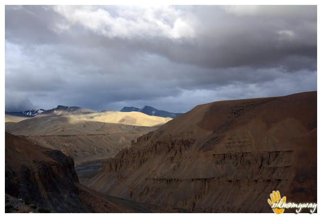
. Anyways finally one army personnel guided us the proper route but we had to return some 30+ kms. This is how we wasted 2 precious riding hours.
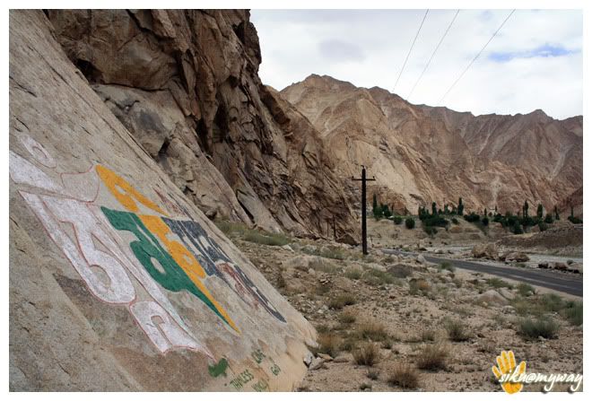
        But before this we already had skipped Shey Palace and Aalchi Monastery due to lack of time. And I was little upset for this too.

        The proper routeChumathang, here you need to deposit a copy of your permit and the lake is 60 kilometers from here. The guard also told that there is no road for last 20-25 kms and one need to follow the Jeep track to reach the lake. But after riding few kilometers and seeing the road condition I was unable to believe that there is no road. The road was newly constructed and butter smooth. But it was hard to ride because of the cross winds. But at a point suddenly the road ended and I had to believe that there is really no road. And we were the alone there and it was going to dark so the only option was to practice off-roading with a pillion. After 14-16 kms we got the first view of a lake and it was not Tso-moriri as there was no symbol and the track was also leading further. After 5 kilometers we got the first glimpse of the lake and it was amazing but the sky was fully covered with clouds. After reaching at Lake we found co symbol of civilization expect few boards describing not to camp at the lake side. What the hell is this!! Where is village Korzok then!! There was no one to whom we can ask about the road or village. It was the festival time in the Korzok monastery but there was no symbol of it. But the jeep track was going somewhere along with the lake and we decided to follow that. After 5 kilometers we got in to Korzok village which was hidden by the hills. It was a relief.

        There was a camp site at the first lot of the settlement, and they charge 3K per night. We went a kilometer ahead to the Korzok village and there are plenty options to stay including tents, camp sites and home stays. We opted for a home stay with a nice view of the lake. It was almost dark by then and it was quite windy and cold at 15000+ feet. And Om got a bad headache so we decided to take rest at the home stay after having roti n omelet, as our initial plan was to stay a day or two to capture the sunrise and sunset and also to see the festival at Korzok monastery.


        RouteTotal distance covered - 266 Kilometers
        Road conditionEvent of the dayImportant places - Karu (last petrol pump)
        Tourist interest pointsPrecautions
        sigpic

        www.archi-star.net
        www.theindianexpedition.com

        http://www.flickr.com/photos/archistar

        Comment


        • #79
          Beautiful photos and nice trip-log there!

          Comment


          • #80
            @Archi: The pictures just keep getting better and better with each passing day. Lovely work.

            Did you manage to visit Chandrataal? Chandrataal has been a long-cherished dream of mine. Hopefully, sometime in the coming week (if everything goes well), I might just be riding out through Spiti, to Chandrataal, and back through the Manali route.
            :)

            Comment


            • #81
              Nice pics Archi..

              Pics are simply "out of this world"..

              Facebook

              Comment


              • #82
                Awesome shots dude. your camera is doing it's full duty...

                Comment


                • #83
                  havent read the post, ll do that later, just sw the mindblowing pictures, awesome
                  http://www.throughmysenses.com/

                  Comment


                  • #84
                    nic to see a biker and a bike from orissa at greatest heights of world...U are the first biker from orissa to do this
                    sigpic
                    2005-06 @ activa n ambition
                    2006-09 @ ambition
                    2010... @ yamaha R-15, new ACTIVA
                    2015:-R15(V1),Iron 883,Activa

                    biker REDEfined

                    Comment


                    • #85
                      Originally posted by moeed View Post
                      Beautiful photos and nice trip-log there!
                      thanks moeed... glad you liked them.

                      Originally posted by Aryan View Post
                      @Archi: The pictures just keep getting better and better with each passing day. Lovely work.

                      Did you manage to visit Chandrataal? Chandrataal has been a long-cherished dream of mine. Hopefully, sometime in the coming week (if everything goes well), I might just be riding out through Spiti, to Chandrataal, and back through the Manali route.
                      Thanks Aryan...

                      chandertaal is yet to be visited... as we discussed we can ride there together...

                      Originally posted by inder.cool View Post
                      Nice pics Archi..

                      Pics are simply "out of this world"..
                      Thanks Inder...

                      Originally posted by sherry_unicornlover View Post
                      Awesome shots dude. your camera is doing it's full duty...
                      Thanks, yes, 'm getting maximum out of my cam

                      Originally posted by psycho28 View Post
                      havent read the post, ll do that later, just sw the mindblowing pictures, awesome
                      thanks bro...

                      Originally posted by raman sriharsha View Post
                      nic to see a biker and a bike from orissa at greatest heights of world...U are the first biker from orissa to do this
                      'm not the first one from orissa to do Leh, i know/met 2 guys from orissa at mulbekh. you can find their pics too... and there must be many, but might be unpublished...

                      and yes, i always feel good while riding my OR Uni...
                      sigpic

                      www.archi-star.net
                      www.theindianexpedition.com

                      http://www.flickr.com/photos/archistar

                      Comment


                      • #86


                        Last night was simply horrible. My whole body was aching like any thing and Om got a very bad cold and tired too. I was doubtful if AMSKorzok Festival behind and started for Pang, the complete unknown route. Asked the owner of our home stay and he told that there is good road/tar road after Tso-kar. And the road diverts after 40+ kilometers from Korzok. I was just expecting not to get bad roads like the 25 kms stretch.


                        But the road was literally bad beyond my expectations. It was literary a task to cover 25+80 kilometers in off-roading track. There was everything on road, big boulders, dirt, mud, salt dunes, sand, rocks and even bushes. The road work is in progress and by next season we can expect Pang-Tso Kar-Tso Moriri tar route.


                        Some 20 kilometers before Tso-kar we were chased by rain. Though we were geared with rain suit and the luggage were also under rain cover, but we were afraid of the road condition ahead. Tso-kar was visible but there was no sign of road but finally we reached at Tso-kar village and from here the tar road started. Kind enough rain god poured all his blessings once we entered in to a tent-hotel for our lunch. It was 3.20 PM then and we were seeing human beings after some 70-80 kms.
                        One interesting fact here, there are total 20-30 houses in Tso-kar village and at that time there were only 3-4 people in that village. Asking about the others, the only dhaba wala, where we took shelter replied that all are shifted to Manali-Leh highway with their assets (sheep) to feed them. And every individual have more than 1000 sheeps/goats. I did not believe this until I saw them later.
                        Finally the rain slowed down and we decided to go further, we had to reach Pang. After 15 kilometers we touched Manali-Leh highway. The right goes to Leh and we took the left for Manali. The view after the rain was amazing. We were running short of time and had to reach Pang for our night stay so we took very less photo breaks. After it we entered More Planes, a 40 kilometer stretch at high altitudes. Again bad roads as the road construction work were in progress. Truckers made their own way in the planes and were zipping with dust trails.


                        Finally managed to reach Pang at 6.40 PM and there were still some day light left so after arranging accommodation I wanted to return few kilometers back to capture some photographs but after dumping my luggage I noticed the front flat tyre. But there was a tyre repair shop in the front. So no photography as it was dark by the time got the tyre fixed. Finally the off-roading took its toll .

                        RouteTotal distance coveredRoad condition - Bad
                        Event of the dayImportant placesTourist interest pointsPrecautions
                        sigpic

                        www.archi-star.net
                        www.theindianexpedition.com

                        http://www.flickr.com/photos/archistar

                        Comment


                        • #87
                          @ Archi: Mannn...these photos are getting better and better everyday...amazing photography skills you got..

                          Facebook

                          Comment


                          • #88
                            Wow, some stunning shots....Loved these shots!!

                            [img]http://i281.photobucket.com/albums/kk223/d_archistar/LADAKH/Ladakh%20day%2011/Picture677-1acopy.jpg


                            http://i281.photobucket.com/albums/k...ure699copy.jpg [/img]

                            sigpic

                            Comment


                            • #89
                              Originally posted by inder.cool View Post
                              @ Archi: Mannn...these photos are getting better and better everyday...amazing photography skills you got..
                              thanks inder, but sad that it was the second last set...

                              Originally posted by chicane1879 View Post
                              Wow, some stunning shots....Loved these shots!!
                              thanks swagat...
                              sigpic

                              www.archi-star.net
                              www.theindianexpedition.com

                              http://www.flickr.com/photos/archistar

                              Comment


                              • #90
                                Originally posted by archistar View Post

                                Thanks Aryan...

                                chandertaal is yet to be visited... as we discussed we can ride there together...
                                Hey Archi, although my plan was to leave on 18th night (Friday), but it seems the highway both ways (Manali - Chandrataal - Kaza), or from Shimla - Kaza has been closed (at Nako) due to landslides and snowfall, last week!

                                Let's see how this tour shapes up.

                                And as usual, tremendous photographs, really.
                                :)

                                Comment

                                Working...
                                X